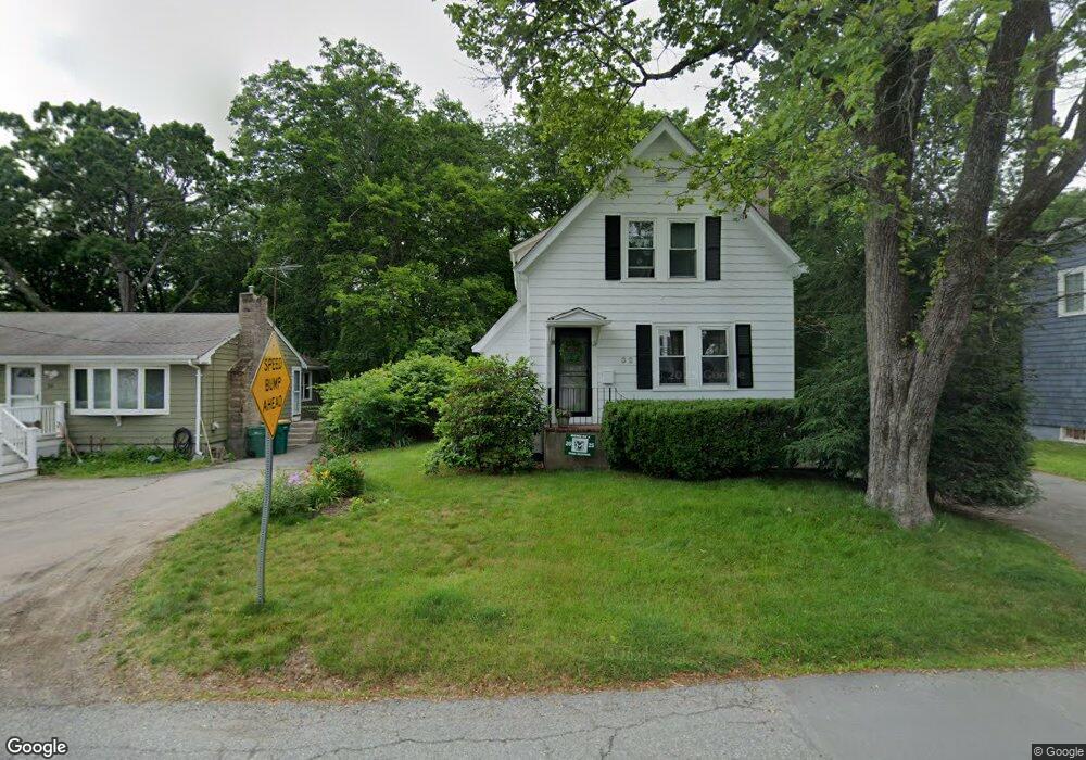
32 Highland Ave Mansfield, MA 02048
Estimated Value: $469,000 - $522,256
3
Beds
1
Bath
1,185
Sq Ft
$425/Sq Ft
Est. Value
About This Home
This home is located at 32 Highland Ave, Mansfield, MA 02048 and is currently estimated at $504,064, approximately $425 per square foot. 32 Highland Ave is a home located in Bristol County with nearby schools including Everett W. Robinson Elementary School, Jordan/Jackson Elementary School, and Harold L. Qualters Middle School.
Ownership History
Date
Name
Owned For
Owner Type
Purchase Details
Closed on
Oct 20, 2008
Sold by
Hayes Thomas M and Hayes Margaret M
Bought by
Coombes Jason M and Coombes Josephine
Current Estimated Value
Home Financials for this Owner
Home Financials are based on the most recent Mortgage that was taken out on this home.
Original Mortgage
$200,981
Outstanding Balance
$133,520
Interest Rate
6.41%
Mortgage Type
FHA
Estimated Equity
$370,544
Purchase Details
Closed on
Jul 15, 2005
Sold by
Lerch Lawrence J
Bought by
Hayes Thomas M and Hayes Margaret M
Home Financials for this Owner
Home Financials are based on the most recent Mortgage that was taken out on this home.
Original Mortgage
$172,000
Interest Rate
5.67%
Mortgage Type
Purchase Money Mortgage
Create a Home Valuation Report for This Property
The Home Valuation Report is an in-depth analysis detailing your home's value as well as a comparison with similar homes in the area
Home Values in the Area
Average Home Value in this Area
Purchase History
| Date | Buyer | Sale Price | Title Company |
|---|---|---|---|
| Coombes Jason M | $209,000 | -- | |
| Coombes Jason M | -- | -- | |
| Hayes Thomas M | $289,900 | -- | |
| Hayes Margaret M | $289,900 | -- |
Source: Public Records
Mortgage History
| Date | Status | Borrower | Loan Amount |
|---|---|---|---|
| Open | Coombes Jason M | $200,981 | |
| Closed | Coombes Jason M | $200,981 | |
| Previous Owner | Hayes Margaret M | $172,000 |
Source: Public Records
Tax History Compared to Growth
Tax History
| Year | Tax Paid | Tax Assessment Tax Assessment Total Assessment is a certain percentage of the fair market value that is determined by local assessors to be the total taxable value of land and additions on the property. | Land | Improvement |
|---|---|---|---|---|
| 2025 | $5,523 | $419,400 | $230,700 | $188,700 |
| 2024 | $5,589 | $414,000 | $230,700 | $183,300 |
| 2023 | $5,475 | $388,600 | $230,700 | $157,900 |
| 2022 | $5,411 | $356,700 | $213,500 | $143,200 |
| 2021 | $113,100 | $329,000 | $186,900 | $142,100 |
| 2020 | $2,996 | $301,400 | $178,000 | $123,400 |
| 2019 | $4,382 | $287,900 | $148,300 | $139,600 |
| 2018 | $0 | $274,700 | $141,300 | $133,400 |
| 2017 | $0 | $268,000 | $137,100 | $130,900 |
| 2016 | $3,819 | $247,800 | $130,600 | $117,200 |
| 2015 | $3,687 | $237,900 | $130,600 | $107,300 |
Source: Public Records
Map
Nearby Homes
- 150 Rumford Ave Unit 222
- 22 Pleasant St Unit B
- 22 Pleasant St Unit A
- 241-243 N Main St
- 60 King St
- 99 Pleasant St
- 82 Brook St
- 76 Samoset Ave
- 28 Court St
- 28 Court St Unit 4
- 38 Court St
- 72 Court St Unit B
- 356 Central St
- 16 East St Unit 2
- 21 East St Unit 1D
- 450 West St
- 132 S High St
- 12 Wilson Place
- 115 S High St
- 124 E Belcher Rd
- 26 Highland Ave
- 36 Highland Ave
- 22 Highland Ave
- 46 Highland Ave
- 25 Highland Ave Unit 27
- 35 Highland Ave
- 0 Allen St
- 18 Highland Ave
- 25-27 Highland Ave
- 50 Highland Ave
- 43 Highland Ave
- 9 Allen St Unit 11
- 11 Allen St Unit 2
- 9 Allen St Unit 1
- 18 Allen St
- 56 Highland Ave
- 40 Draper Ave
- 36 Draper Ave
- 42 Draper Ave
- 30 Draper Ave Unit 32