Estimated Value: $346,000 - $477,000
4
Beds
3
Baths
1,995
Sq Ft
$197/Sq Ft
Est. Value
About This Home
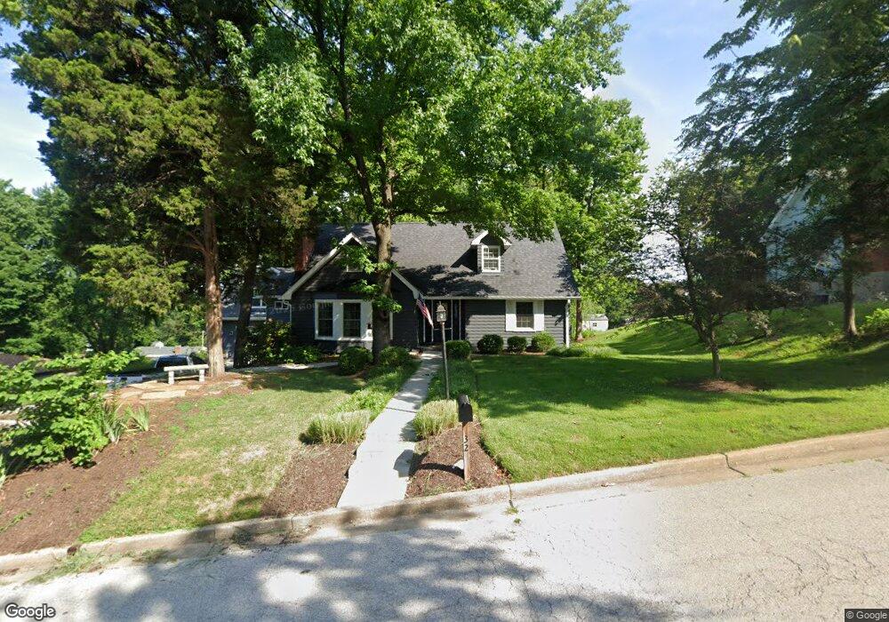
This home is located at 32 James Dr, Saint Charles, MO 63301 and is currently estimated at $393,058, approximately $197 per square foot. 32 James Dr is a home located in St. Charles County with nearby schools including George M. Null Elementary School, Hardin Middle School, and Jefferson Intermediate School.
Ownership History
Date
Name
Owned For
Owner Type
Purchase Details
Closed on
Nov 17, 2006
Sold by
Bade Jonathan and Bade Rodney
Bought by
Wright Colin Robert
Current Estimated Value
Home Financials for this Owner
Home Financials are based on the most recent Mortgage that was taken out on this home.
Original Mortgage
$147,680
Outstanding Balance
$101,074
Interest Rate
9.2%
Mortgage Type
Purchase Money Mortgage
Estimated Equity
$291,984
Purchase Details
Closed on
Aug 23, 2004
Sold by
Bade Wall Lyndell and Wall Jeremy
Bought by
Bade Jonathan and Bade Rodney
Home Financials for this Owner
Home Financials are based on the most recent Mortgage that was taken out on this home.
Original Mortgage
$55,000
Interest Rate
8.35%
Mortgage Type
Purchase Money Mortgage
Purchase Details
Closed on
Mar 28, 2002
Sold by
Bade Wall Lyndell and Estate Of Norman D Bade
Bought by
Bade Wall Lyndell and Bade Jonathan
Create a Home Valuation Report for This Property
The Home Valuation Report is an in-depth analysis detailing your home's value as well as a comparison with similar homes in the area
Home Values in the Area
Average Home Value in this Area
Purchase History
| Date | Buyer | Sale Price | Title Company |
|---|---|---|---|
| Wright Colin Robert | $184,600 | Security Title | |
| Bade Jonathan | -- | Inv | |
| Bade Wall Lyndell | -- | -- |
Source: Public Records
Mortgage History
| Date | Status | Borrower | Loan Amount |
|---|---|---|---|
| Open | Wright Colin Robert | $147,680 | |
| Previous Owner | Bade Jonathan | $55,000 |
Source: Public Records
Tax History
| Year | Tax Paid | Tax Assessment Tax Assessment Total Assessment is a certain percentage of the fair market value that is determined by local assessors to be the total taxable value of land and additions on the property. | Land | Improvement |
|---|---|---|---|---|
| 2025 | $4,965 | $69,370 | -- | -- |
| 2023 | $4,957 | $77,612 | $0 | $0 |
| 2022 | $2,708 | $39,345 | $0 | $0 |
| 2021 | $2,711 | $39,345 | $0 | $0 |
| 2020 | $3,149 | $44,009 | $0 | $0 |
| 2019 | $3,122 | $44,009 | $0 | $0 |
| 2018 | $3,069 | $41,151 | $0 | $0 |
| 2017 | $3,028 | $41,151 | $0 | $0 |
| 2016 | $2,539 | $33,184 | $0 | $0 |
| 2015 | $2,534 | $33,184 | $0 | $0 |
| 2014 | $2,489 | $32,150 | $0 | $0 |
Source: Public Records
Map
Nearby Homes
- 34 James Dr
- 56 Judy Dr
- 7 Wayne St
- 2713 Treadway Ave
- 625 Nancy Dr
- 2809 Mayer Dr
- 524 Rebecca Dr
- 904 Kingston Terrace Ct
- 1116 Chargene St
- 1200 Chargene St
- 429 Dove Dr
- 1464 Hawks Nest Ct Unit H
- 76 Ruth Dr
- 28 Eau Claire Dr
- 202 King Dr Unit B
- 1710 Forest Hills Dr Unit C
- 2709 Sibley St
- 1620 Forest Hills Dr Unit D
- 21 Cambrian Way
- 10 Fairways Cir Unit E
Your Personal Tour Guide
Ask me questions while you tour the home.