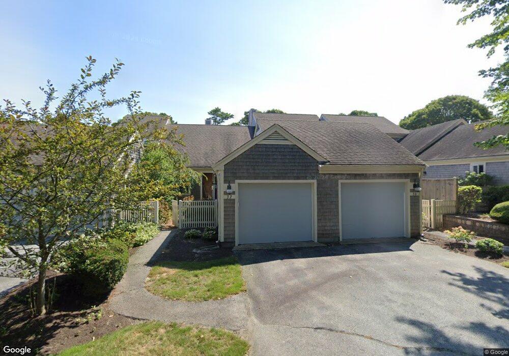
32 Kates Path Unit A Yarmouth Port, MA 02675
Yarmouth Port NeighborhoodEstimated Value: $491,510 - $580,000
2
Beds
2
Baths
2,044
Sq Ft
$266/Sq Ft
Est. Value
About This Home
This home is located at 32 Kates Path Unit A, Yarmouth Port, MA 02675 and is currently estimated at $542,878, approximately $265 per square foot. 32 Kates Path Unit A is a home located in Barnstable County with nearby schools including Dennis-Yarmouth Regional High School.
Ownership History
Date
Name
Owned For
Owner Type
Purchase Details
Closed on
Sep 15, 2010
Sold by
Lund Doreen A
Bought by
Fitzgerald Elaine M
Current Estimated Value
Purchase Details
Closed on
Nov 28, 1995
Sold by
Paolella Gloria
Bought by
Lund Doreen A
Home Financials for this Owner
Home Financials are based on the most recent Mortgage that was taken out on this home.
Original Mortgage
$162,800
Interest Rate
7.47%
Mortgage Type
Purchase Money Mortgage
Purchase Details
Closed on
May 24, 1991
Sold by
The Green Co Inc
Bought by
Paolella Gloria
Create a Home Valuation Report for This Property
The Home Valuation Report is an in-depth analysis detailing your home's value as well as a comparison with similar homes in the area
Home Values in the Area
Average Home Value in this Area
Purchase History
| Date | Buyer | Sale Price | Title Company |
|---|---|---|---|
| Fitzgerald Elaine M | $320,000 | -- | |
| Lund Doreen A | $203,500 | -- | |
| Paolella Gloria | $200,000 | -- |
Source: Public Records
Mortgage History
| Date | Status | Borrower | Loan Amount |
|---|---|---|---|
| Previous Owner | Lund Doreen A | $162,800 |
Source: Public Records
Tax History Compared to Growth
Tax History
| Year | Tax Paid | Tax Assessment Tax Assessment Total Assessment is a certain percentage of the fair market value that is determined by local assessors to be the total taxable value of land and additions on the property. | Land | Improvement |
|---|---|---|---|---|
| 2025 | $3,175 | $448,400 | $0 | $448,400 |
| 2024 | $2,980 | $403,800 | $0 | $403,800 |
| 2023 | $2,899 | $357,500 | $0 | $357,500 |
| 2022 | $3,439 | $374,600 | $0 | $374,600 |
| 2021 | $3,191 | $333,800 | $0 | $333,800 |
| 2020 | $3,221 | $322,100 | $0 | $322,100 |
| 2019 | $3,021 | $299,100 | $0 | $299,100 |
| 2018 | $2,841 | $276,100 | $0 | $276,100 |
| 2017 | $2,651 | $264,600 | $0 | $264,600 |
| 2016 | $2,490 | $249,500 | $0 | $249,500 |
| 2015 | $2,493 | $248,300 | $0 | $248,300 |
Source: Public Records
Map
Nearby Homes
- 17 Kates Path Unit A
- 228 Kates Path
- 64 Kates Path
- 158 Kates Path
- 43 Canterbury Rd
- 19 John Halls Cartpath Village Unit E
- 19 John Hall Cartway Unit E
- 50 John Hall Cartway
- 50 John Hall Cartway Unit 50
- 42 John Hall Cartway Unit 42
- 28 Oak Glen
- 44 Stratford Ln
- 25 Oak Glen Village Unit 25
- 25 Oak Glen
- 17 Nottingham Dr
- 30 W Woods
- 30 W Woods Cir Unit 30
- 2 Pine Grove
- 800 Route 6a
- 800 Route 6a
- 32 Kates Path
- 30 Kates Path
- 26 Kates Path
- 26 Kates Path Unit E
- 11 Kate's Path Unit 11
- 22 Kates Path
- 26 Kate's Path Unit 26
- 9 Kate's Unit 9
- 15 Kate's Path Unit 15
- 34 Kates Path
- 28 Kates Path
- 34 Kates Path Unit 34
- 34 Kates Path Unit D
- 28 Kates Village Path Unit 28
- 34 Kates Village D
- 24 Kates Path
- 20 Kates Path
- 24 Kates Path
- 24 Kates Path Unit 24
- 20 Kates Path Unit 20