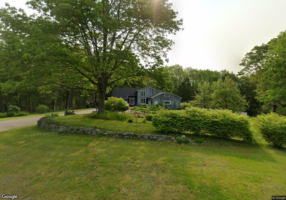
32 Katie Ln Topsham, ME 04086
Estimated Value: $501,000 - $575,238
4
Beds
4
Baths
2,016
Sq Ft
$264/Sq Ft
Est. Value
About This Home
This home is located at 32 Katie Ln, Topsham, ME 04086 and is currently estimated at $532,413, approximately $264 per square foot. 32 Katie Ln is a home located in Sagadahoc County with nearby schools including Mt Ararat High School.
Create a Home Valuation Report for This Property
The Home Valuation Report is an in-depth analysis detailing your home's value as well as a comparison with similar homes in the area
Home Values in the Area
Average Home Value in this Area
Tax History Compared to Growth
Tax History
| Year | Tax Paid | Tax Assessment Tax Assessment Total Assessment is a certain percentage of the fair market value that is determined by local assessors to be the total taxable value of land and additions on the property. | Land | Improvement |
|---|---|---|---|---|
| 2025 | $5,975 | $466,800 | $90,600 | $376,200 |
| 2024 | $5,775 | $462,000 | $85,800 | $376,200 |
| 2023 | $5,584 | $411,200 | $82,700 | $328,500 |
| 2022 | $5,898 | $409,000 | $80,500 | $328,500 |
| 2021 | $5,575 | $351,300 | $75,700 | $275,600 |
| 2020 | $5,671 | $317,500 | $75,700 | $241,800 |
| 2019 | $5,716 | $298,500 | $75,700 | $222,800 |
| 2018 | $5,420 | $289,400 | $70,100 | $219,300 |
| 2017 | $5,244 | $289,400 | $70,100 | $219,300 |
| 2016 | $2,633 | $287,300 | $70,100 | $217,200 |
| 2015 | $5,004 | $278,600 | $70,100 | $208,500 |
| 2014 | $4,790 | $276,400 | $70,100 | $206,300 |
| 2013 | $4,602 | $276,400 | $70,100 | $206,300 |
Source: Public Records
Map
Nearby Homes
- 428 Cathance Rd
- 75 Adams Landing Rd
- 594 Middlesex Rd
- 210 Augusta Rd
- Lot 08 Sara's Way
- 314 Meadow Rd
- 51 Mountain View Cir
- 26 Bay Park Dr
- 156 Main St
- 17 Chestnut Dr
- 55 Somerset Place
- 55 Munroe Ln
- 14 Loon Dr
- 35 Eider Ln
- 23 Merrymeeting Dr
- 27 Tegans Way
- 34 Compass Ln
- 2 Haskell Cir
- 45A-A Hornbeck Cross
- 1 Birch Ridge Ave