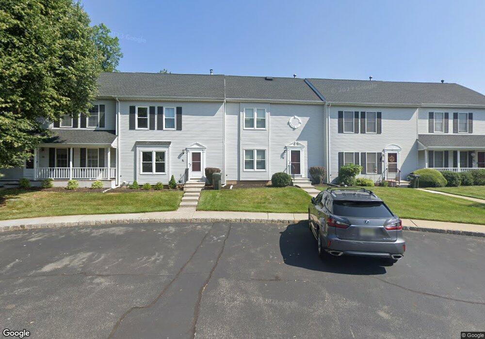
32 Kingswood Rd Branchburg, NJ 08876
Branchburg Township NeighborhoodEstimated Value: $432,000 - $465,000
--
Bed
--
Bath
1,296
Sq Ft
$342/Sq Ft
Est. Value
About This Home
This home is located at 32 Kingswood Rd, Branchburg, NJ 08876 and is currently estimated at $443,101, approximately $341 per square foot. 32 Kingswood Rd is a home located in Somerset County with nearby schools including Whiton Elementary School, Stony Brook School, and Branchburg Central Middle School.
Ownership History
Date
Name
Owned For
Owner Type
Purchase Details
Closed on
Feb 26, 1998
Sold by
Napoleon Michael
Bought by
Crosby Lawrence
Current Estimated Value
Home Financials for this Owner
Home Financials are based on the most recent Mortgage that was taken out on this home.
Original Mortgage
$98,000
Outstanding Balance
$17,944
Interest Rate
7.03%
Estimated Equity
$425,157
Create a Home Valuation Report for This Property
The Home Valuation Report is an in-depth analysis detailing your home's value as well as a comparison with similar homes in the area
Home Values in the Area
Average Home Value in this Area
Purchase History
| Date | Buyer | Sale Price | Title Company |
|---|---|---|---|
| Crosby Lawrence | $122,500 | -- |
Source: Public Records
Mortgage History
| Date | Status | Borrower | Loan Amount |
|---|---|---|---|
| Open | Crosby Lawrence | $98,000 |
Source: Public Records
Tax History Compared to Growth
Tax History
| Year | Tax Paid | Tax Assessment Tax Assessment Total Assessment is a certain percentage of the fair market value that is determined by local assessors to be the total taxable value of land and additions on the property. | Land | Improvement |
|---|---|---|---|---|
| 2025 | $5,998 | $373,000 | $84,000 | $289,000 |
| 2024 | $5,998 | $332,500 | $84,000 | $248,500 |
| 2023 | $5,368 | $286,900 | $84,000 | $202,900 |
| 2022 | $5,336 | $271,000 | $84,000 | $187,000 |
| 2021 | $5,283 | $249,900 | $84,000 | $165,900 |
| 2020 | $5,190 | $242,200 | $84,000 | $158,200 |
| 2019 | $5,144 | $238,700 | $84,000 | $154,700 |
| 2018 | $5,087 | $235,400 | $84,000 | $151,400 |
| 2017 | $5,031 | $231,200 | $79,000 | $152,200 |
| 2016 | $5,083 | $232,100 | $78,000 | $154,100 |
| 2015 | $5,139 | $235,100 | $81,000 | $154,100 |
| 2014 | $5,098 | $236,000 | $80,000 | $156,000 |
Source: Public Records
Map
Nearby Homes
- 511 Red Crest Ln
- 1601 Breckenridge Dr
- 203 Red Crest Ln
- 2 Carlisle Rd
- 46 Strawberry Hill Rd
- 5 Walnut Dr
- 232 River Rd
- 6 Heritage Ct
- 713 Colonial Ct
- 215 Readington Rd
- 23 Buffalo Hollow Rd
- 27 Fremont St
- 31 S Davenport St
- 21 Cheyenne Trail
- 9 Weavers Ln
- 185 Milltown Rd
- 317 Old York Rd
- 15 Campbell Ct
- 16 Iroquois Trail
- 33 Iroquois Trail
- 34 Kingswood Rd
- 30 Kingswood Rd
- 36 Kingswood Rd
- 28 Kingswood Rd
- 26 Kingswood Rd
- 38 Kingswood Rd
- 7 Sheephill Cir
- 23 Kingswood Rd
- 24 Kingswood Rd
- 40 Kingswood Rd
- 5 Sheephill Cir
- 21 Kingswood Rd
- 22 Kingswood Rd
- 42 Kingswood Rd
- 19 Kingswood Rd
- 39 Kingswood Rd
- 20 Kingswood Rd
- 3 Sheephill Cir
- 44 Kingswood Rd
- 46 Kingswood Rd