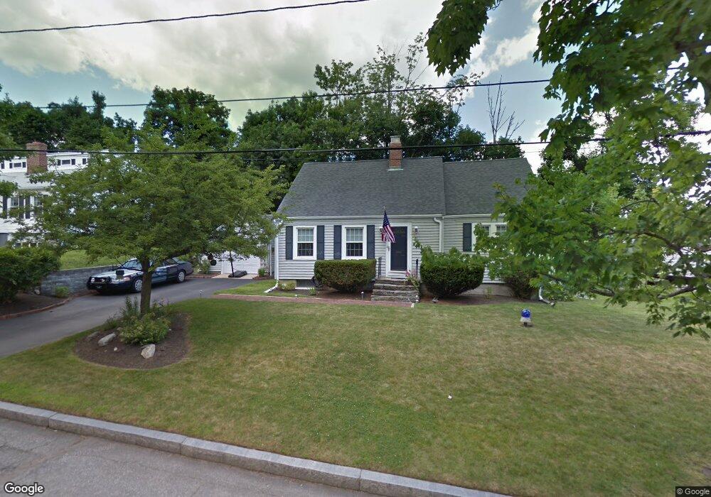
32 Lansing Ave Worcester, MA 01605
Forest Grove NeighborhoodEstimated Value: $467,637 - $508,000
3
Beds
2
Baths
1,596
Sq Ft
$310/Sq Ft
Est. Value
About This Home
This home is located at 32 Lansing Ave, Worcester, MA 01605 and is currently estimated at $494,909, approximately $310 per square foot. 32 Lansing Ave is a home located in Worcester County with nearby schools including Nelson Place Elementary School, Jacob Hiatt Magnet School, and Chandler Magnet.
Ownership History
Date
Name
Owned For
Owner Type
Purchase Details
Closed on
Jan 29, 1999
Sold by
Fitzgerald Edward S and Fitzgerald Elaine M
Bought by
Labossiere Sharon M and Santiago Luis A
Current Estimated Value
Purchase Details
Closed on
Aug 1, 1994
Sold by
Morrison John P and Morrison Deborah
Bought by
Fitzgerald Edward S and Fitzgerald Elaine
Create a Home Valuation Report for This Property
The Home Valuation Report is an in-depth analysis detailing your home's value as well as a comparison with similar homes in the area
Home Values in the Area
Average Home Value in this Area
Purchase History
| Date | Buyer | Sale Price | Title Company |
|---|---|---|---|
| Labossiere Sharon M | $133,000 | -- | |
| Fitzgerald Edward S | $125,000 | -- |
Source: Public Records
Mortgage History
| Date | Status | Borrower | Loan Amount |
|---|---|---|---|
| Open | Fitzgerald Edward S | $149,500 | |
| Closed | Fitzgerald Edward S | $10,713 | |
| Closed | Fitzgerald Edward S | $124,466 |
Source: Public Records
Tax History
| Year | Tax Paid | Tax Assessment Tax Assessment Total Assessment is a certain percentage of the fair market value that is determined by local assessors to be the total taxable value of land and additions on the property. | Land | Improvement |
|---|---|---|---|---|
| 2025 | $5,407 | $409,900 | $117,900 | $292,000 |
| 2024 | $5,291 | $384,800 | $117,900 | $266,900 |
| 2023 | $5,085 | $354,600 | $102,500 | $252,100 |
| 2022 | $4,677 | $307,500 | $82,000 | $225,500 |
| 2021 | $4,586 | $281,700 | $65,600 | $216,100 |
| 2020 | $4,549 | $267,600 | $65,600 | $202,000 |
| 2019 | $4,329 | $240,500 | $59,000 | $181,500 |
| 2018 | $4,340 | $229,500 | $59,000 | $170,500 |
| 2017 | $4,094 | $213,000 | $59,000 | $154,000 |
| 2016 | $4,062 | $197,100 | $43,000 | $154,100 |
| 2015 | $3,956 | $197,100 | $43,000 | $154,100 |
| 2014 | $3,851 | $197,100 | $43,000 | $154,100 |
Source: Public Records
Map
Nearby Homes
- 97 Parkton Ave
- 25 Chester St
- 84 Chester St
- 90 Bjorklund Ave
- 23 Leslie Rd
- 158 Chester St
- 61 Barry Rd
- 37 Mohave Rd
- 577 Grove St
- 46 Barry Rd
- 14 Balder Rd
- 36 Eagle Rd
- 24 Watt Rd
- 11 Balder Rd
- 42 N Worcester Ave
- 46 Hastings Ave
- 5 Piehl Ave
- 101 Ararat St
- 4004 Brompton Cir
- 3901 Knightsbridge Close Unit 3901
- 34 Lansing Ave
- 30 Lansing Ave
- 63 Parkton Ave
- 63 Parkton Ave Unit 1
- 57 Parkton Ave
- 67 Parkton Ave
- 36 Lansing Ave
- 721 Grove St
- 721 Grove St
- 33 Lansing Ave
- 35 Lansing Ave
- 727 Grove St
- 71 Parkton Ave
- 31 Lansing Ave
- 37 Lansing Ave
- 3 Winter Hill Dr
- 62 Parkton Ave
- 715 Grove St
- 58 Parkton Ave
- 64 Parkton Ave
Your Personal Tour Guide
Ask me questions while you tour the home.