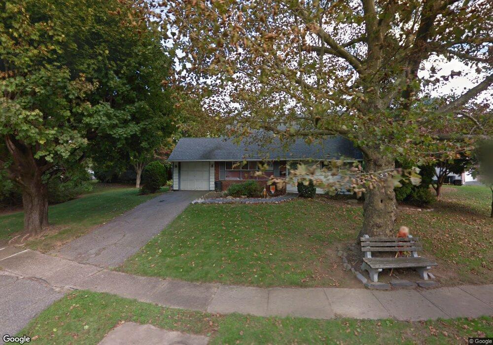
32 Long Loop Rd Levittown, PA 19056
Estimated Value: $326,000 - $493,000
4
Beds
2
Baths
2,118
Sq Ft
$206/Sq Ft
Est. Value
About This Home
This home is located at 32 Long Loop Rd, Levittown, PA 19056 and is currently estimated at $436,576, approximately $206 per square foot. 32 Long Loop Rd is a home located in Bucks County with nearby schools including Walter Miller Elementary School, Sandburg Middle School, and Neshaminy High School.
Ownership History
Date
Name
Owned For
Owner Type
Purchase Details
Closed on
Jul 9, 2012
Sold by
Estate Of Patricia A Crandall and Crandall Leonard T
Bought by
Oshea Kevin M
Current Estimated Value
Home Financials for this Owner
Home Financials are based on the most recent Mortgage that was taken out on this home.
Original Mortgage
$109,000
Outstanding Balance
$75,241
Interest Rate
3.67%
Mortgage Type
New Conventional
Estimated Equity
$361,335
Purchase Details
Closed on
Aug 31, 1955
Bought by
Crandall Patricia A
Create a Home Valuation Report for This Property
The Home Valuation Report is an in-depth analysis detailing your home's value as well as a comparison with similar homes in the area
Purchase History
| Date | Buyer | Sale Price | Title Company |
|---|---|---|---|
| Oshea Kevin M | $150,000 | None Available | |
| Crandall Patricia A | -- | -- |
Source: Public Records
Mortgage History
| Date | Status | Borrower | Loan Amount |
|---|---|---|---|
| Open | Oshea Kevin M | $109,000 |
Source: Public Records
Tax History
| Year | Tax Paid | Tax Assessment Tax Assessment Total Assessment is a certain percentage of the fair market value that is determined by local assessors to be the total taxable value of land and additions on the property. | Land | Improvement |
|---|---|---|---|---|
| 2025 | $4,093 | $25,960 | $4,240 | $21,720 |
| 2024 | $4,093 | $18,800 | $4,240 | $14,560 |
| 2023 | $4,028 | $18,800 | $4,240 | $14,560 |
| 2022 | $3,922 | $18,800 | $4,240 | $14,560 |
| 2021 | $3,922 | $18,800 | $4,240 | $14,560 |
| 2020 | $3,875 | $18,800 | $4,240 | $14,560 |
| 2019 | $3,789 | $18,800 | $4,240 | $14,560 |
| 2018 | $3,719 | $18,800 | $4,240 | $14,560 |
| 2017 | $3,624 | $18,800 | $4,240 | $14,560 |
| 2016 | $3,624 | $18,800 | $4,240 | $14,560 |
| 2015 | $3,813 | $18,800 | $4,240 | $14,560 |
| 2014 | $3,813 | $18,800 | $4,240 | $14,560 |
Source: Public Records
Map
Nearby Homes
- 43 Petunia Rd
- 6 Unity Turn
- 21 Border Rock Rd
- 10 Inbrook Rd
- 111 Border Rock Rd
- 24 Rose Apple Rd
- 10 Macintosh Rd
- 122 Ivy Hill Rd
- 131 Ivy Hill Rd
- 53 Pamela Ct Unit 318
- 56 Indian Red Rd
- 194 Cobalt Ridge Dr S Unit S
- 51 Hollybrooke Dr
- 1019 Green Ln
- 56 Goldenridge Dr
- 2822 Avenue E
- 2519 Woodlawn Dr
- 2718 Avenue C
- 2818 Avenue E
- 2816 Avenue E
- 24 Long Loop Rd
- 42 Long Loop Rd
- 46 Long Loop Rd
- 5 Limewood Rd
- 20 Long Loop Rd
- 29 Long Loop Rd
- 25 Long Loop Rd
- 39 Long Loop Rd
- 23 Long Loop Rd
- 33 Long Loop Rd
- 41 Long Loop Rd
- 9 Limewood Rd
- 50 Long Loop Rd
- 45 Long Loop Rd
- 19 Long Loop Rd
- 49 Long Loop Rd
- 11 Limewood Rd
- 54 Long Loop Rd
- 15 Long Loop Rd
- 2 Limewood Rd
Your Personal Tour Guide
Ask me questions while you tour the home.