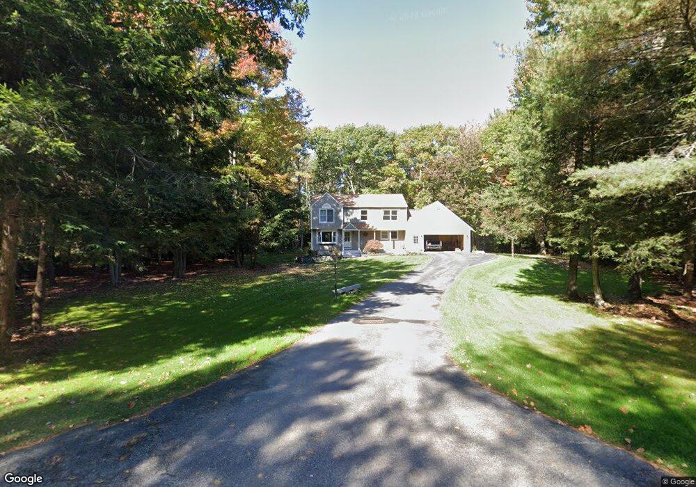
32 Longmeadow Rd Scarborough, ME 04074
Estimated Value: $811,000 - $874,000
4
Beds
3
Baths
2,180
Sq Ft
$382/Sq Ft
Est. Value
About This Home
This home is located at 32 Longmeadow Rd, Scarborough, ME 04074 and is currently estimated at $831,676, approximately $381 per square foot. 32 Longmeadow Rd is a home with nearby schools including Scarborough High School.
Ownership History
Date
Name
Owned For
Owner Type
Purchase Details
Closed on
Sep 19, 2022
Sold by
Philip J Caiazzi Lt
Bought by
Norton Nicholas and Norton Haley
Current Estimated Value
Home Financials for this Owner
Home Financials are based on the most recent Mortgage that was taken out on this home.
Original Mortgage
$560,000
Outstanding Balance
$533,880
Interest Rate
4.99%
Mortgage Type
Purchase Money Mortgage
Estimated Equity
$297,796
Purchase Details
Closed on
Jun 19, 2013
Sold by
Caiazzi Philip J and Caiazzi Theresa J
Bought by
Theresa J Caiazzi Lt
Create a Home Valuation Report for This Property
The Home Valuation Report is an in-depth analysis detailing your home's value as well as a comparison with similar homes in the area
Home Values in the Area
Average Home Value in this Area
Purchase History
| Date | Buyer | Sale Price | Title Company |
|---|---|---|---|
| Norton Nicholas | $700,000 | None Available | |
| Theresa J Caiazzi Lt | -- | -- |
Source: Public Records
Mortgage History
| Date | Status | Borrower | Loan Amount |
|---|---|---|---|
| Open | Norton Nicholas | $560,000 |
Source: Public Records
Tax History Compared to Growth
Tax History
| Year | Tax Paid | Tax Assessment Tax Assessment Total Assessment is a certain percentage of the fair market value that is determined by local assessors to be the total taxable value of land and additions on the property. | Land | Improvement |
|---|---|---|---|---|
| 2024 | $7,298 | $667,700 | $171,900 | $495,800 |
| 2023 | $6,473 | $405,300 | $123,100 | $282,200 |
| 2022 | $6,238 | $405,300 | $123,100 | $282,200 |
| 2021 | $6,088 | $405,300 | $123,100 | $282,200 |
| 2020 | $6,023 | $405,300 | $123,100 | $282,200 |
| 2019 | $5,958 | $405,300 | $123,100 | $282,200 |
| 2017 | $4,665 | $302,900 | $104,300 | $198,600 |
| 2016 | $4,822 | $302,900 | $104,300 | $198,600 |
| 2015 | $4,692 | $302,900 | $104,300 | $198,600 |
| 2014 | $4,423 | $302,900 | $104,300 | $198,600 |
| 2013 | -- | $302,900 | $104,300 | $198,600 |
Source: Public Records
Map
Nearby Homes
- 0 Provident Dr
- 117 Beech Ridge Rd
- 91 C Broadturn Rd
- 4 Dresser Rd
- 0 W Beech Ridge Rd
- Lot 72 Martell Way
- 138 Beech Ridge Rd
- 107 Holmes Rd
- 14 Ash Swamp Rd
- 91 B Broadturn Rd
- 96C Broadturn Rd
- 90 Broadturn Rd Unit 9
- 79 Mitchell Hill Rd
- 5 Kinney Rd
- 64 Hearn Rd
- 93 Two Rod Rd
- 149 Stewart Dr
- 153 Stewart Dr
- 159 Stewart Dr
- 45 Mitchell Hill Rd
- 30 Longmeadow Rd
- 34 Longmeadow Rd
- 29 Longmeadow Rd
- 1 High Bluff Ln
- 2 High Bluff Ln
- 28 Longmeadow Rd
- 36 Longmeadow Rd
- 35 Longmeadow Rd
- 25 Longmeadow Rd
- 4 Springbrook Ln
- 40 Longmeadow Rd
- 38 Longmeadow Rd
- 3 Springbrook Ln
- 37 Longmeadow Rd
- 26 Longmeadow Rd
- 42 Longmeadow Rd
- 4 High Bluff Ln
- 3 High Bluff Ln
- 44 Longmeadow Rd
- 6 Springbrook Ln