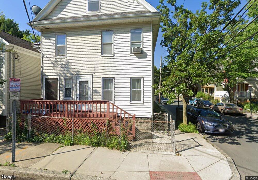
32 Malvern Ave Somerville, MA 02144
Teele Square NeighborhoodEstimated Value: $1,203,000 - $1,514,000
4
Beds
2
Baths
2,136
Sq Ft
$619/Sq Ft
Est. Value
About This Home
This home is located at 32 Malvern Ave, Somerville, MA 02144 and is currently estimated at $1,321,452, approximately $618 per square foot. 32 Malvern Ave is a home located in Middlesex County with nearby schools including Somerville High School, Benjamin Banneker Charter Public School, and International School of Boston.
Ownership History
Date
Name
Owned For
Owner Type
Purchase Details
Closed on
Oct 9, 2015
Sold by
30 and 32 Malvern R
Bought by
Jean Hermite C
Current Estimated Value
Home Financials for this Owner
Home Financials are based on the most recent Mortgage that was taken out on this home.
Original Mortgage
$340,000
Interest Rate
3.88%
Mortgage Type
New Conventional
Create a Home Valuation Report for This Property
The Home Valuation Report is an in-depth analysis detailing your home's value as well as a comparison with similar homes in the area
Home Values in the Area
Average Home Value in this Area
Purchase History
| Date | Buyer | Sale Price | Title Company |
|---|---|---|---|
| Jean Hermite C | $400,000 | -- |
Source: Public Records
Mortgage History
| Date | Status | Borrower | Loan Amount |
|---|---|---|---|
| Closed | Jean Hermite C | $340,000 |
Source: Public Records
Tax History
| Year | Tax Paid | Tax Assessment Tax Assessment Total Assessment is a certain percentage of the fair market value that is determined by local assessors to be the total taxable value of land and additions on the property. | Land | Improvement |
|---|---|---|---|---|
| 2025 | $11,877 | $1,088,600 | $699,700 | $388,900 |
| 2024 | $11,381 | $1,081,800 | $699,700 | $382,100 |
| 2023 | $10,922 | $1,056,300 | $699,700 | $356,600 |
| 2022 | $10,275 | $1,009,300 | $666,300 | $343,000 |
| 2021 | $9,897 | $971,200 | $647,000 | $324,200 |
| 2020 | $9,164 | $908,200 | $602,700 | $305,500 |
| 2019 | $8,595 | $798,800 | $535,800 | $263,000 |
| 2018 | $8,643 | $764,200 | $533,900 | $230,300 |
| 2017 | $8,464 | $725,300 | $503,700 | $221,600 |
| 2016 | $8,302 | $662,600 | $475,900 | $186,700 |
| 2015 | $7,828 | $620,800 | $435,700 | $185,100 |
Source: Public Records
Map
Nearby Homes
- 5 Glendale Ave Unit 5
- 39 Seven Pines Ave
- 69 Clarendon Ave Unit A
- 32 Cameron Ave
- 97 Elmwood St Unit 313
- 97 Elmwood St Unit 110
- 97 Elmwood St Unit 310
- 50 Howard St Unit 5
- 2353 Massachusetts Ave Unit 73
- 69 Harvey St Unit 1
- 29 Packard Ave
- 69 Electric Ave Unit 3
- 69 Electric Ave Unit 2
- 69 Electric Ave Unit 1
- 20 Electric Ave Unit 2
- 127 Harvey St
- 127 Harvey St Unit 127
- 55 Packard Ave Unit 1
- 202 Powder House Blvd Unit 1
- 202 Powder House Blvd Unit 2
- 28 Malvern Ave
- 90 Yorktown St Unit 1
- 92 Yorktown St
- 92 Yorktown St Unit 2
- 22 Malvern Ave
- 22 Malvern Ave Unit 1
- 0 Malvern Ave Unit 73091834
- 0 Malvern Ave Unit 72836203
- 0 Malvern Ave Unit 72711661
- 86 Yorktown St
- 25 Glendale Ave
- 97 Yorktown St
- 93 Yorktown St
- 20 Malvern Ave Unit A
- 20 Malvern Ave Unit 20A
- 20 Malvern Ave
- 20 Malvern Ave Unit 1,20
- 101 Yorktown St
- 23 Glendale Ave
- 89 Yorktown St