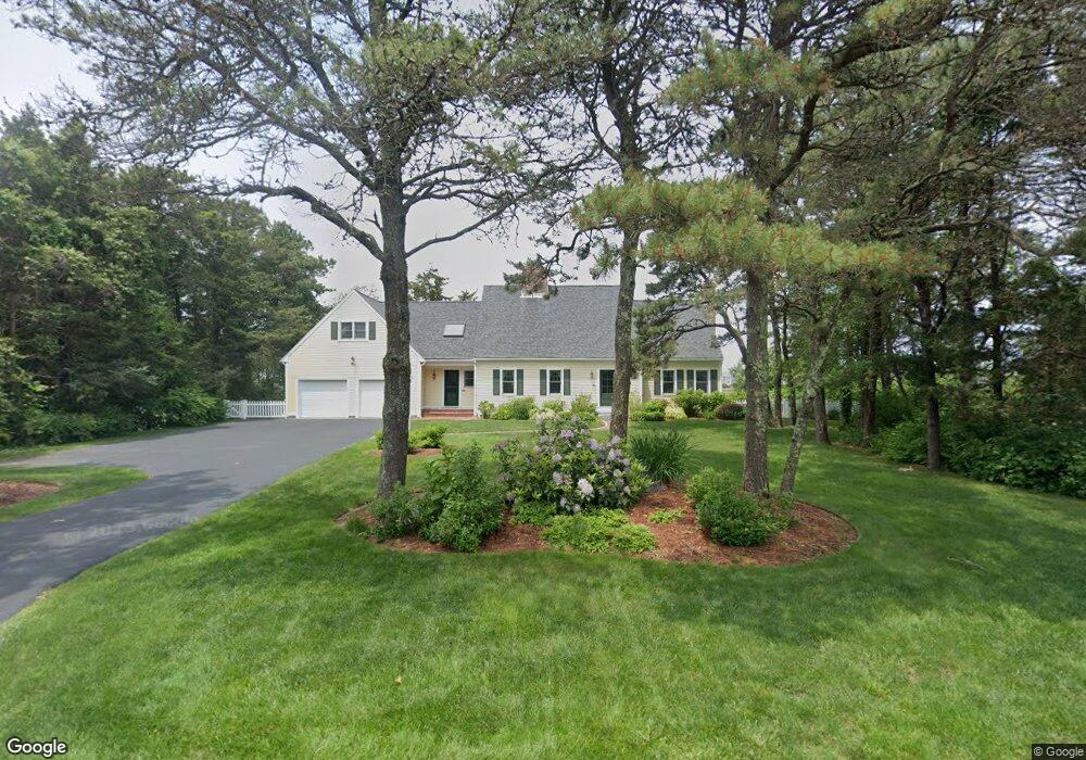
32 Marshview Cir East Sandwich, MA 02537
Estimated Value: $1,132,000 - $1,303,000
3
Beds
4
Baths
2,701
Sq Ft
$451/Sq Ft
Est. Value
About This Home
This home is located at 32 Marshview Cir, East Sandwich, MA 02537 and is currently estimated at $1,218,625, approximately $451 per square foot. 32 Marshview Cir is a home located in Barnstable County with nearby schools including Sandwich Middle High School and Riverview School.
Ownership History
Date
Name
Owned For
Owner Type
Purchase Details
Closed on
Aug 28, 2024
Sold by
Spilman Jeffrey M and Spilman Robin B
Bought by
Spilman Ft and Spilman
Current Estimated Value
Purchase Details
Closed on
Jan 27, 1998
Sold by
Odonoghue Bernard J and Odonoghue Rita A
Bought by
Spilman Jeffrey M and Spilman Robin B
Create a Home Valuation Report for This Property
The Home Valuation Report is an in-depth analysis detailing your home's value as well as a comparison with similar homes in the area
Home Values in the Area
Average Home Value in this Area
Purchase History
| Date | Buyer | Sale Price | Title Company |
|---|---|---|---|
| Spilman Ft | -- | None Available | |
| Spilman Ft | -- | None Available | |
| Spilman Jeffrey M | $310,000 | -- | |
| Spilman Jeffrey M | $310,000 | -- |
Source: Public Records
Mortgage History
| Date | Status | Borrower | Loan Amount |
|---|---|---|---|
| Previous Owner | Spilman Jeffrey M | $290,000 | |
| Previous Owner | Spilman Jeffrey M | $200,000 |
Source: Public Records
Tax History Compared to Growth
Tax History
| Year | Tax Paid | Tax Assessment Tax Assessment Total Assessment is a certain percentage of the fair market value that is determined by local assessors to be the total taxable value of land and additions on the property. | Land | Improvement |
|---|---|---|---|---|
| 2025 | $10,784 | $1,020,200 | $276,800 | $743,400 |
| 2024 | $10,642 | $985,400 | $247,200 | $738,200 |
| 2023 | $10,183 | $885,500 | $224,700 | $660,800 |
| 2022 | $10,224 | $776,900 | $244,000 | $532,900 |
| 2021 | $9,751 | $708,100 | $234,600 | $473,500 |
| 2020 | $9,621 | $672,300 | $223,100 | $449,200 |
| 2019 | $9,295 | $649,100 | $227,900 | $421,200 |
| 2018 | $3,903 | $625,500 | $228,600 | $396,900 |
| 2017 | $8,837 | $591,900 | $221,300 | $370,600 |
| 2016 | $8,306 | $574,000 | $208,100 | $365,900 |
| 2015 | $8,314 | $561,000 | $202,200 | $358,800 |
Source: Public Records
Map
Nearby Homes
- 37 Ploughed Neck Rd
- 99 N Shore Blvd Unit 1
- 99 N Shore Blvd Unit A
- 56 N Shore Blvd
- 4 Cowslip Path
- 21 Quiet St
- 420 Massachusetts 6a
- 32 N Shore Boulevard Extension
- 46 Roos Rd
- 49 Atkins Rd
- 49 Atkins Rd
- 390 Massachusetts 6a
- 46 Roos Rd
- 507 Massachusetts 6a Unit 9
- 36 Atkins Rd Unit D2
- 20 Crestview Dr
- 21 Manor Dr
- 394 Quaker Meetinghouse Rd
- 394 Quaker Meeting House Rd
- 0 Captain Kidd Rd
- 34 Marshview Cir
- 30 Marshview Cir
- 29 Marshview Cir
- 31 Marshview Cir
- 2 Arrowhead Cir
- 2 Arrowhead Cir
- 4 Arrowhead Cir
- 28 Marshview Cir
- 33 Marshview Cir
- 6 Arrowhead Cir
- 0 Arrowhead Cir
- 21 Marshview Cir
- 26 Marshview Cir
- 37 Marshview Cir
- 2 Scorton Cir
- 1 Arrowhead Cir
- 3 Scorton Cir
- 6 Scorton Cir
- 8 Roberts Way
- 8 Robert's Way