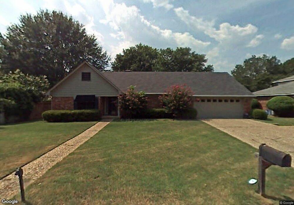
32 Mckee Cir North Little Rock, AR 72116
Lakewood NeighborhoodEstimated Value: $268,868 - $307,000
--
Bed
2
Baths
2,365
Sq Ft
$123/Sq Ft
Est. Value
About This Home
This home is located at 32 Mckee Cir, North Little Rock, AR 72116 and is currently estimated at $290,217, approximately $122 per square foot. 32 Mckee Cir is a home located in Pulaski County with nearby schools including Crestwood Elementary School, North Little Rock Middle School 6th Grade Campus, and North Little Rock High School.
Ownership History
Date
Name
Owned For
Owner Type
Purchase Details
Closed on
Apr 30, 2009
Sold by
Blackwood James Carl and Blackwood Deanna
Bought by
Reed Darin Jason and Reed Melissa Lee
Current Estimated Value
Home Financials for this Owner
Home Financials are based on the most recent Mortgage that was taken out on this home.
Original Mortgage
$173,552
Outstanding Balance
$108,708
Interest Rate
4.77%
Mortgage Type
VA
Estimated Equity
$181,509
Create a Home Valuation Report for This Property
The Home Valuation Report is an in-depth analysis detailing your home's value as well as a comparison with similar homes in the area
Home Values in the Area
Average Home Value in this Area
Purchase History
| Date | Buyer | Sale Price | Title Company |
|---|---|---|---|
| Reed Darin Jason | $170,000 | American Abstract & Title Co |
Source: Public Records
Mortgage History
| Date | Status | Borrower | Loan Amount |
|---|---|---|---|
| Open | Reed Darin Jason | $173,552 |
Source: Public Records
Tax History Compared to Growth
Tax History
| Year | Tax Paid | Tax Assessment Tax Assessment Total Assessment is a certain percentage of the fair market value that is determined by local assessors to be the total taxable value of land and additions on the property. | Land | Improvement |
|---|---|---|---|---|
| 2025 | $3,338 | $50,020 | $9,200 | $40,820 |
| 2024 | $3,060 | $50,020 | $9,200 | $40,820 |
| 2023 | $3,060 | $50,020 | $9,200 | $40,820 |
| 2022 | $3,104 | $50,020 | $9,200 | $40,820 |
| 2021 | $2,961 | $41,650 | $12,200 | $29,450 |
| 2020 | $2,583 | $41,650 | $12,200 | $29,450 |
| 2019 | $2,579 | $41,650 | $12,200 | $29,450 |
| 2018 | $2,601 | $41,650 | $12,200 | $29,450 |
| 2017 | $2,514 | $41,650 | $12,200 | $29,450 |
| 2016 | $2,385 | $38,420 | $6,000 | $32,420 |
| 2015 | $2,566 | $38,420 | $6,000 | $32,420 |
| 2014 | $2,566 | $37,452 | $6,000 | $31,452 |
Source: Public Records
Map
Nearby Homes
- 4524 Dawson Dr
- 5101 Burrow Dr
- 5009 Burrow Dr
- 4425 Valley Brook Dr
- 10 Campden Hill Rd
- 5201 Fairway Dr
- 5317 Fairway Ave
- 4204 Fox Hill Rd
- 926 Karla Cir
- 901 Coulter Rd
- 105 Saint Francis Ct
- 3305 Seminole Trail
- 718 Coulter Rd
- 400 Fork River Rd
- 205 Spring River Rd
- 604 Beverly Ave E
- 3405 Bunker Hill Dr
- 5000 Fairway Ave
- 3404 Bunker Hill Dr
- 301 E Devon Ave