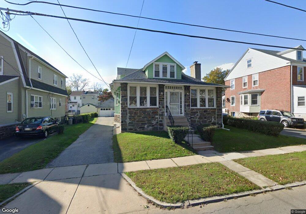
32 Melrose Ave Lansdowne, PA 19050
Estimated Value: $267,000 - $313,000
4
Beds
2
Baths
2,101
Sq Ft
$137/Sq Ft
Est. Value
About This Home
This home is located at 32 Melrose Ave, Lansdowne, PA 19050 and is currently estimated at $288,850, approximately $137 per square foot. 32 Melrose Ave is a home located in Delaware County with nearby schools including East Lansdowne Elementary School, Penn Wood Middle School, and Penn Wood High School - Cypress Street Campus.
Ownership History
Date
Name
Owned For
Owner Type
Purchase Details
Closed on
Jan 24, 1999
Sold by
Eury Richard D and Eury Annie D
Bought by
Phillips Christopher
Current Estimated Value
Home Financials for this Owner
Home Financials are based on the most recent Mortgage that was taken out on this home.
Original Mortgage
$87,850
Outstanding Balance
$20,218
Interest Rate
6.67%
Mortgage Type
FHA
Estimated Equity
$268,632
Create a Home Valuation Report for This Property
The Home Valuation Report is an in-depth analysis detailing your home's value as well as a comparison with similar homes in the area
Home Values in the Area
Average Home Value in this Area
Purchase History
| Date | Buyer | Sale Price | Title Company |
|---|---|---|---|
| Phillips Christopher | $89,900 | Commonwealth Land Title Ins |
Source: Public Records
Mortgage History
| Date | Status | Borrower | Loan Amount |
|---|---|---|---|
| Open | Phillips Christopher | $87,850 |
Source: Public Records
Tax History Compared to Growth
Tax History
| Year | Tax Paid | Tax Assessment Tax Assessment Total Assessment is a certain percentage of the fair market value that is determined by local assessors to be the total taxable value of land and additions on the property. | Land | Improvement |
|---|---|---|---|---|
| 2025 | $6,538 | $153,010 | $47,640 | $105,370 |
| 2024 | $6,538 | $153,010 | $47,640 | $105,370 |
| 2023 | $4,889 | $153,010 | $47,640 | $105,370 |
| 2022 | $5,897 | $153,010 | $47,640 | $105,370 |
| 2021 | $8,792 | $153,010 | $47,640 | $105,370 |
| 2020 | $5,307 | $80,580 | $20,600 | $59,980 |
| 2019 | $5,218 | $80,580 | $20,600 | $59,980 |
| 2018 | $5,150 | $80,580 | $0 | $0 |
| 2017 | $4,886 | $80,580 | $0 | $0 |
| 2016 | $442 | $80,580 | $0 | $0 |
| 2015 | $451 | $80,580 | $0 | $0 |
| 2014 | $442 | $80,580 | $0 | $0 |
Source: Public Records
Map
Nearby Homes
- 608 Pembroke Ave
- 230 Wynnewood Ave
- 226 E Greenwood Ave
- 603 Penn St
- 209 E Greenwood Ave
- 319 E Essex Ave
- 317 E Essex Ave
- 315 E Essex Ave
- 75 E Stewart Ave
- 407 Church Ln
- 32 N Wycombe Ave
- 435 Bonsall Ave
- 178 N Union Ave
- 7026 Atlantic Ave
- 192 Fairview Ave
- 37 E Stratford Ave
- 7129 Seaford Rd
- 408 S Union Ave
- 7123 Seaford Rd
- 503 Bonsall Ave