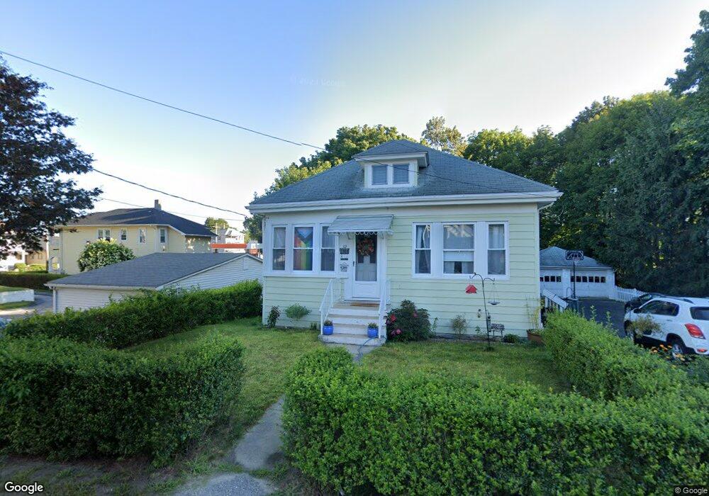
32 Merrill Ct Woonsocket, RI 02895
Bernon District NeighborhoodEstimated Value: $376,000 - $398,000
4
Beds
2
Baths
1,620
Sq Ft
$241/Sq Ft
Est. Value
About This Home
This home is located at 32 Merrill Ct, Woonsocket, RI 02895 and is currently estimated at $390,710, approximately $241 per square foot. 32 Merrill Ct is a home located in Providence County with nearby schools including Woonsocket High School, Founders Academy, and Beacon Charter School.
Ownership History
Date
Name
Owned For
Owner Type
Purchase Details
Closed on
May 21, 2020
Sold by
Forget Robert L and Forget Gerald P
Bought by
Forget Amanda
Current Estimated Value
Home Financials for this Owner
Home Financials are based on the most recent Mortgage that was taken out on this home.
Original Mortgage
$207,740
Outstanding Balance
$183,683
Interest Rate
3.3%
Mortgage Type
New Conventional
Estimated Equity
$207,027
Create a Home Valuation Report for This Property
The Home Valuation Report is an in-depth analysis detailing your home's value as well as a comparison with similar homes in the area
Home Values in the Area
Average Home Value in this Area
Purchase History
| Date | Buyer | Sale Price | Title Company |
|---|---|---|---|
| Forget Amanda | $221,000 | None Available | |
| Forget Amanda | $221,000 | None Available | |
| Forget Amanda | $221,000 | None Available |
Source: Public Records
Mortgage History
| Date | Status | Borrower | Loan Amount |
|---|---|---|---|
| Open | Forget Amanda | $207,740 | |
| Closed | Forget Amanda | $207,740 |
Source: Public Records
Tax History
| Year | Tax Paid | Tax Assessment Tax Assessment Total Assessment is a certain percentage of the fair market value that is determined by local assessors to be the total taxable value of land and additions on the property. | Land | Improvement |
|---|---|---|---|---|
| 2025 | $4,182 | $372,400 | $107,400 | $265,000 |
| 2024 | $3,804 | $261,600 | $95,200 | $166,400 |
| 2023 | $3,657 | $261,600 | $95,200 | $166,400 |
| 2022 | $3,657 | $261,600 | $95,200 | $166,400 |
| 2021 | $4,356 | $183,400 | $59,900 | $123,500 |
| 2020 | $4,402 | $183,400 | $59,900 | $123,500 |
| 2018 | $4,416 | $183,400 | $59,900 | $123,500 |
| 2017 | $4,380 | $145,500 | $46,800 | $98,700 |
| 2016 | $4,633 | $145,500 | $46,800 | $98,700 |
| 2015 | $5,322 | $145,500 | $46,800 | $98,700 |
| 2014 | $3,535 | $140,500 | $51,500 | $89,000 |
Source: Public Records
Map
Nearby Homes
- 1060 Park Ave
- 122 Grand St
- 59 Cooper Ave
- 0 Irving Lot 192 Ave Unit 1383138
- 63 Capwell Ave
- 15 Knight St
- 1 Admiral St
- 202 Jenckes St
- 147 Warwick St
- 25 Ormond St
- 109 Hemond Ave
- 0 Irving Lot 206 Ave Unit 1397321
- 80 Summit St
- 219 Crawford St
- 604 Providence St
- 0 Caron Ave Unit 1379503
- 0 Caron Ave Unit 73342710
- 190 Crawford St
- 379 Front St
- 0 Laflamme Ave
- 890 Park Ave
- 890 Park Ave Unit first floor
- 880 Park Ave
- 900 Park Ave
- 878 Park Ave Unit 2
- 0 Merrill Ct Unit 1337486
- 0 Merrill Ct Unit 1066144
- 0 Merrill Ct Unit 1202718
- 906 Park Ave
- 25 Napoleon St
- 916 Park Ave
- 27 Napoleon St
- 920 Park Ave
- 73 Merrill Ct
- 20 Napoleon St
- 46 Gilbert St
- 877 Park Ave
- 899 Park Ave
- 867 Park Ave
- 887 Park Ave