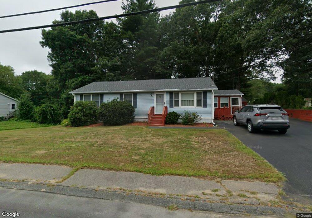
32 Mockingbird Way East Taunton, MA 02718
East Taunton NeighborhoodEstimated Value: $491,153 - $551,000
3
Beds
2
Baths
1,196
Sq Ft
$437/Sq Ft
Est. Value
About This Home
This home is located at 32 Mockingbird Way, East Taunton, MA 02718 and is currently estimated at $523,038, approximately $437 per square foot. 32 Mockingbird Way is a home located in Bristol County with nearby schools including East Taunton Elementary School, Joseph H. Martin, and Taunton High School.
Ownership History
Date
Name
Owned For
Owner Type
Purchase Details
Closed on
Jul 26, 2022
Sold by
Dougherty Edith V
Bought by
E V Dougherty 2022 Irt
Current Estimated Value
Purchase Details
Closed on
Nov 1, 1994
Sold by
Ramalho Steven A
Bought by
Dougherty William J and Dougherty Edith
Create a Home Valuation Report for This Property
The Home Valuation Report is an in-depth analysis detailing your home's value as well as a comparison with similar homes in the area
Home Values in the Area
Average Home Value in this Area
Purchase History
| Date | Buyer | Sale Price | Title Company |
|---|---|---|---|
| E V Dougherty 2022 Irt | -- | None Available | |
| Dougherty William J | $125,000 | -- |
Source: Public Records
Tax History Compared to Growth
Tax History
| Year | Tax Paid | Tax Assessment Tax Assessment Total Assessment is a certain percentage of the fair market value that is determined by local assessors to be the total taxable value of land and additions on the property. | Land | Improvement |
|---|---|---|---|---|
| 2025 | $4,578 | $418,500 | $130,300 | $288,200 |
| 2024 | $4,271 | $381,700 | $130,300 | $251,400 |
| 2023 | $4,213 | $349,600 | $124,400 | $225,200 |
| 2022 | $4,150 | $314,900 | $113,500 | $201,400 |
| 2021 | $3,941 | $277,500 | $103,200 | $174,300 |
| 2020 | $3,922 | $263,900 | $103,200 | $160,700 |
| 2019 | $3,973 | $252,100 | $103,200 | $148,900 |
| 2018 | $3,705 | $235,700 | $104,200 | $131,500 |
| 2017 | $3,566 | $227,000 | $98,800 | $128,200 |
| 2016 | $3,439 | $219,300 | $95,900 | $123,400 |
| 2015 | $3,272 | $218,000 | $93,100 | $124,900 |
| 2014 | $3,135 | $214,600 | $93,100 | $121,500 |
Source: Public Records
Map
Nearby Homes
- 220 Erin Rd
- 81 Tania Dr
- 203 Bluejay Ln
- 28 B Staples St Unit B
- 550 Middleboro Ave
- 96 Old Colony Ave Unit 264
- 649 Middleboro Ave
- 96 Old Colony Ave Unit 318
- 96 Old Colony Ave Unit 268
- 96 Old Colony Ave Unit 202
- 68 Metacomet Ave
- 32 Kendall Ct
- 120 South St E
- 218R Hart St Unit B
- 17 Maries Way
- 210 Linsay Dr
- 31 Bruno's Way Unit A
- 138 Pine Tree Ln
- 80 Bally Dr
- 49 Louie Ln
- 22 Mockingbird Way
- 42 Mockingbird Way
- 44 Wren St
- 54 Wren St
- 52 Mockingbird Way
- 34 Wren St
- 59 Blackbird Ln
- 29 Mockingbird Way
- 41 Mockingbird Way
- 67 Blackbird Ln
- 24 Wren St
- 53 Mockingbird Way
- 62 Mockingbird Way
- 28 Cormorant St
- 12 Wren St
- 5 Mockingbird Way
- 236 Caswell St
- 65 Mockingbird Way
- 244 Caswell St
- 41 Wren St