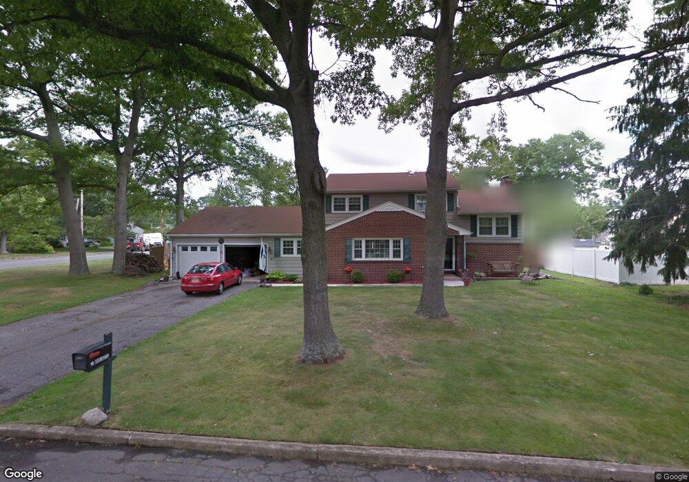
32 Morningside Dr Toms River, NJ 08755
Estimated Value: $528,865 - $593,000
3
Beds
3
Baths
1,846
Sq Ft
$310/Sq Ft
Est. Value
About This Home
This home is located at 32 Morningside Dr, Toms River, NJ 08755 and is currently estimated at $572,466, approximately $310 per square foot. 32 Morningside Dr is a home located in Ocean County with nearby schools including Ocean County Christian Academy, St Joseph Grade School, and Ambassador Christian Academy.
Ownership History
Date
Name
Owned For
Owner Type
Purchase Details
Closed on
May 27, 2025
Sold by
Sheriff Of The County Of Ocean
Bought by
25 Home St Llc
Current Estimated Value
Purchase Details
Closed on
May 6, 2011
Sold by
Brennan Teri J
Bought by
Brennan David S
Purchase Details
Closed on
Oct 17, 2000
Sold by
Patterson Robert
Bought by
Brennan David and Brennan Terri
Home Financials for this Owner
Home Financials are based on the most recent Mortgage that was taken out on this home.
Original Mortgage
$145,399
Interest Rate
7.88%
Mortgage Type
FHA
Create a Home Valuation Report for This Property
The Home Valuation Report is an in-depth analysis detailing your home's value as well as a comparison with similar homes in the area
Home Values in the Area
Average Home Value in this Area
Purchase History
We collect this data history from publicly available records. To have your information removed, we recommend requesting removal directly through your county’s website.
| Date | Buyer | Sale Price | Title Company |
|---|---|---|---|
| 25 Home St Llc | $441,000 | None Listed On Document | |
| 25 Home St Llc | $441,000 | None Listed On Document | |
| Brennan David S | $142,585 | None Available | |
| Brennan David | $158,000 | -- | |
| Brennan David | $158,000 | -- |
Source: Public Records
Mortgage History
We collect this data history from publicly available records. To have your information removed, we recommend requesting removal directly through your county’s website.
| Date | Status | Borrower | Loan Amount |
|---|---|---|---|
| Previous Owner | Brennan David | $145,399 |
Source: Public Records
Tax History
| Year | Tax Paid | Tax Assessment Tax Assessment Total Assessment is a certain percentage of the fair market value that is determined by local assessors to be the total taxable value of land and additions on the property. | Land | Improvement |
|---|---|---|---|---|
| 2025 | $7,376 | $377,500 | $110,000 | $267,500 |
| 2024 | $6,535 | $377,500 | $110,000 | $267,500 |
| 2023 | $6,300 | $377,500 | $110,000 | $267,500 |
| 2022 | $6,300 | $377,500 | $110,000 | $267,500 |
| 2021 | $6,215 | $248,100 | $95,000 | $153,100 |
| 2020 | $6,188 | $248,100 | $95,000 | $153,100 |
| 2019 | $5,920 | $248,100 | $95,000 | $153,100 |
| 2018 | $5,840 | $248,100 | $95,000 | $153,100 |
| 2017 | $5,791 | $248,100 | $95,000 | $153,100 |
| 2016 | $5,639 | $248,100 | $95,000 | $153,100 |
| 2015 | $5,426 | $248,100 | $95,000 | $153,100 |
| 2014 | $5,165 | $248,100 | $95,000 | $153,100 |
Source: Public Records
Map
Nearby Homes
- 70 Oak Ridge Pkwy
- 25 Winding River Dr
- 14 Woodridge Ave
- 15 Sands Point Dr
- 109 Woodridge Ave
- 111 Oak Ridge Pkwy
- 39 Blue Jay Dr
- 4 Oak Leaf Ln
- 10 Cardinal Dr
- 17 Chestnut Hill Dr
- 7 Boxwood Terrace
- 536 Skylark Dr
- 13 Saint Pierri Ct
- 12 Michele Dr
- 38 Grenada St
- 51 Charlotteville Dr S
- 75 Grenada St
- 66 Grenada St
- 1111 Glenwood Rd
- 40 Dover Walk Unit 540
- 35 Oak Leaf Ln
- 30 Morningside Dr
- 33 Oak Leaf Ln
- 33 Morningside Dr
- 31 Oak Leaf Ln
- 59 Cardinal Dr
- 63 Cardinal Dr
- 31 Morningside Dr
- 28 Morningside Dr
- 55 Cardinal Dr
- 67 Cardinal Dr
- 82 Shady Nook Dr
- 34 Oak Leaf Ln
- 32 Oak Leaf Ln
- 29 Oak Leaf Ln
- 29 Morningside Dr
- 80 Shady Nook Dr
- 30 Oak Leaf Ln
- 51 Cardinal Dr
- 26 Morningside Dr
Your Personal Tour Guide
Ask me questions while you tour the home.