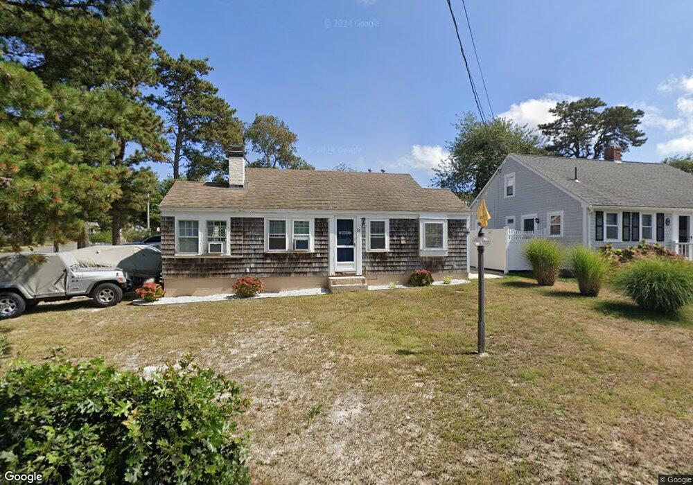
32 Myrtle Rd Dennis Port, MA 02639
Dennis Port NeighborhoodEstimated Value: $460,000 - $585,000
2
Beds
1
Bath
664
Sq Ft
$813/Sq Ft
Est. Value
About This Home
This home is located at 32 Myrtle Rd, Dennis Port, MA 02639 and is currently estimated at $539,942, approximately $813 per square foot. 32 Myrtle Rd is a home located in Barnstable County with nearby schools including Dennis-Yarmouth Regional High School and St. Pius X. School.
Ownership History
Date
Name
Owned For
Owner Type
Purchase Details
Closed on
Dec 26, 2012
Sold by
Petrillo Patricia M and Petrillo Stephen L
Bought by
Petrillo Ft
Current Estimated Value
Purchase Details
Closed on
Nov 3, 2011
Sold by
Crowley Neil D and Crowley Cindy J
Bought by
Petrillo Patricia M and Petrillo Stephen L
Home Financials for this Owner
Home Financials are based on the most recent Mortgage that was taken out on this home.
Original Mortgage
$200,800
Interest Rate
4.08%
Mortgage Type
Purchase Money Mortgage
Purchase Details
Closed on
Sep 13, 2001
Sold by
Smith David H and Smith Catherine O
Bought by
Crowley Neil D and Crowley Cindy J
Home Financials for this Owner
Home Financials are based on the most recent Mortgage that was taken out on this home.
Original Mortgage
$120,800
Interest Rate
6.99%
Mortgage Type
Purchase Money Mortgage
Create a Home Valuation Report for This Property
The Home Valuation Report is an in-depth analysis detailing your home's value as well as a comparison with similar homes in the area
Home Values in the Area
Average Home Value in this Area
Purchase History
| Date | Buyer | Sale Price | Title Company |
|---|---|---|---|
| Petrillo Ft | -- | -- | |
| Petrillo Patricia M | $251,000 | -- | |
| Crowley Neil D | $151,000 | -- |
Source: Public Records
Mortgage History
| Date | Status | Borrower | Loan Amount |
|---|---|---|---|
| Previous Owner | Petrillo Patricia M | $200,800 | |
| Previous Owner | Crowley Neil D | $120,800 |
Source: Public Records
Tax History Compared to Growth
Tax History
| Year | Tax Paid | Tax Assessment Tax Assessment Total Assessment is a certain percentage of the fair market value that is determined by local assessors to be the total taxable value of land and additions on the property. | Land | Improvement |
|---|---|---|---|---|
| 2025 | $2,185 | $504,700 | $279,000 | $225,700 |
| 2024 | $2,026 | $461,400 | $268,300 | $193,100 |
| 2023 | $1,959 | $419,400 | $243,900 | $175,500 |
| 2022 | $1,824 | $325,800 | $192,200 | $133,600 |
| 2021 | $1,789 | $296,700 | $188,400 | $108,300 |
| 2020 | $1,748 | $286,600 | $188,400 | $98,200 |
| 2019 | $1,783 | $288,900 | $200,600 | $88,300 |
| 2018 | $1,725 | $272,100 | $191,000 | $81,100 |
| 2017 | $1,565 | $254,400 | $175,900 | $78,500 |
| 2016 | $1,520 | $232,800 | $165,800 | $67,000 |
| 2015 | $1,490 | $232,800 | $165,800 | $67,000 |
| 2014 | $1,415 | $222,800 | $155,800 | $67,000 |
Source: Public Records
Map
Nearby Homes
- 37-A Beach Hills Rd
- 22 Ferncliff Rd
- 37 Beach Hills Rd
- 102 Sea St
- 262 Old Wharf Rd Unit 67
- 262 Old Wharf Rd Unit 5
- 262 Old Wharf Rd Unit 5
- 262 Old Wharf Rd Unit 20
- 262 Old Wharf Rd Unit 87
- 241 Old Wharf Rd Unit 82
- 241 Old Wharf Rd Unit 127
- 241 Old Wharf Rd Unit 90
- 402 Old Wharf Rd
- 402 Old Wharf Rd
- 405 Old Wharf Rd Unit B204
- 405 Old Wharf Rd Unit B204
- 217 Old Wharf Rd Unit 64
- 31 Easy St
- 9 Chase Ave Unit 6
- 11 Ocean Park W