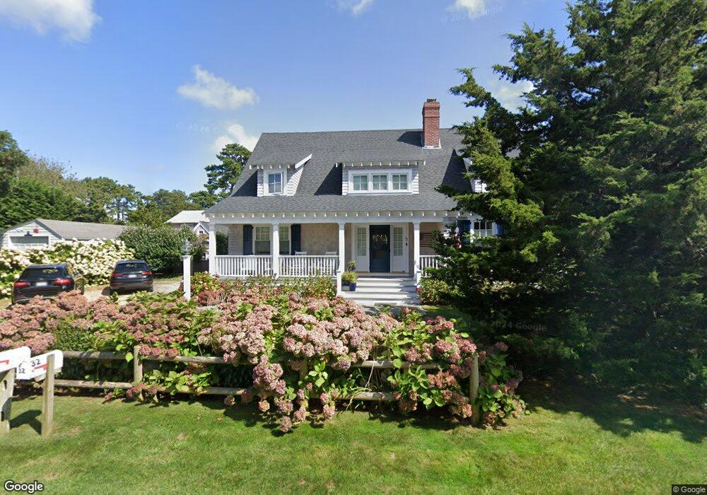
32 Ocean Dr Dennis Port, MA 02639
Dennis Port NeighborhoodEstimated Value: $634,000 - $1,634,000
3
Beds
2
Baths
1,103
Sq Ft
$1,163/Sq Ft
Est. Value
About This Home
This home is located at 32 Ocean Dr, Dennis Port, MA 02639 and is currently estimated at $1,282,387, approximately $1,162 per square foot. 32 Ocean Dr is a home located in Barnstable County with nearby schools including Dennis-Yarmouth Regional High School and St. Pius X. School.
Ownership History
Date
Name
Owned For
Owner Type
Purchase Details
Closed on
Apr 26, 2024
Sold by
Debenedictis Anthony P and Debenedictis Maria
Bought by
Debenedictis Ft and Debenedictis
Current Estimated Value
Purchase Details
Closed on
May 23, 2017
Sold by
Bacon Paula
Bought by
Debenedictis Anthony P and Debenedictis Maria
Purchase Details
Closed on
Nov 14, 1979
Bought by
Abellera Thomas
Create a Home Valuation Report for This Property
The Home Valuation Report is an in-depth analysis detailing your home's value as well as a comparison with similar homes in the area
Home Values in the Area
Average Home Value in this Area
Purchase History
| Date | Buyer | Sale Price | Title Company |
|---|---|---|---|
| Debenedictis Ft | -- | None Available | |
| Debenedictis Ft | -- | None Available | |
| Debenedictis Anthony P | $300,000 | -- | |
| Abellera Thomas | -- | -- |
Source: Public Records
Tax History Compared to Growth
Tax History
| Year | Tax Paid | Tax Assessment Tax Assessment Total Assessment is a certain percentage of the fair market value that is determined by local assessors to be the total taxable value of land and additions on the property. | Land | Improvement |
|---|---|---|---|---|
| 2025 | $6,615 | $1,527,800 | $316,200 | $1,211,600 |
| 2024 | $6,545 | $1,490,800 | $304,100 | $1,186,700 |
| 2023 | $5,861 | $1,255,100 | $276,400 | $978,700 |
| 2022 | $5,276 | $942,200 | $217,900 | $724,300 |
| 2021 | $0 | $836,700 | $213,600 | $623,100 |
| 2020 | $3,594 | $616,700 | $213,600 | $403,100 |
| 2019 | $0 | $362,100 | $227,400 | $134,700 |
| 2018 | $2,138 | $337,200 | $216,400 | $120,800 |
| 2017 | $1,945 | $316,200 | $199,300 | $116,900 |
| 2016 | $1,873 | $286,800 | $188,000 | $98,800 |
| 2015 | $1,836 | $286,800 | $188,000 | $98,800 |
| 2014 | $1,749 | $275,400 | $176,600 | $98,800 |
Source: Public Records
Map
Nearby Homes
- 37 Ocean Dr Unit 2
- 64 Beaten Rd
- 112 Old Wharf Rd Unit E4
- 112 Old Wharf Rd Unit E1
- 120 Old Wharf Rd Unit 11
- 154 Old Wharf Rd Unit 26
- 154 Old Wharf Rd Unit 14
- 80 Michaels Ave
- 217 Old Wharf Rd Unit 64
- 31 Easy St
- 241 Old Wharf Rd Unit 82
- 241 Old Wharf Rd Unit 127
- 241 Old Wharf Rd Unit 90
- 262 Old Wharf Rd Unit 67
- 262 Old Wharf Rd Unit 5
- 262 Old Wharf Rd Unit 5
- 262 Old Wharf Rd Unit 20
- 262 Old Wharf Rd Unit 87
- 6 Baker Way
- 37 Beach Hills Rd