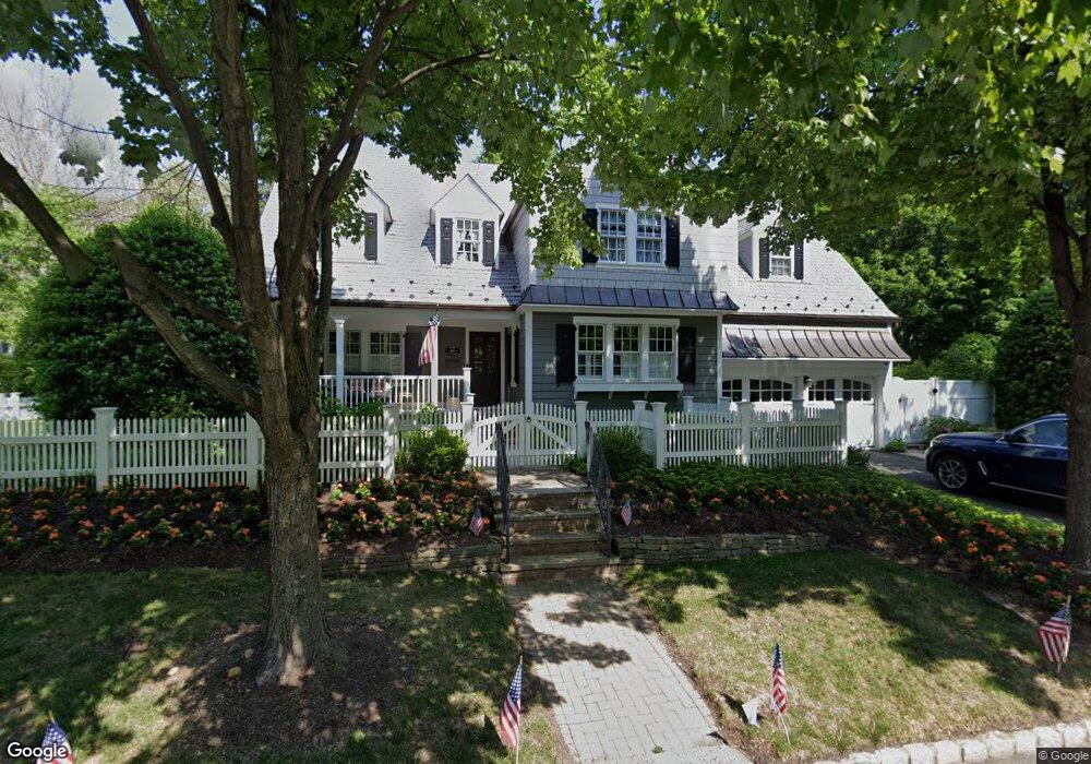
32 Olmstead Rd Morristown, NJ 07960
Estimated Value: $977,000 - $1,213,000
4
Beds
3
Baths
3,028
Sq Ft
$357/Sq Ft
Est. Value
About This Home
This home is located at 32 Olmstead Rd, Morristown, NJ 07960 and is currently estimated at $1,081,184, approximately $357 per square foot. 32 Olmstead Rd is a home located in Morris County with nearby schools including Hillcrest School, Thomas Jefferson School, and Alexander Hamilton School.
Ownership History
Date
Name
Owned For
Owner Type
Purchase Details
Closed on
Aug 2, 1999
Sold by
Bauer Larry R and Bauer Carol Diehl
Bought by
Bollag Jacqueline A
Current Estimated Value
Home Financials for this Owner
Home Financials are based on the most recent Mortgage that was taken out on this home.
Original Mortgage
$332,000
Outstanding Balance
$94,586
Interest Rate
7.54%
Mortgage Type
Purchase Money Mortgage
Estimated Equity
$986,598
Create a Home Valuation Report for This Property
The Home Valuation Report is an in-depth analysis detailing your home's value as well as a comparison with similar homes in the area
Home Values in the Area
Average Home Value in this Area
Purchase History
| Date | Buyer | Sale Price | Title Company |
|---|---|---|---|
| Bollag Jacqueline A | $415,000 | -- |
Source: Public Records
Mortgage History
| Date | Status | Borrower | Loan Amount |
|---|---|---|---|
| Open | Bollag Jacqueline A | $332,000 |
Source: Public Records
Tax History Compared to Growth
Tax History
| Year | Tax Paid | Tax Assessment Tax Assessment Total Assessment is a certain percentage of the fair market value that is determined by local assessors to be the total taxable value of land and additions on the property. | Land | Improvement |
|---|---|---|---|---|
| 2025 | $14,106 | $704,600 | $274,700 | $429,900 |
| 2024 | $14,127 | $704,600 | $274,700 | $429,900 |
| 2023 | $14,127 | $704,600 | $274,700 | $429,900 |
| 2022 | $13,472 | $704,600 | $274,700 | $429,900 |
| 2021 | $13,472 | $704,600 | $274,700 | $429,900 |
| 2020 | $13,120 | $704,600 | $274,700 | $429,900 |
| 2019 | $10,857 | $592,300 | $274,700 | $317,600 |
| 2018 | $10,738 | $592,300 | $274,700 | $317,600 |
| 2017 | $10,667 | $592,300 | $274,700 | $317,600 |
| 2016 | $10,501 | $592,300 | $274,700 | $317,600 |
| 2015 | $11,754 | $463,500 | $229,700 | $233,800 |
| 2014 | $11,601 | $463,500 | $229,700 | $233,800 |
Source: Public Records
Map
Nearby Homes
- 55 Georgian Rd
- 15 Georgian Rd
- 180 Franklin St
- 15 Harding Rd
- 172 Franklin St
- 61 Village Dr
- 9 Green Knolls Rd
- 309 Pitney Place Unit 309
- 508 Pitney Place Unit 508
- 1A Dorado Dr
- 25 Taft Ln
- 15 Catalpa Rd
- 93 Columbia Rd
- 54B Ridgedale Ave
- 21 Franklin Place
- 21 Beechwood Dr
- 320 South St Unit E
- 320 South St Unit G
- 320 South St Unit O
- 31 Hamilton Rd