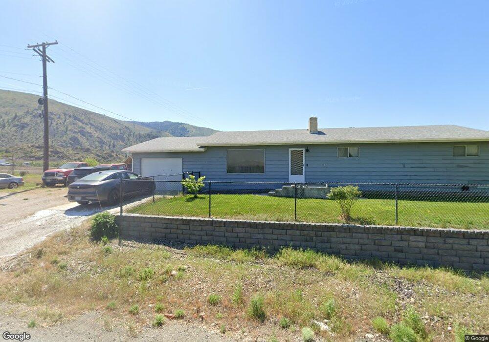
32 Orondo Loop Rd Orondo, WA 98843
Estimated Value: $411,695 - $1,166,000
3
Beds
2
Baths
2,006
Sq Ft
$340/Sq Ft
Est. Value
About This Home
This home is located at 32 Orondo Loop Rd, Orondo, WA 98843 and is currently estimated at $681,924, approximately $339 per square foot. 32 Orondo Loop Rd is a home located in Douglas County with nearby schools including Orondo Elementary/Middle School.
Ownership History
Date
Name
Owned For
Owner Type
Purchase Details
Closed on
May 21, 2016
Sold by
Dennis Joann
Bought by
Dennis Justin K and Dennis Christine
Current Estimated Value
Home Financials for this Owner
Home Financials are based on the most recent Mortgage that was taken out on this home.
Original Mortgage
$142,000
Outstanding Balance
$113,042
Interest Rate
3.66%
Mortgage Type
VA
Estimated Equity
$568,882
Purchase Details
Closed on
Feb 26, 2016
Sold by
Thorne Wayne L and Thorne Donna K
Bought by
Dennis Joann
Create a Home Valuation Report for This Property
The Home Valuation Report is an in-depth analysis detailing your home's value as well as a comparison with similar homes in the area
Home Values in the Area
Average Home Value in this Area
Purchase History
| Date | Buyer | Sale Price | Title Company |
|---|---|---|---|
| Dennis Justin K | $142,000 | First American Title Ins Co | |
| Dennis Joann | -- | None Available |
Source: Public Records
Mortgage History
| Date | Status | Borrower | Loan Amount |
|---|---|---|---|
| Open | Dennis Justin K | $142,000 |
Source: Public Records
Tax History Compared to Growth
Tax History
| Year | Tax Paid | Tax Assessment Tax Assessment Total Assessment is a certain percentage of the fair market value that is determined by local assessors to be the total taxable value of land and additions on the property. | Land | Improvement |
|---|---|---|---|---|
| 2025 | $273 | $309,200 | $36,000 | $273,200 |
| 2024 | $273 | $281,100 | $36,000 | $245,100 |
| 2023 | $294 | $281,100 | $36,000 | $245,100 |
| 2022 | $332 | $204,300 | $36,000 | $168,300 |
| 2021 | $1,220 | $204,300 | $36,000 | $168,300 |
| 2020 | $1,191 | $145,500 | $36,000 | $109,500 |
| 2018 | $1,306 | $145,500 | $36,000 | $109,500 |
| 2017 | $1,165 | $145,500 | $36,000 | $109,500 |
| 2016 | $1,174 | $133,500 | $24,000 | $109,500 |
| 2015 | $1,260 | $133,500 | $24,000 | $109,500 |
| 2014 | -- | $133,500 | $24,000 | $109,500 |
| 2013 | -- | $133,500 | $24,000 | $109,500 |
Source: Public Records
Map
Nearby Homes
- 21500 U S 97
- 0 Fisher Ln
- 13397 State Rd
- 24 Mile Entiat River Rd
- 66 Coyote Ln
- 25 Corral Ln
- 2431 Entiat Way
- 9955 Griffith Place
- 9968 Griffith Place
- 2370 Albin Dr
- 0 XX Melvin Rd
- 98 Tyee View Loop Rd
- 15003 Allison Place
- 6 XX Chipmunk Trail
- 15009 Allison Place
- 103 Fir Rd
- 5058 Mills Canyon Rd
- 219 Chipmunk Trail
- 1 XX Redfield Rd
- 2 XX Redfield Rd
- 32 Orondo Spur Rd
- 11 Orondo Spur Rd
- 61 Orondo Loop Rd
- 21332 State Highway 97
- 14011 U S Highway 2
- 14007 U S 97
- 5 Orondo Spur Rd
- 14006 Us 2
- 0 218xx U S 97 Unit C
- 0 218xx U S 97 Unit B
- 7 U S 97
- 21325 State Highway 97
- 21325 Highway 97
- 21339 State Highway 97
- 21315 State Highway 97
- 21310 State Highway 97
- 13990 Us 2
- 10 Lodgewater Dr
- 14 Dewie Dr
- 18 Dewie Dr