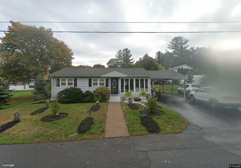
32 Phillips Rd Leominster, MA 01453
Estimated Value: $390,000 - $466,000
3
Beds
2
Baths
1,120
Sq Ft
$391/Sq Ft
Est. Value
About This Home
This home is located at 32 Phillips Rd, Leominster, MA 01453 and is currently estimated at $437,664, approximately $390 per square foot. 32 Phillips Rd is a home located in Worcester County with nearby schools including Leominster High School, St. Leo School, and St. Anna Catholic School.
Ownership History
Date
Name
Owned For
Owner Type
Purchase Details
Closed on
Oct 4, 2005
Sold by
Mayou Brian M and Mayou Sharon A
Bought by
Carney William D
Current Estimated Value
Home Financials for this Owner
Home Financials are based on the most recent Mortgage that was taken out on this home.
Original Mortgage
$210,400
Interest Rate
5.84%
Mortgage Type
Purchase Money Mortgage
Purchase Details
Closed on
Aug 30, 2001
Sold by
Flynn Steven D and Flynn Karen A
Bought by
Mayou Brian M and Mayou Sharon A
Create a Home Valuation Report for This Property
The Home Valuation Report is an in-depth analysis detailing your home's value as well as a comparison with similar homes in the area
Home Values in the Area
Average Home Value in this Area
Purchase History
| Date | Buyer | Sale Price | Title Company |
|---|---|---|---|
| Carney William D | $263,000 | -- | |
| Carney William D | $263,000 | -- | |
| Mayou Brian M | $177,000 | -- | |
| Mayou Brian M | $177,000 | -- |
Source: Public Records
Mortgage History
| Date | Status | Borrower | Loan Amount |
|---|---|---|---|
| Open | Mayou Brian M | $263,189 | |
| Closed | Carney William D | $210,400 | |
| Closed | Carney William D | $52,600 |
Source: Public Records
Tax History
| Year | Tax Paid | Tax Assessment Tax Assessment Total Assessment is a certain percentage of the fair market value that is determined by local assessors to be the total taxable value of land and additions on the property. | Land | Improvement |
|---|---|---|---|---|
| 2025 | $5,663 | $403,600 | $125,400 | $278,200 |
| 2024 | $5,435 | $374,600 | $119,400 | $255,200 |
| 2023 | $5,276 | $339,500 | $103,800 | $235,700 |
| 2022 | $5,077 | $306,600 | $90,300 | $216,300 |
| 2021 | $4,804 | $265,000 | $70,300 | $194,700 |
| 2020 | $4,563 | $253,800 | $70,300 | $183,500 |
| 2019 | $4,368 | $235,600 | $66,900 | $168,700 |
| 2018 | $4,260 | $220,400 | $64,900 | $155,500 |
| 2017 | $4,005 | $203,000 | $60,700 | $142,300 |
| 2016 | $3,846 | $196,400 | $60,700 | $135,700 |
| 2015 | $3,657 | $188,100 | $60,700 | $127,400 |
| 2014 | $3,427 | $181,400 | $63,700 | $117,700 |
Source: Public Records
Map
Nearby Homes
- 46 Eugene St
- 47 Carolyn St
- 65 Gordon St
- 242 Pleasant St
- 192 Pleasant St Unit 25
- 123 Lancaster St
- 59 Lancaster St
- 186 Elm St
- 5 Eaton Place
- 51 Pleasant St
- 556 Central St Unit 141
- 556 Central St Unit 183
- 556 Central St Unit 11
- 11 Pine St
- 44 Chapman Place Unit 44
- 0 Wheeler St
- 59 Webber St
- 14 Walker St
- 16 Depot Square
- 77 Carter St
Your Personal Tour Guide
Ask me questions while you tour the home.