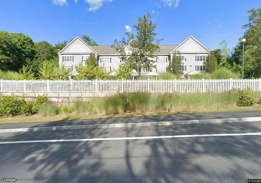
32 Pommogussett Rd Unit 5 Rutland, MA 01543
Estimated Value: $329,208 - $401,000
2
Beds
2
Baths
1,296
Sq Ft
$272/Sq Ft
Est. Value
About This Home
This home is located at 32 Pommogussett Rd Unit 5, Rutland, MA 01543 and is currently estimated at $352,552, approximately $272 per square foot. 32 Pommogussett Rd Unit 5 is a home located in Worcester County with nearby schools including Wachusett Regional High School.
Ownership History
Date
Name
Owned For
Owner Type
Purchase Details
Closed on
Nov 17, 2021
Sold by
Warsheski Erin
Bought by
Warsheski Erin F and Warsheski Robert S
Current Estimated Value
Home Financials for this Owner
Home Financials are based on the most recent Mortgage that was taken out on this home.
Original Mortgage
$120,000
Outstanding Balance
$109,496
Interest Rate
2.99%
Mortgage Type
New Conventional
Estimated Equity
$243,056
Purchase Details
Closed on
Aug 13, 2004
Sold by
Britney Realty Llc
Bought by
Gabaree Erin F
Home Financials for this Owner
Home Financials are based on the most recent Mortgage that was taken out on this home.
Original Mortgage
$193,900
Interest Rate
6.16%
Mortgage Type
Purchase Money Mortgage
Create a Home Valuation Report for This Property
The Home Valuation Report is an in-depth analysis detailing your home's value as well as a comparison with similar homes in the area
Home Values in the Area
Average Home Value in this Area
Purchase History
| Date | Buyer | Sale Price | Title Company |
|---|---|---|---|
| Warsheski Erin F | -- | None Available | |
| Warsheski Erin F | -- | None Available | |
| Gabaree Erin F | $199,900 | -- | |
| Gabaree Erin F | $199,900 | -- | |
| Gabaree Erin F | $199,900 | -- |
Source: Public Records
Mortgage History
| Date | Status | Borrower | Loan Amount |
|---|---|---|---|
| Open | Warsheski Erin F | $120,000 | |
| Closed | Warsheski Erin F | $120,000 | |
| Previous Owner | Gabaree Erin F | $193,900 |
Source: Public Records
Tax History Compared to Growth
Tax History
| Year | Tax Paid | Tax Assessment Tax Assessment Total Assessment is a certain percentage of the fair market value that is determined by local assessors to be the total taxable value of land and additions on the property. | Land | Improvement |
|---|---|---|---|---|
| 2025 | $3,744 | $262,900 | $0 | $262,900 |
| 2024 | $3,899 | $262,900 | $0 | $262,900 |
| 2023 | $3,405 | $248,200 | $0 | $248,200 |
| 2022 | $3,300 | $209,000 | $0 | $209,000 |
| 2021 | $3,420 | $204,800 | $0 | $204,800 |
| 2020 | $3,031 | $172,100 | $0 | $172,100 |
| 2019 | $3,009 | $168,200 | $0 | $168,200 |
| 2018 | $2,968 | $163,700 | $0 | $163,700 |
| 2017 | $2,999 | $163,700 | $0 | $163,700 |
| 2016 | $2,713 | $156,200 | $0 | $156,200 |
| 2015 | $2,757 | $156,200 | $0 | $156,200 |
| 2014 | $2,673 | $156,200 | $0 | $156,200 |
Source: Public Records
Map
Nearby Homes
- 32 Pommogussett Rd Unit 1
- 5 Miles Rd
- 55 Pommogussett Rd
- 10 Soucy Dr
- 25 Watson Ln
- 28 Forest Hill Dr
- 11 Lewis St
- 21 Lewis St
- 6 Lewis St
- 12 Lewis St
- 27 Lewis St
- 2 Forest Hill Dr
- 16 Richards Ave
- 10 Fidelity Dr Unit 5
- 12 Fidelity Dr Unit 6
- 132 Fidelity Dr Unit 61
- 85 Maple Ave Unit A
- 21 Highland Park Rd
- 47 Woodside Ave
- 7 Prescott St
- 32 Pommogussett Rd Unit 8
- 32 Pommogussett Rd Unit 7
- 32 Pommogussett Rd Unit 6
- 32 Pommogussett Rd Unit 4
- 32 Pommogussett Rd Unit 3
- 32 Pommogussett Rd Unit 2
- 26-32 Pommogussett Rd
- 24 Pommogussett Rd
- 24 Pommogussett Rd Unit 3
- 24 Pommogussett Rd
- 21 Memorial Dr
- 21 Memorial Dr Unit 1
- 34 Pommogussett Rd
- 11 Prouty Ln
- 11 Memorial Dr Unit 4B
- 11 Memorial Dr Unit 3A
- 11 Memorial Dr
- 13 Prouty Ln
- 9 Prouty Ln
- 15 Prouty Ln