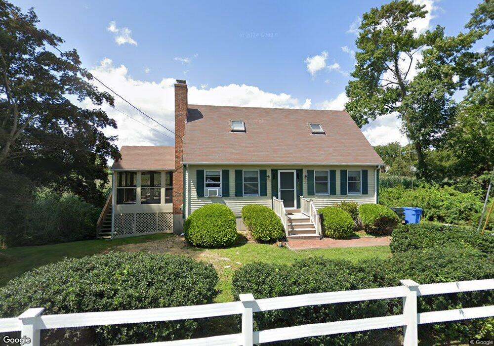
32 Pratt Rd Clinton, CT 06413
Estimated Value: $480,000 - $611,000
2
Beds
3
Baths
1,306
Sq Ft
$408/Sq Ft
Est. Value
About This Home
This home is located at 32 Pratt Rd, Clinton, CT 06413 and is currently estimated at $532,406, approximately $407 per square foot. 32 Pratt Rd is a home located in Middlesex County with nearby schools including Lewin G. Joel Jr. School, The Morgan School, and Our Lady of Mercy Preparatory Academy.
Ownership History
Date
Name
Owned For
Owner Type
Purchase Details
Closed on
Jan 27, 2014
Sold by
Posner Kenneth R and Posner Arlene L
Bought by
M Posner Spec Needs Z
Current Estimated Value
Purchase Details
Closed on
May 21, 2004
Sold by
Sours D Matthew
Bought by
Posner Kenneth R and Posner Erline L
Purchase Details
Closed on
Mar 2, 1999
Sold by
Defrino John A
Bought by
Gerwig Cathleen M
Home Financials for this Owner
Home Financials are based on the most recent Mortgage that was taken out on this home.
Original Mortgage
$295,000
Interest Rate
6.13%
Purchase Details
Closed on
Nov 20, 1996
Sold by
Sinclair Charles and Sinclair Nancy J
Bought by
Sours Katherine D and Matthew Sours D
Purchase Details
Closed on
Mar 15, 1991
Sold by
Farmers & Mech Svg Bk
Bought by
Page Nancy J and Sinclair Charles
Create a Home Valuation Report for This Property
The Home Valuation Report is an in-depth analysis detailing your home's value as well as a comparison with similar homes in the area
Home Values in the Area
Average Home Value in this Area
Purchase History
| Date | Buyer | Sale Price | Title Company |
|---|---|---|---|
| M Posner Spec Needs Z | -- | -- | |
| Needs Z M Posner Spec | -- | -- | |
| Posner Kenneth R | $266,000 | -- | |
| Posner Kenneth R | $266,000 | -- | |
| Gerwig Cathleen M | $395,000 | -- | |
| Gerwig Cathleen M | $395,000 | -- | |
| Sours Katherine D | $148,000 | -- | |
| Sours Katherine D | $148,000 | -- | |
| Page Nancy J | $145,000 | -- |
Source: Public Records
Mortgage History
| Date | Status | Borrower | Loan Amount |
|---|---|---|---|
| Previous Owner | Page Nancy J | $295,000 |
Source: Public Records
Tax History Compared to Growth
Tax History
| Year | Tax Paid | Tax Assessment Tax Assessment Total Assessment is a certain percentage of the fair market value that is determined by local assessors to be the total taxable value of land and additions on the property. | Land | Improvement |
|---|---|---|---|---|
| 2025 | $6,107 | $196,100 | $95,000 | $101,100 |
| 2024 | $5,934 | $196,100 | $95,000 | $101,100 |
| 2023 | $5,850 | $196,100 | $95,000 | $101,100 |
| 2022 | $5,850 | $196,100 | $95,000 | $101,100 |
| 2021 | $5,680 | $190,400 | $95,000 | $95,400 |
| 2020 | $5,950 | $190,400 | $95,000 | $95,400 |
| 2019 | $5,950 | $190,400 | $95,000 | $95,400 |
| 2018 | $5,815 | $190,400 | $95,000 | $95,400 |
| 2017 | $5,695 | $190,400 | $95,000 | $95,400 |
| 2016 | $5,167 | $190,400 | $95,000 | $95,400 |
| 2015 | $4,821 | $180,100 | $86,800 | $93,300 |
| 2014 | $4,731 | $180,100 | $86,800 | $93,300 |
Source: Public Records
Map
Nearby Homes
- 0 Cow Hill Rd
- 64 W Main St
- 116 Commerce St Unit F-9
- 133 W Main St Unit MV1
- 133 W Main St Unit TRLR A9
- 3 Sandgate Cir
- 13 Waterside Ln
- 4 Currycross Rd Unit 4
- 4 North St
- 27 College St Unit 4
- 63GG Dudley Ln
- 1 Downing Way Unit 1
- 7 3rd St
- 6 Young's Village
- 151 E Main St Unit 12
- 153 E Main St Unit 10
- 153 E Main St Unit 13
- 153 E Main St Unit 31
- 153 E Main St Unit 8
- 153 E Main St Unit 9