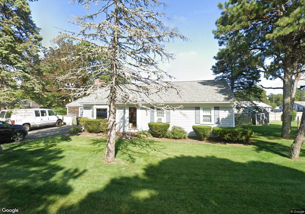
32 Princeton Cir West Dennis, MA 02670
West Dennis NeighborhoodEstimated Value: $563,000 - $707,000
3
Beds
1
Bath
1,532
Sq Ft
$422/Sq Ft
Est. Value
About This Home
This home is located at 32 Princeton Cir, West Dennis, MA 02670 and is currently estimated at $646,085, approximately $421 per square foot. 32 Princeton Cir is a home located in Barnstable County with nearby schools including Dennis-Yarmouth Regional High School and St. Pius X. School.
Ownership History
Date
Name
Owned For
Owner Type
Purchase Details
Closed on
Sep 30, 1999
Sold by
Sarkas Marjorie A
Bought by
Ezersky Richard E and Wiley Christine M
Current Estimated Value
Home Financials for this Owner
Home Financials are based on the most recent Mortgage that was taken out on this home.
Original Mortgage
$136,800
Outstanding Balance
$41,369
Interest Rate
7.85%
Mortgage Type
Purchase Money Mortgage
Estimated Equity
$604,716
Create a Home Valuation Report for This Property
The Home Valuation Report is an in-depth analysis detailing your home's value as well as a comparison with similar homes in the area
Home Values in the Area
Average Home Value in this Area
Purchase History
| Date | Buyer | Sale Price | Title Company |
|---|---|---|---|
| Ezersky Richard E | $152,000 | -- |
Source: Public Records
Mortgage History
| Date | Status | Borrower | Loan Amount |
|---|---|---|---|
| Open | Ezersky Richard E | $136,800 |
Source: Public Records
Tax History Compared to Growth
Tax History
| Year | Tax Paid | Tax Assessment Tax Assessment Total Assessment is a certain percentage of the fair market value that is determined by local assessors to be the total taxable value of land and additions on the property. | Land | Improvement |
|---|---|---|---|---|
| 2025 | $2,731 | $630,800 | $233,400 | $397,400 |
| 2024 | $2,630 | $599,200 | $224,500 | $374,700 |
| 2023 | $2,544 | $544,700 | $204,000 | $340,700 |
| 2022 | $2,316 | $413,500 | $159,300 | $254,200 |
| 2021 | $2,229 | $369,600 | $156,200 | $213,400 |
| 2020 | $2,178 | $357,000 | $168,200 | $188,800 |
| 2019 | $2,018 | $327,000 | $176,700 | $150,300 |
| 2018 | $4,244 | $298,700 | $157,000 | $141,700 |
| 2017 | $1,809 | $294,200 | $157,000 | $137,200 |
| 2016 | $1,836 | $281,100 | $162,600 | $118,500 |
| 2015 | $1,799 | $281,100 | $162,600 | $118,500 |
| 2014 | $1,785 | $281,100 | $162,600 | $118,500 |
Source: Public Records
Map
Nearby Homes
- 15 Woodside Park Rd
- 12 Spoonbill Rd
- 61 Trotters Ln
- 80 Michaels Ave
- 26 Center St
- 71 Main St
- 3 Pinefield Ln
- 19 Standish Way
- 4 Coffey Ln
- 95 Center St
- 125 Main St Unit 3
- 467 Main St
- 22 Wixon Rd
- 31 Easy St
- 401 Main St Unit 201
- 401 Main St Unit 101
- 37 Ocean Dr Unit 2
- 72 Bassett Ln
- 268 Main St
- 64 Beaten Rd
- 51 Dartmouth Rd
- 26 Princeton Cir
- 37 Princeton Cir
- 36 Princeton Cir
- 33 Princeton Cir
- 57 Dartmouth Rd
- 45 Dartmouth Rd
- 41 Princeton Cir
- 20 Princeton Cir
- 20 Princeton Cir Unit 1
- 20 Princeton Cir
- 40 Princeton Cir
- 31 Princeton Cir
- 61 Dartmouth Rd
- 22 Arrowhead Dr
- 46 Dartmouth Rd
- 28 Arrowhead Dr
- 47 Princeton Cir
- 50 Dartmouth Rd
- 43 Dartmouth Rd