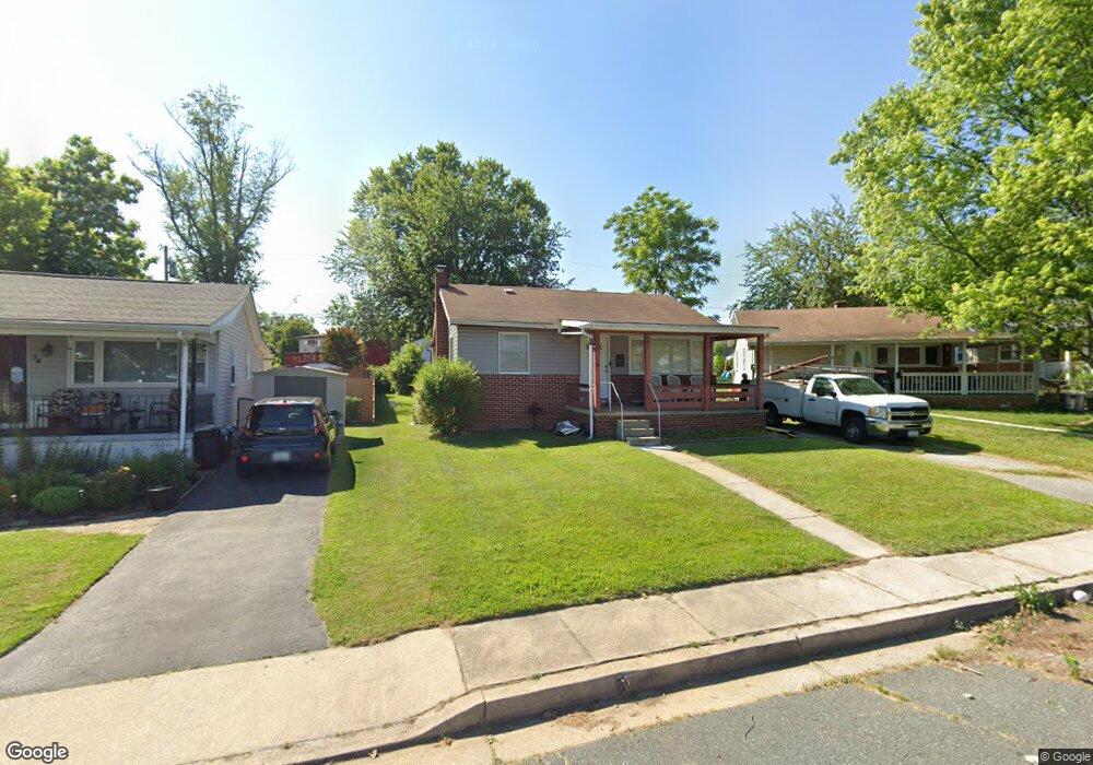
32 Propeller Dr Middle River, MD 21220
Estimated Value: $247,333 - $278,000
3
Beds
1
Bath
1,102
Sq Ft
$237/Sq Ft
Est. Value
About This Home
This home is located at 32 Propeller Dr, Middle River, MD 21220 and is currently estimated at $261,583, approximately $237 per square foot. 32 Propeller Dr is a home located in Baltimore County with nearby schools including Orems Elementary, Stemmers Run Middle School, and Kenwood High.
Ownership History
Date
Name
Owned For
Owner Type
Purchase Details
Closed on
Nov 10, 2011
Sold by
Bowen Jack and Bowen Alice Virginia
Bought by
Thomas Richard H
Current Estimated Value
Home Financials for this Owner
Home Financials are based on the most recent Mortgage that was taken out on this home.
Original Mortgage
$148,146
Outstanding Balance
$101,508
Interest Rate
4.12%
Mortgage Type
FHA
Estimated Equity
$160,075
Purchase Details
Closed on
Oct 30, 2006
Sold by
Bowen Jack
Bought by
Bowen Jack
Purchase Details
Closed on
Oct 12, 2006
Sold by
Bowen Jack
Bought by
Bowen Jack
Purchase Details
Closed on
Sep 6, 2002
Sold by
Bowen Jack
Bought by
Bowen Jack
Create a Home Valuation Report for This Property
The Home Valuation Report is an in-depth analysis detailing your home's value as well as a comparison with similar homes in the area
Home Values in the Area
Average Home Value in this Area
Purchase History
| Date | Buyer | Sale Price | Title Company |
|---|---|---|---|
| Thomas Richard H | $152,000 | Sage Title Group Llc | |
| Bowen Jack | -- | -- | |
| Bowen Jack | -- | -- | |
| Bowen Jack | -- | -- |
Source: Public Records
Mortgage History
| Date | Status | Borrower | Loan Amount |
|---|---|---|---|
| Open | Thomas Richard H | $148,146 |
Source: Public Records
Tax History
| Year | Tax Paid | Tax Assessment Tax Assessment Total Assessment is a certain percentage of the fair market value that is determined by local assessors to be the total taxable value of land and additions on the property. | Land | Improvement |
|---|---|---|---|---|
| 2025 | $2,347 | $174,733 | -- | -- |
| 2024 | $2,347 | $163,267 | $0 | $0 |
| 2023 | $1,129 | $151,800 | $53,500 | $98,300 |
| 2022 | $2,153 | $144,967 | $0 | $0 |
| 2021 | $2,022 | $138,133 | $0 | $0 |
| 2020 | $2,022 | $131,300 | $53,500 | $77,800 |
| 2019 | $1,956 | $130,133 | $0 | $0 |
| 2018 | $1,921 | $128,967 | $0 | $0 |
| 2017 | $1,840 | $127,800 | $0 | $0 |
| 2016 | $2,172 | $124,400 | $0 | $0 |
| 2015 | $2,172 | $121,000 | $0 | $0 |
| 2014 | $2,172 | $117,600 | $0 | $0 |
Source: Public Records
Map
Nearby Homes
- 17 Propeller Dr
- 1018 Cord St
- 1008 Fuselage Ave
- 902 Cord St
- 33 Left Wing Dr
- 109 Judywood Ln
- 35 Rockywood Ln
- 1201 Fuselage Ave
- 18 Blister St
- 49 Rockywood Ln
- 946 Middlesex Rd
- 1100 N Marlyn Ave
- 417 Torner Rd
- 8 Control Ct
- 116 Old Maple Ct
- 15 Russet Ct
- 0 John Ave Unit MDBC2113138
- 215 Seamaster Rd
- 577 Welbrook Rd
- 1713 Glen Curtis Rd
- 30 Propeller Dr
- 34 Propeller Dr
- 28 Propeller Dr
- 1017 Cord St
- 35 Hydroplane Dr
- 37 Hydroplane Dr
- 1101 Cord St
- 1015 Cord St
- 33 Hydroplane Dr
- 26 Propeller Dr
- 29 Propeller Dr
- 39 Hydroplane Dr
- 27 Propeller Dr
- 31 Hydroplane Dr
- 1103 Cord St
- 24 Propeller Dr
- 25 Propeller Dr
- 29 Hydroplane Dr
- 1011 Cord St
- 1105 Cord St
Your Personal Tour Guide
Ask me questions while you tour the home.