Estimated Value: $686,000 - $804,000
3
Beds
2
Baths
1,856
Sq Ft
$410/Sq Ft
Est. Value
About This Home
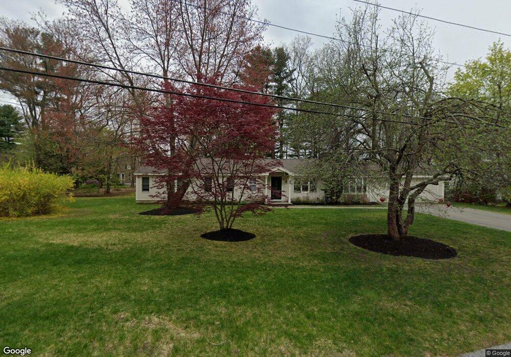
This home is located at 32 Quaboag Rd, Acton, MA 01720 and is currently estimated at $761,095, approximately $410 per square foot. 32 Quaboag Rd is a home located in Middlesex County with nearby schools including Acton-Boxborough Regional High School.
Ownership History
Date
Name
Owned For
Owner Type
Purchase Details
Closed on
Sep 16, 1988
Sold by
Nelke Carmelina R
Bought by
Breslouf John
Current Estimated Value
Home Financials for this Owner
Home Financials are based on the most recent Mortgage that was taken out on this home.
Original Mortgage
$77,000
Interest Rate
10.43%
Mortgage Type
Purchase Money Mortgage
Create a Home Valuation Report for This Property
The Home Valuation Report is an in-depth analysis detailing your home's value as well as a comparison with similar homes in the area
Home Values in the Area
Average Home Value in this Area
Purchase History
| Date | Buyer | Sale Price | Title Company |
|---|---|---|---|
| Breslouf John | $180,000 | -- |
Source: Public Records
Mortgage History
| Date | Status | Borrower | Loan Amount |
|---|---|---|---|
| Open | Breslouf John | $300,000 | |
| Closed | Breslouf John | $77,000 |
Source: Public Records
Tax History
| Year | Tax Paid | Tax Assessment Tax Assessment Total Assessment is a certain percentage of the fair market value that is determined by local assessors to be the total taxable value of land and additions on the property. | Land | Improvement |
|---|---|---|---|---|
| 2025 | $10,997 | $641,200 | $314,500 | $326,700 |
| 2024 | $10,435 | $626,000 | $314,500 | $311,500 |
| 2023 | $10,129 | $576,800 | $286,000 | $290,800 |
| 2022 | $10,083 | $518,400 | $248,500 | $269,900 |
| 2021 | $9,625 | $475,800 | $230,100 | $245,700 |
| 2020 | $9,020 | $468,800 | $230,100 | $238,700 |
| 2019 | $8,583 | $443,100 | $230,100 | $213,000 |
| 2018 | $7,986 | $412,100 | $230,100 | $182,000 |
| 2017 | $7,965 | $417,900 | $230,100 | $187,800 |
| 2016 | $7,490 | $389,500 | $230,100 | $159,400 |
| 2015 | $7,692 | $403,800 | $230,100 | $173,700 |
| 2014 | $7,704 | $396,100 | $230,100 | $166,000 |
Source: Public Records
Map
Nearby Homes
- 5 Perkins Ln
- 20 Joseph Reed Ln
- 235 Arlington St
- 285 Central St Unit 285
- 79 Charter Rd
- 8 Algonquin Rd
- 4 Littlefield Rd
- 60 Nashoba Rd
- 246 Main St Unit 2
- 92 Willow St Unit 3
- 92 Willow St Unit 2
- 90 Willow St Unit 1
- 7 Kelley Rd
- 18 Hayward Rd
- 184 Main St Unit 3
- 11 Braebrook
- 25 Nylander Way
- 46 Taylor Rd
- 129 Main St Unit 129
- 131 Main St
Your Personal Tour Guide
Ask me questions while you tour the home.