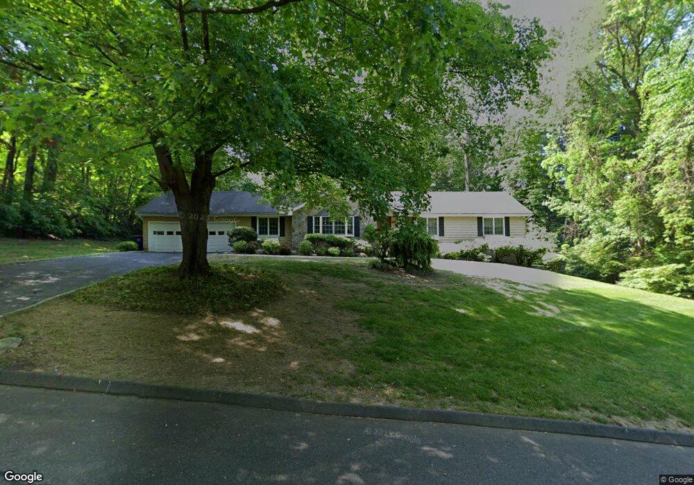
32 Rennison Rd Trumbull, CT 06611
Trumbull Center NeighborhoodEstimated Value: $626,626 - $780,000
3
Beds
3
Baths
1,670
Sq Ft
$413/Sq Ft
Est. Value
About This Home
This home is located at 32 Rennison Rd, Trumbull, CT 06611 and is currently estimated at $690,157, approximately $413 per square foot. 32 Rennison Rd is a home located in Fairfield County with nearby schools including Booth Hill School, Hillcrest Middle School, and Trumbull High School.
Ownership History
Date
Name
Owned For
Owner Type
Purchase Details
Closed on
Aug 14, 2019
Sold by
Crader Jacqueline and Crader Timothy
Bought by
Crader Timothy and Crader Nicole
Current Estimated Value
Purchase Details
Closed on
Aug 29, 2001
Sold by
Montoya Yolanda
Bought by
Crader Timothy and Crader Jacqueline A
Purchase Details
Closed on
Jan 14, 1988
Sold by
Est Wahlberg D
Bought by
Montoya Gustavo
Create a Home Valuation Report for This Property
The Home Valuation Report is an in-depth analysis detailing your home's value as well as a comparison with similar homes in the area
Home Values in the Area
Average Home Value in this Area
Purchase History
| Date | Buyer | Sale Price | Title Company |
|---|---|---|---|
| Crader Timothy | -- | -- | |
| Crader Timothy | $365,000 | -- | |
| Montoya Gustavo | $240,000 | -- |
Source: Public Records
Mortgage History
| Date | Status | Borrower | Loan Amount |
|---|---|---|---|
| Previous Owner | Montoya Gustavo | $340,000 | |
| Previous Owner | Montoya Gustavo | $339,000 |
Source: Public Records
Tax History
| Year | Tax Paid | Tax Assessment Tax Assessment Total Assessment is a certain percentage of the fair market value that is determined by local assessors to be the total taxable value of land and additions on the property. | Land | Improvement |
|---|---|---|---|---|
| 2025 | $11,045 | $298,830 | $163,100 | $135,730 |
| 2024 | $10,727 | $298,830 | $163,100 | $135,730 |
| 2023 | $10,564 | $298,830 | $163,100 | $135,730 |
| 2022 | $10,401 | $298,830 | $163,100 | $135,730 |
| 2021 | $9,376 | $260,750 | $154,700 | $106,050 |
| 2020 | $9,376 | $260,750 | $154,700 | $106,050 |
| 2018 | $9,171 | $260,750 | $154,700 | $106,050 |
| 2017 | $8,996 | $260,750 | $154,700 | $106,050 |
| 2016 | $8,827 | $260,750 | $154,700 | $106,050 |
| 2015 | $8,883 | $263,600 | $154,700 | $108,900 |
| 2014 | $8,694 | $263,600 | $154,700 | $108,900 |
Source: Public Records
Map
Nearby Homes
- 22 Beverly Rd
- 5 W Mischa Rd
- 7 E Lake Rd
- 85 Teeter Rock Rd
- 68 Old Dike Rd
- 0 Pinewood Trail
- 101 Golden Hill St
- 38 Macdonald Rd
- 2449 Huntington Turnpike
- 30 Rolling Wood Dr
- 10 Foxwood Rd
- 244 Strobel Rd
- 111 Stones Throw
- 60 Quail Trail
- 176 Strobel Rd
- 9 Sunnyridge Pkwy
- 311 Isinglass Rd
- 58 Daniels Farm Rd
- 2 Doe Hollow Dr
- 877 White Plains Rd
- 33 Beverly Rd
- 26 Rennison Rd
- 40 Green Ridge Rd
- 29 Beverly Rd
- 48 Green Ridge Rd
- 24 Rennison Rd
- 25 Beverly Rd
- 28 Green Ridge Rd
- 29 Rennison Rd
- 39 Green Ridge Rd
- 20 Rennison Rd
- 30 Beverly Rd
- 23 Beverly Rd
- 50 Green Ridge Rd
- 19 Rennison Rd
- 22 Green Ridge Rd
- 20 Beverly Rd
- 18 Rennison Rd
- 31 Green Ridge Rd
- 19 Beverly Rd
Your Personal Tour Guide
Ask me questions while you tour the home.