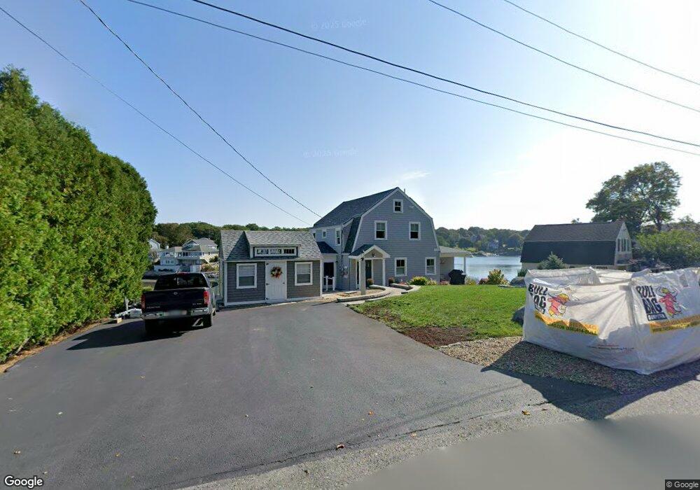
32 Riverside Rd Gloucester, MA 01930
Riverview NeighborhoodEstimated Value: $1,554,000 - $2,372,022
4
Beds
4
Baths
2,274
Sq Ft
$912/Sq Ft
Est. Value
About This Home
This home is located at 32 Riverside Rd, Gloucester, MA 01930 and is currently estimated at $2,074,674, approximately $912 per square foot. 32 Riverside Rd is a home located in Essex County with nearby schools including Beeman Memorial, Ralph B O'maley Middle School, and Gloucester High School.
Ownership History
Date
Name
Owned For
Owner Type
Purchase Details
Closed on
Mar 30, 2022
Sold by
Taylor Lisa C and Taylor Robert M
Bought by
R M & Lisa C Taylor Lt and Taylor
Current Estimated Value
Purchase Details
Closed on
Dec 31, 2019
Sold by
32 Riverside Road Rt and Taylor
Bought by
Taylor Lisa C and Taylor Robert M
Home Financials for this Owner
Home Financials are based on the most recent Mortgage that was taken out on this home.
Original Mortgage
$790,746
Interest Rate
3.6%
Mortgage Type
New Conventional
Purchase Details
Closed on
Mar 14, 2011
Sold by
Taylor Robert M and Taylor Paul E
Bought by
32 Riverside Rd Rt and Taylor
Create a Home Valuation Report for This Property
The Home Valuation Report is an in-depth analysis detailing your home's value as well as a comparison with similar homes in the area
Home Values in the Area
Average Home Value in this Area
Purchase History
| Date | Buyer | Sale Price | Title Company |
|---|---|---|---|
| R M & Lisa C Taylor Lt | -- | None Available | |
| R M & Lisa C Taylor Lt | -- | None Available | |
| Taylor Lisa C | $790,746 | None Available | |
| Taylor Lisa C | $790,746 | None Available | |
| 32 Riverside Rd Rt | -- | -- | |
| 32 Riverside Rd Rt | -- | -- | |
| 32 Riverside Rd Rt | -- | -- |
Source: Public Records
Mortgage History
| Date | Status | Borrower | Loan Amount |
|---|---|---|---|
| Previous Owner | Taylor Lisa C | $790,746 | |
| Previous Owner | 32 Riverside Rd Rt | $109,000 | |
| Previous Owner | 32 Riverside Rd Rt | $77,000 |
Source: Public Records
Tax History
| Year | Tax Paid | Tax Assessment Tax Assessment Total Assessment is a certain percentage of the fair market value that is determined by local assessors to be the total taxable value of land and additions on the property. | Land | Improvement |
|---|---|---|---|---|
| 2025 | $22,715 | $2,336,900 | $1,565,800 | $771,100 |
| 2024 | $21,316 | $2,190,800 | $1,449,000 | $741,800 |
| 2023 | $19,962 | $1,885,000 | $1,236,900 | $648,100 |
| 2022 | $16,647 | $1,419,200 | $1,075,700 | $343,500 |
| 2021 | $16,325 | $1,312,300 | $977,800 | $334,500 |
| 2020 | $16,131 | $1,308,300 | $977,800 | $330,500 |
| 2019 | $15,554 | $1,225,700 | $932,300 | $293,400 |
| 2018 | $15,213 | $1,176,600 | $909,600 | $267,000 |
| 2017 | $14,764 | $1,119,300 | $865,700 | $253,600 |
| 2016 | $14,323 | $1,052,400 | $828,600 | $223,800 |
| 2015 | $13,883 | $1,017,100 | $809,800 | $207,300 |
Source: Public Records
Map
Nearby Homes
- 2 Breezy Point Rd
- 3 Deacon Farm Ln
- 672 Washington St
- 13 Honeysuckle Rd
- 31 Echo Ave
- 167 Atlantic St
- 178 Atlantic St
- 226 Atlantic St
- 136 Leonard St
- 13 Mystic Ave
- 3 Rockland St
- 8 Mystic Ave
- 6 Monroe Ct
- 98 Maplewood Ave
- 9 Cleveland Place
- 12 Arthur St
- 40 Sargent St
- 4 Ciaramitaro Ct
- 19 Trask St Unit 2
- 15 Harvard St
- 28 Riverside Rd
- 3 Hills Rd
- 22 Riverside Rd
- 25 Shore Hill Rd
- 27 Riverside Rd
- 24 Shore Hill Rd
- 7 Hills Rd
- 18 Riverside Rd
- 23 Riverside Rd
- 19R Riverside Rd
- 21 Shore Hill Rd
- 22 Shore Hill Rd
- 19 Riverside Rd
- 16 Riverside Rd
- 14 Riverside Rd
- 14 Riverside Road (Wheelers Pt)
- 6 Larady Rd
- 10 Samuel Riggs Cir
- 9 Wheelers Point Rd
- 12 Samuel Riggs Cir
Your Personal Tour Guide
Ask me questions while you tour the home.