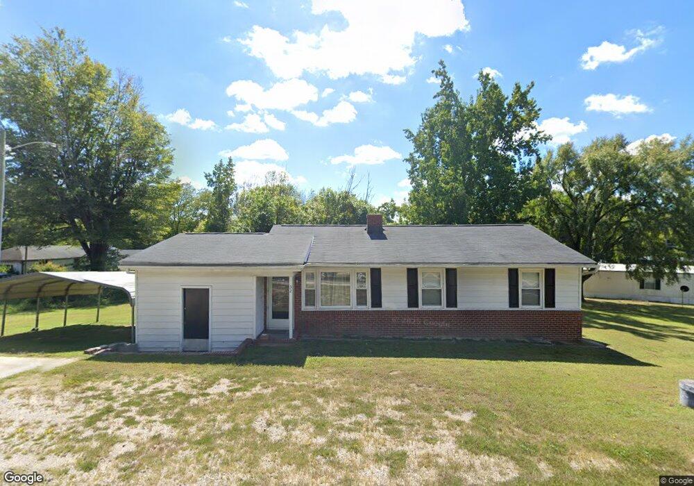
32 Ronald Tharrington Rd Louisburg, NC 27549
Estimated Value: $148,000 - $208,000
3
Beds
1
Bath
1,192
Sq Ft
$142/Sq Ft
Est. Value
About This Home
This home is located at 32 Ronald Tharrington Rd, Louisburg, NC 27549 and is currently estimated at $169,833, approximately $142 per square foot. 32 Ronald Tharrington Rd is a home located in Franklin County with nearby schools including Louisburg Elementary School, Terrell Lane Middle School, and Louisburg High School.
Ownership History
Date
Name
Owned For
Owner Type
Purchase Details
Closed on
Oct 25, 2021
Sold by
King Johnny C and King Pamela W
Bought by
Thornton Family Investment Llc
Current Estimated Value
Home Financials for this Owner
Home Financials are based on the most recent Mortgage that was taken out on this home.
Original Mortgage
$97,600
Outstanding Balance
$88,914
Interest Rate
2.88%
Mortgage Type
New Conventional
Estimated Equity
$80,919
Create a Home Valuation Report for This Property
The Home Valuation Report is an in-depth analysis detailing your home's value as well as a comparison with similar homes in the area
Home Values in the Area
Average Home Value in this Area
Purchase History
| Date | Buyer | Sale Price | Title Company |
|---|---|---|---|
| Thornton Family Investment Llc | $122,000 | None Available |
Source: Public Records
Mortgage History
| Date | Status | Borrower | Loan Amount |
|---|---|---|---|
| Open | Thornton Family Investment Llc | $97,600 |
Source: Public Records
Tax History Compared to Growth
Tax History
| Year | Tax Paid | Tax Assessment Tax Assessment Total Assessment is a certain percentage of the fair market value that is determined by local assessors to be the total taxable value of land and additions on the property. | Land | Improvement |
|---|---|---|---|---|
| 2025 | $777 | $110,735 | $24,225 | $86,510 |
| 2024 | $777 | $110,735 | $24,225 | $86,510 |
| 2023 | $642 | $60,310 | $10,260 | $50,050 |
| 2022 | $632 | $60,310 | $10,260 | $50,050 |
| 2021 | $638 | $60,310 | $10,260 | $50,050 |
| 2020 | $636 | $60,310 | $10,260 | $50,050 |
| 2019 | $624 | $60,310 | $10,260 | $50,050 |
| 2018 | $621 | $60,310 | $10,260 | $50,050 |
| 2017 | $431 | $35,920 | $8,550 | $27,370 |
| 2016 | $444 | $35,920 | $8,550 | $27,370 |
| 2015 | $442 | $35,920 | $8,550 | $27,370 |
| 2014 | $398 | $35,920 | $8,550 | $27,370 |
Source: Public Records
Map
Nearby Homes
- 311 Nc 56 Hwy E
- 191 Nc 56 Hwy E
- 121 Tanglewood Dr
- 491 Nc 56 Hwy E
- 209 Tanglewood Dr
- 102 Tanglewood Dr
- 205 Williamson St
- 4482 N Carolina 39 Hwy
- 125 Davis St
- 25 Leisure Ln
- 95 Leisure Ln
- 604 N Main St
- 401 N Main St
- 612 N Main St
- 7.69 Acres N Carolina 561
- 23.20 Acre N Carolina 561
- 10.26 Acre N Carolina 561
- 0-0 Halifax Rd
- 321 W Noble St
- 126 Person St
- 36 Ronald Tharrington Rd
- 27 Ronald Tharrington Rd
- 309 Nc 56 Hwy E
- 17 Ronald Tharrington Rd
- 52 Ronald Tharrington Rd
- 325 Nc 56 Hwy E
- 78 Ronald Tharrington Rd
- 320 N Carolina 56
- 233 Nc 56 Hwy E
- 326 Nc 56 Hwy E
- 211 Nc 56 Hwy E
- 109 Ronald Tharrington Rd
- 193 Nc 56 Hwy E
- 203 Nc 56 Hwy E
- 117 Ronald Tharrington Rd
- 218 N Carolina 56
- 218 Nc 56 Hwy
- 204 N Carolina 581 Hwy
- 12 Shannon Rd