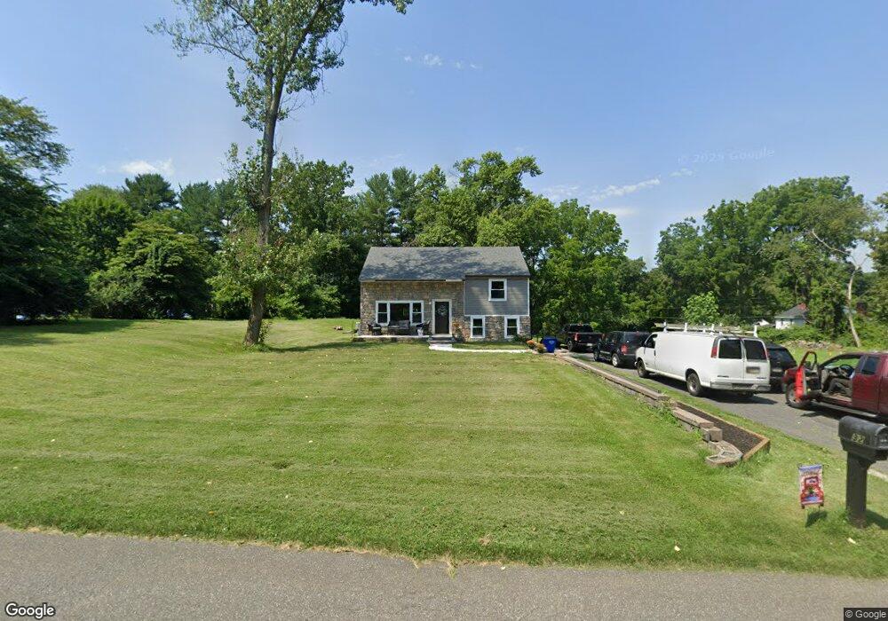
32 Ruby Rd Chadds Ford, PA 19317
Concord NeighborhoodEstimated Value: $512,000 - $585,000
4
Beds
2
Baths
1,832
Sq Ft
$297/Sq Ft
Est. Value
About This Home
This home is located at 32 Ruby Rd, Chadds Ford, PA 19317 and is currently estimated at $543,697, approximately $296 per square foot. 32 Ruby Rd is a home located in Delaware County with nearby schools including Garnet Valley High School, St Cornelius School, and Brandywine Valley Christian Presch.
Ownership History
Date
Name
Owned For
Owner Type
Purchase Details
Closed on
Mar 29, 2020
Sold by
Corradetti Alfred J and Corradetti Aileen M
Bought by
Corradetti Alfred J
Current Estimated Value
Home Financials for this Owner
Home Financials are based on the most recent Mortgage that was taken out on this home.
Original Mortgage
$260,000
Outstanding Balance
$229,891
Interest Rate
3.3%
Mortgage Type
New Conventional
Estimated Equity
$313,806
Purchase Details
Closed on
Jun 23, 2004
Sold by
Wilkerson Robert M and Wilkerson Cheryl A
Bought by
Corradetti Alfred J and Purner Aileen M
Home Financials for this Owner
Home Financials are based on the most recent Mortgage that was taken out on this home.
Original Mortgage
$242,250
Interest Rate
6.32%
Mortgage Type
Fannie Mae Freddie Mac
Create a Home Valuation Report for This Property
The Home Valuation Report is an in-depth analysis detailing your home's value as well as a comparison with similar homes in the area
Home Values in the Area
Average Home Value in this Area
Purchase History
| Date | Buyer | Sale Price | Title Company |
|---|---|---|---|
| Corradetti Alfred J | -- | Trident Land Transfer Co | |
| Corradetti Alfred J | $255,000 | T A Title Insurance Company |
Source: Public Records
Mortgage History
| Date | Status | Borrower | Loan Amount |
|---|---|---|---|
| Open | Corradetti Alfred J | $260,000 | |
| Closed | Corradetti Alfred J | $242,250 |
Source: Public Records
Tax History
| Year | Tax Paid | Tax Assessment Tax Assessment Total Assessment is a certain percentage of the fair market value that is determined by local assessors to be the total taxable value of land and additions on the property. | Land | Improvement |
|---|---|---|---|---|
| 2025 | $6,640 | $291,630 | $129,390 | $162,240 |
| 2024 | $6,640 | $291,630 | $129,390 | $162,240 |
| 2023 | $6,474 | $291,630 | $129,390 | $162,240 |
| 2022 | $6,403 | $291,630 | $129,390 | $162,240 |
| 2021 | $10,766 | $291,630 | $129,390 | $162,240 |
| 2020 | $5,381 | $136,180 | $61,430 | $74,750 |
| 2019 | $5,301 | $136,180 | $61,430 | $74,750 |
| 2018 | $5,220 | $136,180 | $0 | $0 |
| 2017 | $5,114 | $136,180 | $0 | $0 |
| 2016 | $747 | $136,180 | $0 | $0 |
| 2015 | $747 | $136,180 | $0 | $0 |
| 2014 | $747 | $136,180 | $0 | $0 |
Source: Public Records
Map
Nearby Homes
- 86 Summit Ave
- 1078 Smithbridge Rd
- 2604 Century Ln Unit 2604
- 2302 Century Ln Unit 2302
- 106 S Buck Tavern Way
- 135 S Buck Tavern Way Unit 11501
- 129 S Buck Tavern Way Unit 11504
- 124 S Buck Tavern Way Unit 10903
- 123 S Buck Tavern Way Unit 11404
- 117 S Buck Tavern Way
- 348 Milton Stamp Dr
- 136 Trotters Lea Ln
- 3744 Mayfield Ln
- 136A State Line Rd
- 904 Quarter Mile Post
- 605 Meadow Ct Unit 605
- 21 Hunters Way Unit 120
- 312 Winterset Rd
- 1806 Red Fox Ln Unit 360
- 2203 William Campbell Way Unit 345
Your Personal Tour Guide
Ask me questions while you tour the home.