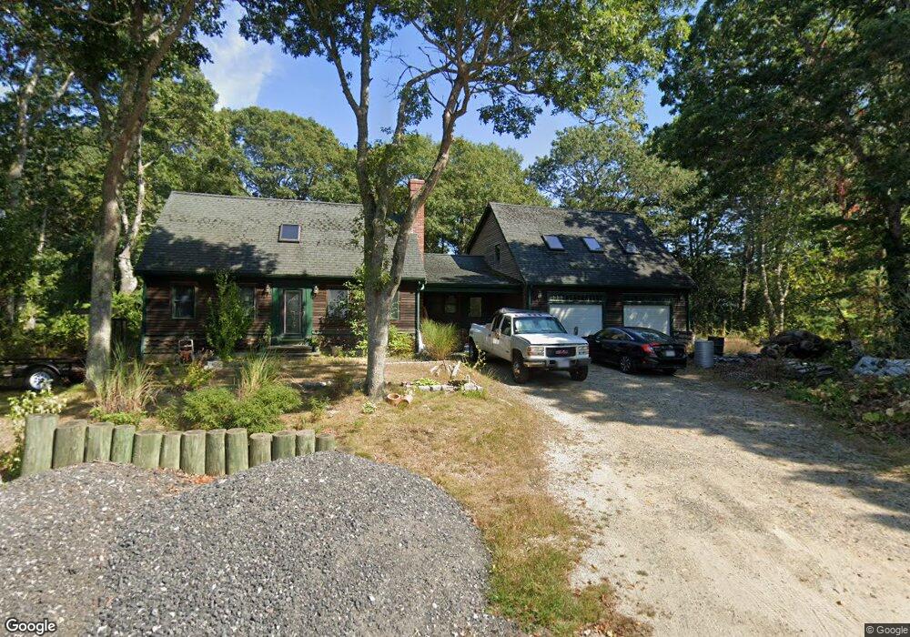
32 Russells Path Marstons Mills, MA 02648
Marstons Mills NeighborhoodEstimated Value: $558,000 - $621,000
4
Beds
2
Baths
1,001
Sq Ft
$601/Sq Ft
Est. Value
About This Home
This home is located at 32 Russells Path, Marstons Mills, MA 02648 and is currently estimated at $601,949, approximately $601 per square foot. 32 Russells Path is a home located in Barnstable County with nearby schools including West Villages Elementary School, Barnstable United Elementary School, and Barnstable Intermediate School.
Ownership History
Date
Name
Owned For
Owner Type
Purchase Details
Closed on
Dec 26, 2019
Sold by
White Linda M
Bought by
White Linda M and White Dean S
Current Estimated Value
Purchase Details
Closed on
Mar 15, 2012
Sold by
White Dean S and White Linda M
Bought by
White Linda M
Purchase Details
Closed on
Nov 26, 1993
Sold by
Jaroff David B
Bought by
White Dean S
Home Financials for this Owner
Home Financials are based on the most recent Mortgage that was taken out on this home.
Original Mortgage
$61,875
Interest Rate
6.72%
Mortgage Type
Purchase Money Mortgage
Create a Home Valuation Report for This Property
The Home Valuation Report is an in-depth analysis detailing your home's value as well as a comparison with similar homes in the area
Home Values in the Area
Average Home Value in this Area
Purchase History
| Date | Buyer | Sale Price | Title Company |
|---|---|---|---|
| White Linda M | -- | None Available | |
| White Linda M | -- | -- | |
| White Dean S | $82,500 | -- |
Source: Public Records
Mortgage History
| Date | Status | Borrower | Loan Amount |
|---|---|---|---|
| Previous Owner | White Dean S | $125,000 | |
| Previous Owner | White Dean S | $61,875 |
Source: Public Records
Tax History
| Year | Tax Paid | Tax Assessment Tax Assessment Total Assessment is a certain percentage of the fair market value that is determined by local assessors to be the total taxable value of land and additions on the property. | Land | Improvement |
|---|---|---|---|---|
| 2025 | $4,786 | $591,600 | $155,900 | $435,700 |
| 2024 | $4,413 | $565,000 | $155,900 | $409,100 |
| 2023 | $4,231 | $507,300 | $141,700 | $365,600 |
| 2022 | $4,047 | $419,800 | $105,000 | $314,800 |
| 2021 | $2,506 | $380,400 | $105,000 | $275,400 |
| 2020 | $2,794 | $369,800 | $105,000 | $264,800 |
| 2019 | $3,863 | $342,500 | $105,000 | $237,500 |
| 2018 | $2,426 | $320,600 | $110,500 | $210,100 |
| 2017 | $3,347 | $311,100 | $110,500 | $200,600 |
| 2016 | $3,402 | $312,100 | $111,500 | $200,600 |
| 2015 | $3,395 | $312,900 | $109,000 | $203,900 |
Source: Public Records
Map
Nearby Homes
- 78 Brittany Dr
- 63 Deer Ridge Rd
- 19 Oriole Ln
- 244 Wakeby Rd
- 170 Forest Hills Rd
- 1456 Santuit-Newtown Rd
- 45 Pequot Rd
- 544 Cotuit Rd
- 48 Holly Ridge Dr
- 24 Widow Coombs Walk
- 173 Main St
- 75 Bob White Run
- 15 Geraldine Rd
- 235 Main St
- 45 Fox Hill Rd
- 68 Fox Hill Rd
- 22 Candlewood Ln
- 36 Moon Compass Ln
- 10 Candlewood Ln
- 16 Balfour Ln
- 22 Russells Path
- 23 Russells Path
- 44 Russells Path
- 47 Russells Path
- 23 Russell's
- 67 Lauries Ln
- 81 Lauries Ln
- 47 Lauries Ln
- 33 Lauries Ln
- 8 Russells Path
- 62 Russells Path
- 61 Russells Path
- 148 Audreys Ln
- 19 Lauries Ln
- 93 Lauries Ln
- 116 Audreys Ln
- 116 Audreys Ln Unit 2
- 38 Lauries Ln
- 127 Audrey's
- 160 Audreys Ln
Your Personal Tour Guide
Ask me questions while you tour the home.