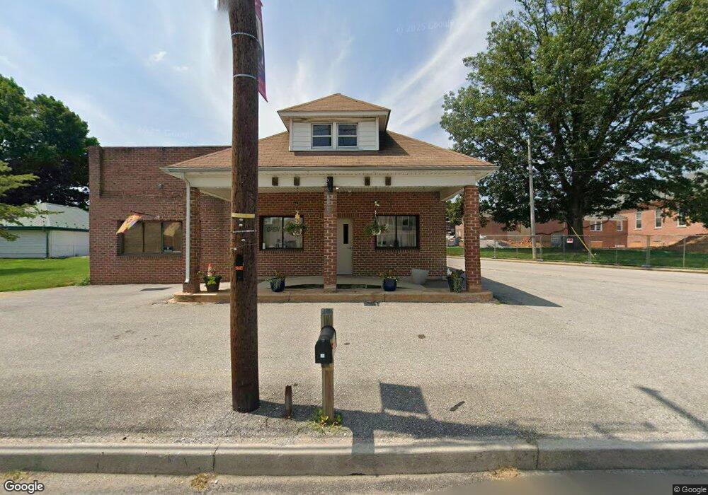
32 S Main St Stewartstown, PA 17363
Estimated Value: $146,008
--
Bed
--
Bath
1,600
Sq Ft
$91/Sq Ft
Est. Value
About This Home
This home is located at 32 S Main St, Stewartstown, PA 17363 and is currently estimated at $146,008, approximately $91 per square foot. 32 S Main St is a home located in York County with nearby schools including South Eastern Intermediate School, South Eastern Middle School, and Kennard-Dale High School.
Ownership History
Date
Name
Owned For
Owner Type
Purchase Details
Closed on
Jul 10, 2015
Sold by
Wistort Linda and Dowalo Robert
Bought by
Rgrg Partners
Current Estimated Value
Purchase Details
Closed on
May 28, 1998
Sold by
Bosler Taliano Francesco and Bosler Taliano Cynthia
Bought by
Wistort David J B and Wistort Linda L
Home Financials for this Owner
Home Financials are based on the most recent Mortgage that was taken out on this home.
Original Mortgage
$70,400
Interest Rate
7.12%
Mortgage Type
Commercial
Purchase Details
Closed on
Nov 16, 1989
Bought by
Wistort David J B
Create a Home Valuation Report for This Property
The Home Valuation Report is an in-depth analysis detailing your home's value as well as a comparison with similar homes in the area
Home Values in the Area
Average Home Value in this Area
Purchase History
| Date | Buyer | Sale Price | Title Company |
|---|---|---|---|
| Rgrg Partners | $76,000 | None Available | |
| Wistort David J B | $88,000 | -- | |
| Wistort David J B | $68,000 | -- |
Source: Public Records
Mortgage History
| Date | Status | Borrower | Loan Amount |
|---|---|---|---|
| Previous Owner | Wistort David J B | $70,400 |
Source: Public Records
Tax History Compared to Growth
Tax History
| Year | Tax Paid | Tax Assessment Tax Assessment Total Assessment is a certain percentage of the fair market value that is determined by local assessors to be the total taxable value of land and additions on the property. | Land | Improvement |
|---|---|---|---|---|
| 2025 | $3,873 | $121,030 | $15,510 | $105,520 |
| 2024 | $3,873 | $121,030 | $15,510 | $105,520 |
| 2023 | $3,873 | $121,030 | $15,510 | $105,520 |
| 2022 | $3,873 | $121,030 | $15,510 | $105,520 |
| 2021 | $3,752 | $121,030 | $15,510 | $105,520 |
| 2020 | $3,752 | $121,030 | $15,510 | $105,520 |
| 2019 | $3,740 | $121,030 | $15,510 | $105,520 |
| 2018 | $3,740 | $121,030 | $15,510 | $105,520 |
| 2017 | $3,740 | $121,030 | $15,510 | $105,520 |
| 2016 | $0 | $121,030 | $15,510 | $105,520 |
| 2015 | -- | $121,030 | $15,510 | $105,520 |
| 2014 | -- | $121,030 | $15,510 | $105,520 |
Source: Public Records
Map
Nearby Homes
- 2 S Main St
- 13 Baneberry St
- 1208 Crestview Ln Unit 1208
- 231 Cool Spring Ln
- 4341 Forbes Dr
- 120 Charles Ave
- 140 Lantern Ln
- 24 Scarborough Fare
- 17756 Barrens Rd N
- 10 Black Oak Ct
- 150 Patterson Dr Unit 47
- 160 Patterson Dr Unit 48
- 170 Patterson Dr Unit 49
- 180 Patterson Dr Unit 50
- 200 Patterson Dr Unit 52
- 18010 Dave Anne Cir
- 119 Edie Cir
- 17796 Iron Bridge Rd
- 515 Log House Rd Unit 119
- 18487 Zeigler School Rd