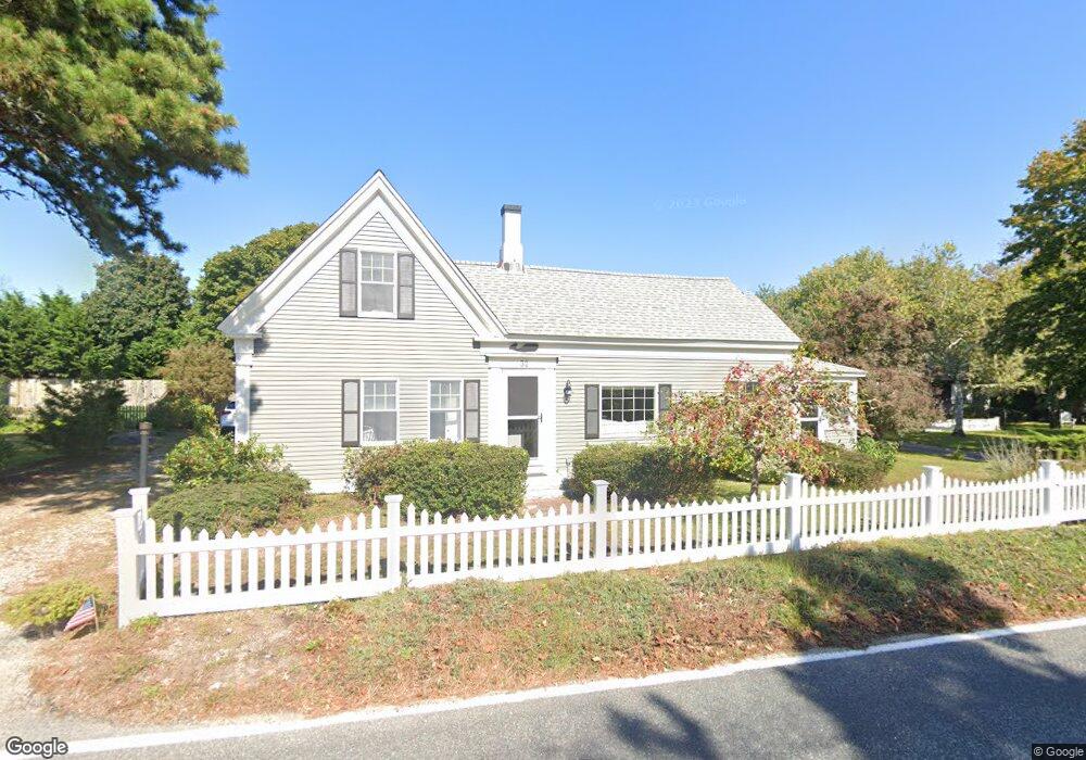
32 S Main St West Dennis, MA 02670
West Dennis NeighborhoodEstimated Value: $656,000 - $986,000
3
Beds
2
Baths
1,884
Sq Ft
$422/Sq Ft
Est. Value
About This Home
This home is located at 32 S Main St, West Dennis, MA 02670 and is currently estimated at $794,855, approximately $421 per square foot. 32 S Main St is a home located in Barnstable County with nearby schools including Dennis-Yarmouth Regional High School and St. Pius X. School.
Ownership History
Date
Name
Owned For
Owner Type
Purchase Details
Closed on
Mar 2, 2022
Sold by
Pauline H Gill T
Bought by
G Gill Supplemental T L
Current Estimated Value
Purchase Details
Closed on
Aug 11, 2020
Sold by
Gill Thomas W and Gill Pauline H
Bought by
Gill Pauline H
Purchase Details
Closed on
Dec 8, 1980
Bought by
Gill Thomas W and Gill Pauline H
Create a Home Valuation Report for This Property
The Home Valuation Report is an in-depth analysis detailing your home's value as well as a comparison with similar homes in the area
Home Values in the Area
Average Home Value in this Area
Purchase History
| Date | Buyer | Sale Price | Title Company |
|---|---|---|---|
| G Gill Supplemental T L | -- | None Available | |
| Gill Pauline H | -- | None Available | |
| Gill Thomas W | -- | -- |
Source: Public Records
Mortgage History
| Date | Status | Borrower | Loan Amount |
|---|---|---|---|
| Previous Owner | Gill Thomas W | $100,000 | |
| Previous Owner | Gill Thomas W | $35,000 |
Source: Public Records
Tax History Compared to Growth
Tax History
| Year | Tax Paid | Tax Assessment Tax Assessment Total Assessment is a certain percentage of the fair market value that is determined by local assessors to be the total taxable value of land and additions on the property. | Land | Improvement |
|---|---|---|---|---|
| 2025 | $2,217 | $512,100 | $154,400 | $357,700 |
| 2024 | $2,151 | $489,900 | $148,400 | $341,500 |
| 2023 | $2,103 | $450,300 | $134,900 | $315,400 |
| 2022 | $2,098 | $374,600 | $133,700 | $240,900 |
| 2021 | $2,211 | $366,700 | $131,100 | $235,600 |
| 2020 | $2,296 | $376,400 | $143,000 | $233,400 |
| 2019 | $2,202 | $356,900 | $116,800 | $240,100 |
| 2018 | $2,397 | $378,100 | $166,800 | $211,300 |
| 2017 | $2,167 | $352,300 | $133,500 | $218,800 |
| 2016 | $2,202 | $337,200 | $150,200 | $187,000 |
Source: Public Records
Map
Nearby Homes
- 178 School St
- 14 Schoolhouse Ln
- 23 Doric Ave
- 209 Main St Unit 3
- 209 Main St Unit 6
- 209 Main St Unit 1
- 209 Main St Unit 2
- 209 Main St Unit 4
- 209 Main St Unit 5
- 401 Main St Unit 201
- 401 Main St Unit 101
- 2 Rita Mary Way
- 467 Main St
- 428 Main St Unit 1-11
- 61 Trotters Ln
- 6 Baker Way
- 27 Mayflower Ln
- 45 Seth Ln
- 308 Old Main St
- 15 Woodside Park Rd