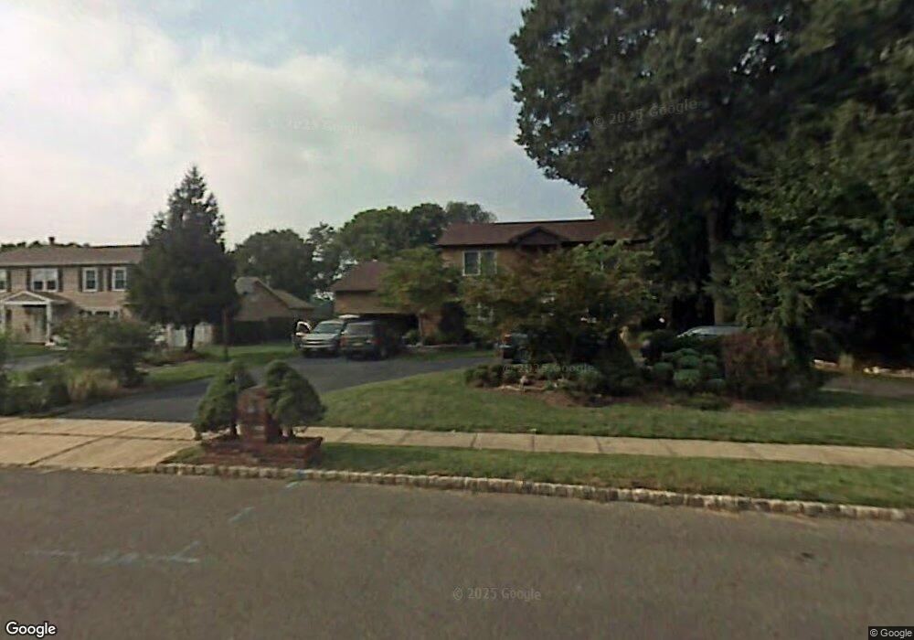
32 Saratoga Dr Manalapan, NJ 07726
Estimated Value: $866,592 - $1,020,000
4
Beds
4
Baths
2,765
Sq Ft
$338/Sq Ft
Est. Value
About This Home
This home is located at 32 Saratoga Dr, Manalapan, NJ 07726 and is currently estimated at $934,648, approximately $338 per square foot. 32 Saratoga Dr is a home located in Monmouth County with nearby schools including Clark Mills Elementary School, Pine Brook Elementary School, and Manalapan-Englishtown Middle School.
Ownership History
Date
Name
Owned For
Owner Type
Purchase Details
Closed on
Oct 16, 2023
Sold by
Ciavattoni Anthony and Ciavattoni John R
Bought by
Vonfrolio Thomas and Vonfrolio Nicole M
Current Estimated Value
Purchase Details
Closed on
Aug 21, 2021
Sold by
Vonfrolio Nicole M and Estate Of John Simone Ciavatto
Bought by
Ciavattoni Anthony and Vonfrolio Nicole
Purchase Details
Closed on
Oct 30, 1998
Sold by
Cirillo Pasquale
Bought by
Ciavattoni John and Ciavattoni Linda
Home Financials for this Owner
Home Financials are based on the most recent Mortgage that was taken out on this home.
Original Mortgage
$100,000
Interest Rate
6.78%
Create a Home Valuation Report for This Property
The Home Valuation Report is an in-depth analysis detailing your home's value as well as a comparison with similar homes in the area
Home Values in the Area
Average Home Value in this Area
Purchase History
| Date | Buyer | Sale Price | Title Company |
|---|---|---|---|
| Vonfrolio Thomas | $567,187 | None Listed On Document | |
| Vonfrolio Thomas | $567,187 | None Listed On Document | |
| Ciavattoni Anthony | -- | None Available | |
| Ciavattoni John | $305,000 | -- |
Source: Public Records
Mortgage History
| Date | Status | Borrower | Loan Amount |
|---|---|---|---|
| Previous Owner | Ciavattoni John | $100,000 |
Source: Public Records
Tax History Compared to Growth
Tax History
| Year | Tax Paid | Tax Assessment Tax Assessment Total Assessment is a certain percentage of the fair market value that is determined by local assessors to be the total taxable value of land and additions on the property. | Land | Improvement |
|---|---|---|---|---|
| 2025 | $13,509 | $874,200 | $377,200 | $497,000 |
| 2024 | $13,152 | $800,300 | $377,200 | $423,100 |
| 2023 | $13,152 | $790,400 | $377,200 | $413,200 |
| 2022 | $10,508 | $708,900 | $315,500 | $393,400 |
| 2021 | $10,508 | $551,400 | $201,500 | $349,900 |
| 2020 | $10,908 | $531,300 | $180,100 | $351,200 |
| 2019 | $11,048 | $537,600 | $194,400 | $343,200 |
| 2018 | $10,684 | $516,900 | $189,600 | $327,300 |
| 2017 | $10,473 | $506,900 | $199,600 | $307,300 |
| 2016 | $12,083 | $591,700 | $229,300 | $362,400 |
| 2015 | $10,685 | $517,700 | $164,600 | $353,100 |
| 2014 | $10,210 | $481,600 | $162,500 | $319,100 |
Source: Public Records
Map
Nearby Homes
- 37 Pease Rd
- 17 Yorktowne Dr
- 104 Gordons Corner Rd
- 124 Taylors Mills Rd
- 16 Timber Ln
- 89 Old Queens Blvd
- 56 Tarrytown Rd
- 8 Derek Ct
- 32 Devon Dr
- 8 Kensington Dr
- 32 Tarrytown Rd
- 8 Chesapeake Rd
- 11 Oxford Rd
- 1 Princeton Dr
- 102 Blue Jay Ct
- 30 Shilling Rd
- 5 Mallard Ct
- 11 Browning Place
- 1 Briar Hill Dr
- 2 Silverleaf Way
- 34 Saratoga Dr
- 30 Saratoga Dr
- 36 Saratoga Dr
- 28 Saratoga Dr
- 33 Saratoga Dr
- 38 Saratoga Dr
- 2 Westbrook Way
- 41 Bunker Hill Dr
- 26 Saratoga Dr
- 4 Beverly Terrace
- 40 Saratoga Dr
- 4 Westbrook Way
- 3 Beverly Terrace
- 39 Bunker Hill Dr
- 24 Saratoga Dr
- 5 Constitution Ct
- 1 Constitution Place
- 3 Westbrook Way
- 3 Constitution Ct
- 3 Constitution Place