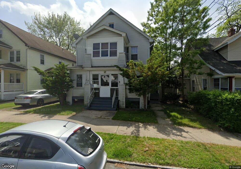
32 Shawmut St Unit 34 Springfield, MA 01108
Forest Park NeighborhoodEstimated Value: $330,000 - $369,000
4
Beds
2
Baths
2,418
Sq Ft
$145/Sq Ft
Est. Value
About This Home
This home is located at 32 Shawmut St Unit 34, Springfield, MA 01108 and is currently estimated at $351,536, approximately $145 per square foot. 32 Shawmut St Unit 34 is a home located in Hampden County with nearby schools including Alice B. Beal Elementary School, Forest Park Middle School, and High School Of Commerce.
Ownership History
Date
Name
Owned For
Owner Type
Purchase Details
Closed on
Apr 28, 1988
Sold by
Sistsky Lawrence R
Bought by
Manning Martin J
Current Estimated Value
Home Financials for this Owner
Home Financials are based on the most recent Mortgage that was taken out on this home.
Original Mortgage
$107,500
Interest Rate
9.86%
Mortgage Type
Purchase Money Mortgage
Create a Home Valuation Report for This Property
The Home Valuation Report is an in-depth analysis detailing your home's value as well as a comparison with similar homes in the area
Home Values in the Area
Average Home Value in this Area
Purchase History
| Date | Buyer | Sale Price | Title Company |
|---|---|---|---|
| Manning Martin J | $119,500 | -- |
Source: Public Records
Mortgage History
| Date | Status | Borrower | Loan Amount |
|---|---|---|---|
| Open | Manning Martin J | $10,000 | |
| Closed | Manning Martin J | $90,950 | |
| Closed | Manning Martin J | $107,500 |
Source: Public Records
Tax History
| Year | Tax Paid | Tax Assessment Tax Assessment Total Assessment is a certain percentage of the fair market value that is determined by local assessors to be the total taxable value of land and additions on the property. | Land | Improvement |
|---|---|---|---|---|
| 2025 | $4,875 | $310,900 | $36,800 | $274,100 |
| 2024 | $4,526 | $281,800 | $36,800 | $245,000 |
| 2023 | $3,924 | $228,200 | $35,100 | $193,100 |
| 2022 | $3,549 | $188,600 | $35,100 | $153,500 |
| 2021 | $3,536 | $187,100 | $31,900 | $155,200 |
| 2020 | $3,332 | $170,600 | $31,900 | $138,700 |
| 2019 | $3,326 | $169,000 | $31,900 | $137,100 |
| 2018 | $3,161 | $160,600 | $31,900 | $128,700 |
| 2017 | $3,151 | $160,300 | $31,900 | $128,400 |
| 2016 | $2,717 | $138,200 | $31,900 | $106,300 |
| 2015 | $2,726 | $138,600 | $31,900 | $106,700 |
Source: Public Records
Map
Nearby Homes
- 58 Appleton St
- 35 Carlton St
- 144 Washington St
- 134-136 Woodlawn St
- 104 Appleton St
- 52 Orlando St
- 114 Sylvan St Unit 116
- 27 Ormond St
- 12 Carroll St
- 132 Carroll St
- 179 Carver St
- 137 Carroll St
- 115 Tiffany St
- 11 Herman St
- 914-916 Belmont Ave
- 22 Eleanor Rd
- 33-35 Ruskin St
- 99 Wilmont St
- 88-90 Beaumont St
- 88 Brunswick St
- 36 Shawmut St Unit 38
- 36-38 Shawmut St
- 28 Shawmut St
- 625 Dickinson St
- 631 Dickinson St Unit 633
- 631-633 Dickinson St
- 42 Shawmut St Unit 44
- 42-44 Shawmut St
- 619 Dickinson St Unit 621
- 1 Groveland St
- 13 Groveland St
- 79 Groveland St
- 46 Shawmut St Unit 48
- 31 Shawmut St
- 37 Shawmut St
- 25 Shawmut St Unit 27
- 11 Groveland St Unit 15
- 41 Shawmut St
- 21 Shawmut St Unit 23
- 21-23 Shawmut St
Your Personal Tour Guide
Ask me questions while you tour the home.