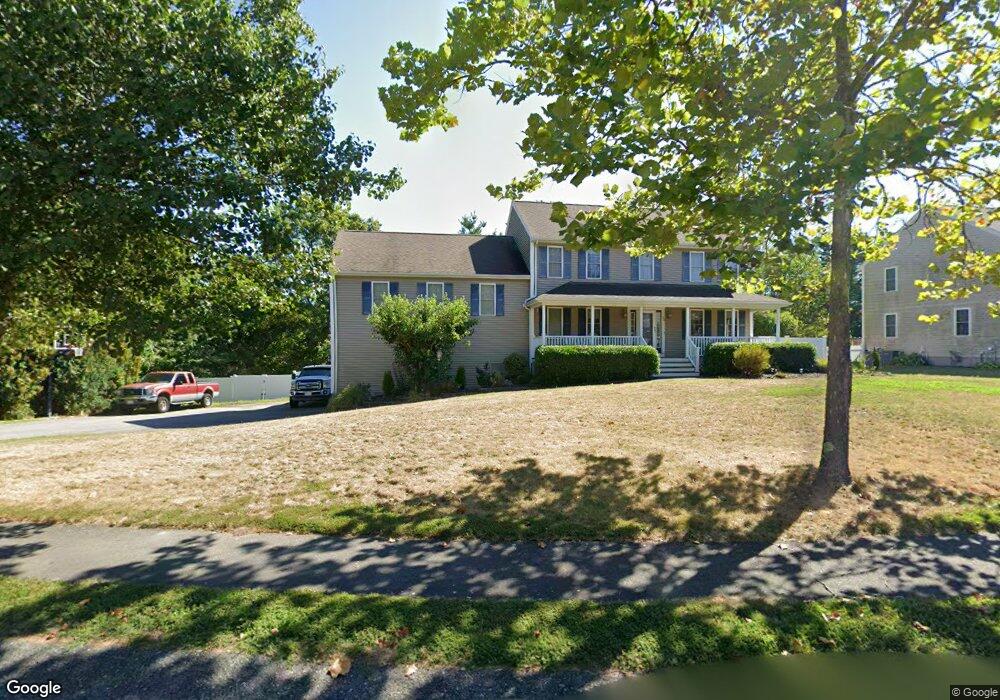
32 Silo Ln Middleboro, MA 02346
Estimated Value: $696,000 - $760,000
3
Beds
3
Baths
2,564
Sq Ft
$284/Sq Ft
Est. Value
About This Home
This home is located at 32 Silo Ln, Middleboro, MA 02346 and is currently estimated at $728,239, approximately $284 per square foot. 32 Silo Ln is a home located in Plymouth County with nearby schools including Mary K. Goode Elementary School and Samuel Fuller School.
Ownership History
Date
Name
Owned For
Owner Type
Purchase Details
Closed on
Mar 11, 2005
Sold by
Tf Dev Inc
Bought by
Mcdonald John J and Mcdonald Lori
Current Estimated Value
Home Financials for this Owner
Home Financials are based on the most recent Mortgage that was taken out on this home.
Original Mortgage
$290,000
Outstanding Balance
$147,314
Interest Rate
5.64%
Mortgage Type
Purchase Money Mortgage
Estimated Equity
$580,925
Create a Home Valuation Report for This Property
The Home Valuation Report is an in-depth analysis detailing your home's value as well as a comparison with similar homes in the area
Home Values in the Area
Average Home Value in this Area
Purchase History
| Date | Buyer | Sale Price | Title Company |
|---|---|---|---|
| Mcdonald John J | $415,995 | -- |
Source: Public Records
Mortgage History
| Date | Status | Borrower | Loan Amount |
|---|---|---|---|
| Open | Mcdonald John J | $290,000 | |
| Closed | Mcdonald John J | $15,000 |
Source: Public Records
Tax History Compared to Growth
Tax History
| Year | Tax Paid | Tax Assessment Tax Assessment Total Assessment is a certain percentage of the fair market value that is determined by local assessors to be the total taxable value of land and additions on the property. | Land | Improvement |
|---|---|---|---|---|
| 2025 | $7,947 | $592,600 | $164,700 | $427,900 |
| 2024 | $7,921 | $585,000 | $157,200 | $427,800 |
| 2023 | $7,193 | $505,100 | $157,200 | $347,900 |
| 2022 | $6,680 | $434,300 | $136,800 | $297,500 |
| 2021 | $6,700 | $411,800 | $125,800 | $286,000 |
| 2020 | $6,584 | $414,600 | $125,800 | $288,800 |
| 2019 | $6,423 | $414,900 | $125,800 | $289,100 |
| 2018 | $6,068 | $389,000 | $114,500 | $274,500 |
| 2017 | $5,575 | $353,500 | $110,200 | $243,300 |
| 2016 | $5,392 | $338,700 | $104,300 | $234,400 |
| 2015 | $5,158 | $326,900 | $104,300 | $222,600 |
Source: Public Records
Map
Nearby Homes
- 124 Ashley Ln Unit 12-4
- 14 Pineridge Way Unit 14
- 14 Pineridge Way
- 425 Wareham St
- Rear Wareham St
- 441 Wareham St
- 386 Wareham St
- 480 Wareham St
- 140 Tispaquin St
- 236 Thomas St
- 4 Bella Path
- LOT B Wood St
- LOT A Wood St
- 11 David Dr
- 167 Old Miller St
- 9 Terrace Way
- 146 Miller St
- 10 Leilo Dr Unit 10
- 73 Wareham St
- 28 Wareham St