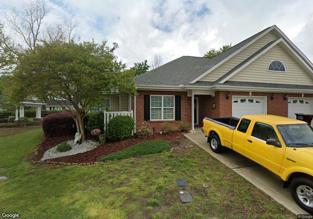
32 Stonegate Dr Unit 1A Angier, NC 27501
Estimated Value: $300,000 - $376,494
3
Beds
2
Baths
1,768
Sq Ft
$191/Sq Ft
Est. Value
About This Home
This home is located at 32 Stonegate Dr Unit 1A, Angier, NC 27501 and is currently estimated at $338,247, approximately $191 per square foot. 32 Stonegate Dr Unit 1A is a home located in Harnett County with nearby schools including Angier Elementary School, North Harnett Primary School, and Harnett Central Middle School.
Ownership History
Date
Name
Owned For
Owner Type
Purchase Details
Closed on
Sep 16, 2022
Sold by
Grant Cathy L and Grant Jimmy A
Bought by
Jimme A Grant And Cathy L Grant Revocable Liv
Current Estimated Value
Purchase Details
Closed on
Sep 6, 2016
Sold by
Grant Cathy L
Bought by
Grant Shane
Purchase Details
Closed on
Sep 1, 2010
Sold by
Wellons Realty Inc
Bought by
Grant Cathy L and Grant Jimmy A
Home Financials for this Owner
Home Financials are based on the most recent Mortgage that was taken out on this home.
Original Mortgage
$88,500
Interest Rate
4.59%
Mortgage Type
New Conventional
Create a Home Valuation Report for This Property
The Home Valuation Report is an in-depth analysis detailing your home's value as well as a comparison with similar homes in the area
Home Values in the Area
Average Home Value in this Area
Purchase History
| Date | Buyer | Sale Price | Title Company |
|---|---|---|---|
| Jimme A Grant And Cathy L Grant Revocable Liv | -- | -- | |
| Grant Shane | -- | -- | |
| Grant Cathy L | $168,500 | -- |
Source: Public Records
Mortgage History
| Date | Status | Borrower | Loan Amount |
|---|---|---|---|
| Previous Owner | Grant Cathy L | $88,500 |
Source: Public Records
Tax History
| Year | Tax Paid | Tax Assessment Tax Assessment Total Assessment is a certain percentage of the fair market value that is determined by local assessors to be the total taxable value of land and additions on the property. | Land | Improvement |
|---|---|---|---|---|
| 2025 | $2,449 | $202,728 | $0 | $0 |
| 2024 | $2,449 | $202,728 | $0 | $0 |
| 2023 | $2,429 | $202,728 | $0 | $0 |
| 2022 | $2,147 | $202,728 | $0 | $0 |
| 2021 | $2,147 | $152,770 | $0 | $0 |
| 2020 | $2,147 | $152,770 | $0 | $0 |
| 2019 | $2,132 | $152,770 | $0 | $0 |
| 2018 | $2,132 | $152,770 | $0 | $0 |
| 2017 | $2,132 | $152,770 | $0 | $0 |
| 2016 | $2,361 | $169,740 | $0 | $0 |
| 2015 | $2,361 | $169,740 | $0 | $0 |
| 2014 | $2,361 | $169,740 | $0 | $0 |
Source: Public Records
Map
Nearby Homes
- 409 E Williams St
- 367 E Williams St
- 261 E Lillington St
- 140 S Dunn St
- 41 Woodcroft Dr
- 248 Horseshoe Place
- 117 Woodcroft Dr
- 129 Crop Rd
- 810 Wiggins Rd
- 0 N Carolina 55 Unit 100556496
- 230 S Raleigh St
- 0 N Willow St Unit 10142099
- 455 N Willow St
- 40 Crepe Myrtle Ct
- 278 S Raleigh St
- 163 W Lillington St
- 106 Buddy Campbell Ct
- 0 Wimberly St Unit 10047549
- 34 Clementine St Unit 190
- 36 Clementine St Unit 189
- 32 Stonegate Dr
- 26 Stonegate Dr Unit 1 B
- 18 Stonegate Dr Unit 2A
- 41 Stonegate Dr Unit 5A
- 41 Stonegate Dr
- 29 Stonegate Dr Unit 4B
- 29 Stonegate Dr
- 45 Stonegate Dr Unit 5B
- 415 E Depot St
- 23 Stonegate Dr Unit 4A
- 12 Stonegate Dr Unit 2B
- 50 Stonegate Dr
- 17 Stonegate Dr Unit 3B
- 403 E Depot St
- 11 Stonegate Dr Unit 3A
- 531 E Depot St
- 604 E Depot St
- 420 E Depot St
- 487 E Depot St
- 400 E Depot St
Your Personal Tour Guide
Ask me questions while you tour the home.