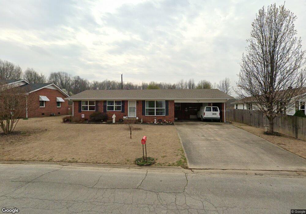
32 Sundale Cir Paragould, AR 72450
Estimated Value: $132,570 - $157,000
--
Bed
2
Baths
1,354
Sq Ft
$107/Sq Ft
Est. Value
About This Home
This home is located at 32 Sundale Cir, Paragould, AR 72450 and is currently estimated at $144,893, approximately $107 per square foot. 32 Sundale Cir is a home located in Greene County with nearby schools including Paragould High School and St. Mary's Catholic School & Preschool.
Ownership History
Date
Name
Owned For
Owner Type
Purchase Details
Closed on
Jun 8, 2022
Current Estimated Value
Purchase Details
Closed on
Jun 19, 2014
Sold by
Steimer Jon L and Steimer Harriet
Bought by
Cannon Tammy
Purchase Details
Closed on
Dec 7, 2006
Sold by
Dowler Loretta and Estate Of Fred Kenneth Herring
Bought by
Cannon Tammy
Home Financials for this Owner
Home Financials are based on the most recent Mortgage that was taken out on this home.
Original Mortgage
$88,000
Interest Rate
6.3%
Mortgage Type
FHA
Create a Home Valuation Report for This Property
The Home Valuation Report is an in-depth analysis detailing your home's value as well as a comparison with similar homes in the area
Home Values in the Area
Average Home Value in this Area
Purchase History
| Date | Buyer | Sale Price | Title Company |
|---|---|---|---|
| -- | -- | None Listed On Document | |
| Cannon Tammy | $972 | None Available | |
| Cannon Tammy | $88,000 | None Available |
Source: Public Records
Mortgage History
| Date | Status | Borrower | Loan Amount |
|---|---|---|---|
| Previous Owner | Cannon Tammy | $88,000 |
Source: Public Records
Tax History Compared to Growth
Tax History
| Year | Tax Paid | Tax Assessment Tax Assessment Total Assessment is a certain percentage of the fair market value that is determined by local assessors to be the total taxable value of land and additions on the property. | Land | Improvement |
|---|---|---|---|---|
| 2025 | $911 | $25,070 | $3,300 | $21,770 |
| 2024 | $911 | $25,070 | $3,300 | $21,770 |
| 2023 | $898 | $19,520 | $3,400 | $16,120 |
| 2022 | $403 | $19,520 | $3,400 | $16,120 |
| 2021 | $368 | $19,520 | $3,400 | $16,120 |
| 2020 | $707 | $15,370 | $3,400 | $11,970 |
| 2019 | $332 | $15,370 | $3,400 | $11,970 |
| 2018 | $357 | $15,370 | $3,400 | $11,970 |
| 2017 | $686 | $15,370 | $3,400 | $11,970 |
| 2016 | $307 | $15,370 | $3,400 | $11,970 |
| 2015 | $630 | $14,020 | $3,000 | $11,020 |
| 2014 | $630 | $14,020 | $3,000 | $11,020 |
Source: Public Records
Map
Nearby Homes
- 1811 Magnolia Ln
- 2001 W Kingshighway
- 1905 Glendale St
- 1701 Barnhill Rd
- 2311 S 20th St
- 1700 Barnhill Rd
- 1801 Sara Ann Cir
- 1103 Summit Ridge Trail
- 1101 Summit Ridge Trail
- 1103 Summit Ridge Dr
- 1104 Summit Ridge Dr
- 3.65 ACRES U S 49
- 412 Magnolia Dr
- 2075 S 141 Hwy
- 4063 GRE 934 Rd
- 1901 Marlanita Dr
- 3.04 Lot 17 Cedar Ridge Estates Ph II
- 125 S 12th St
- 106 Magnolia Dr
- 3200 Red Oak Dr
- 34 Sundale Cir
- 36 Sundale Cir
- 168 Toma Jean Dr
- 28 Sundale Cir
- 31 Sundale Cir
- 35 Sundale Cir
- 26 Sundale Cir
- 37 Sundale Cir
- 167 Toma Jean Dr
- 166 Toma Jean Dr
- 38 Sundale Cir Unit A
- 38 Sundale Cir
- 27 Sundale Cir
- 11 Donna Lynn Dr
- 24 Sundale Cir
- 38 Sundale Cr
- 165 Toma Jean Dr
- 25 Sundale Cir
- 41 Sundale Cir
- 40 Sundale Cir