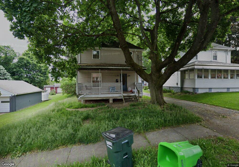
32 Swigart St Barberton, OH 44203
North Barberton NeighborhoodEstimated Value: $105,000 - $164,363
3
Beds
2
Baths
1,512
Sq Ft
$86/Sq Ft
Est. Value
About This Home
This home is located at 32 Swigart St, Barberton, OH 44203 and is currently estimated at $130,591, approximately $86 per square foot. 32 Swigart St is a home located in Summit County with nearby schools including Barberton Middle School, Barberton Intermediate School 3-5, and Barberton High School.
Ownership History
Date
Name
Owned For
Owner Type
Purchase Details
Closed on
Sep 27, 2005
Sold by
Morlan Mark and Morlan Michelle M
Bought by
Lambright Heath J and Lambright Angela R
Current Estimated Value
Home Financials for this Owner
Home Financials are based on the most recent Mortgage that was taken out on this home.
Original Mortgage
$67,340
Interest Rate
5.93%
Mortgage Type
Fannie Mae Freddie Mac
Create a Home Valuation Report for This Property
The Home Valuation Report is an in-depth analysis detailing your home's value as well as a comparison with similar homes in the area
Home Values in the Area
Average Home Value in this Area
Purchase History
| Date | Buyer | Sale Price | Title Company |
|---|---|---|---|
| Lambright Heath J | $67,340 | Land America-Lawyers Title |
Source: Public Records
Mortgage History
| Date | Status | Borrower | Loan Amount |
|---|---|---|---|
| Closed | Lambright Heath J | $67,340 |
Source: Public Records
Tax History Compared to Growth
Tax History
| Year | Tax Paid | Tax Assessment Tax Assessment Total Assessment is a certain percentage of the fair market value that is determined by local assessors to be the total taxable value of land and additions on the property. | Land | Improvement |
|---|---|---|---|---|
| 2025 | $2,142 | $42,424 | $10,612 | $31,812 |
| 2024 | $2,142 | $42,424 | $10,612 | $31,812 |
| 2023 | $2,142 | $42,424 | $10,612 | $31,812 |
| 2022 | $1,623 | $27,874 | $6,937 | $20,937 |
| 2021 | $1,622 | $27,874 | $6,937 | $20,937 |
| 2020 | $1,587 | $27,880 | $6,940 | $20,940 |
| 2019 | $1,674 | $26,640 | $6,100 | $20,540 |
| 2018 | $1,649 | $26,640 | $6,100 | $20,540 |
| 2017 | $1,671 | $26,640 | $6,100 | $20,540 |
| 2016 | $1,674 | $26,640 | $6,100 | $20,540 |
| 2015 | $1,671 | $26,640 | $6,100 | $20,540 |
| 2014 | $1,662 | $26,640 | $6,100 | $20,540 |
| 2013 | $1,675 | $27,820 | $6,100 | $21,720 |
Source: Public Records
Map
Nearby Homes
- 30 W Hiram St
- 103 Mitchell St
- 818 N Summit St
- 690 Saint Clair Ave
- 44 W Summit St
- 277 Glenn St
- 143 Glenn St
- 0 Romig Ave
- 146 Hermann St
- 137 Hermann St
- 76 Hazelwood Ave
- 0 Wooster Rd N
- 117 Fernwood Ave
- 103 & 103 1/2 Fernwood Ave
- 213 Hermann St
- 645 Madison Ave
- 1924 Caroline Ave
- 1150 Wooster Rd N
- 250 Evergreen St
- 613 Wooster Rd N