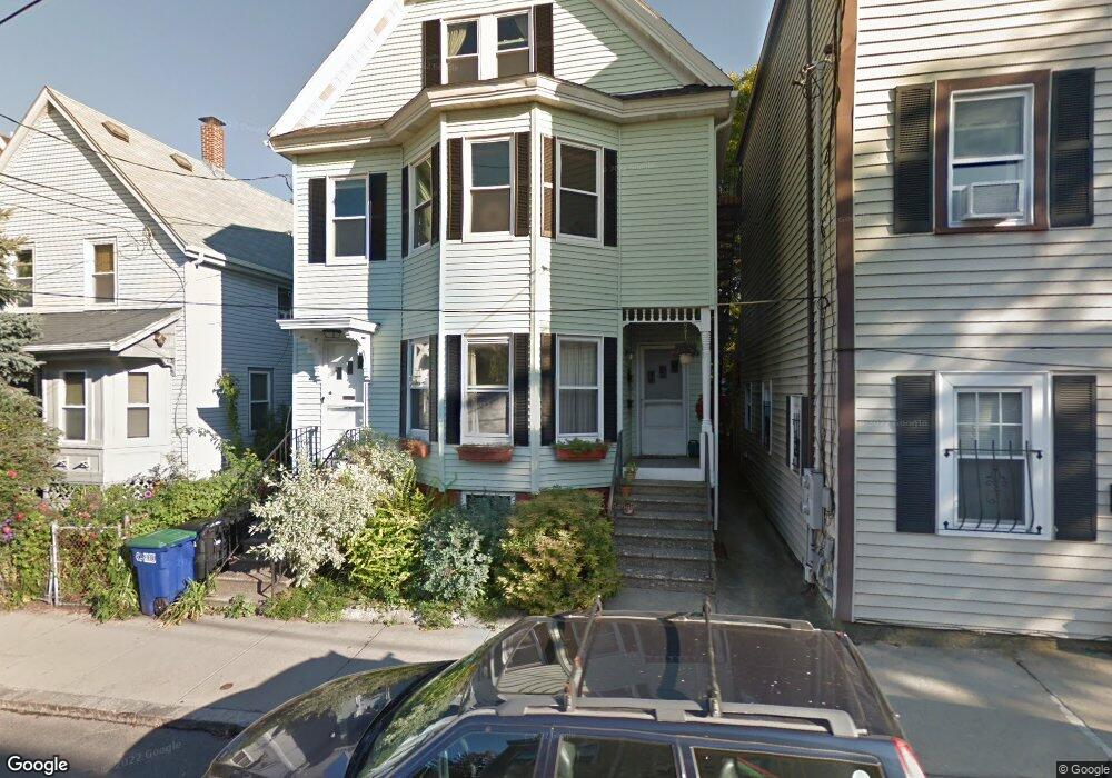
32 Thorndike St Unit 1 Somerville, MA 02144
Davis Square NeighborhoodEstimated Value: $753,387 - $882,000
2
Beds
1
Bath
878
Sq Ft
$939/Sq Ft
Est. Value
About This Home
This home is located at 32 Thorndike St Unit 1, Somerville, MA 02144 and is currently estimated at $824,347, approximately $938 per square foot. 32 Thorndike St Unit 1 is a home located in Middlesex County with nearby schools including Somerville High School, Benjamin Banneker Charter Public School, and St. Clement Elementary School.
Ownership History
Date
Name
Owned For
Owner Type
Purchase Details
Closed on
Mar 30, 2021
Sold by
Swanson Peter and Sawyer Charlene
Bought by
Finn Timothy E and Dubreuil Ellen B
Current Estimated Value
Purchase Details
Closed on
Aug 27, 2003
Sold by
Gross Carol S
Bought by
Sawyer Charlene and Swanson Peter
Home Financials for this Owner
Home Financials are based on the most recent Mortgage that was taken out on this home.
Original Mortgage
$287,900
Interest Rate
5.69%
Mortgage Type
Purchase Money Mortgage
Create a Home Valuation Report for This Property
The Home Valuation Report is an in-depth analysis detailing your home's value as well as a comparison with similar homes in the area
Home Values in the Area
Average Home Value in this Area
Purchase History
| Date | Buyer | Sale Price | Title Company |
|---|---|---|---|
| Finn Timothy E | $660,000 | None Available | |
| Sawyer Charlene | $359,900 | -- |
Source: Public Records
Mortgage History
| Date | Status | Borrower | Loan Amount |
|---|---|---|---|
| Previous Owner | Sawyer Charlene | $287,900 |
Source: Public Records
Tax History
| Year | Tax Paid | Tax Assessment Tax Assessment Total Assessment is a certain percentage of the fair market value that is determined by local assessors to be the total taxable value of land and additions on the property. | Land | Improvement |
|---|---|---|---|---|
| 2025 | $6,811 | $624,300 | $0 | $624,300 |
| 2024 | $6,435 | $611,700 | $0 | $611,700 |
| 2023 | $6,375 | $616,500 | $0 | $616,500 |
| 2022 | $6,037 | $593,000 | $0 | $593,000 |
| 2021 | $5,911 | $580,100 | $0 | $580,100 |
| 2020 | $5,664 | $561,300 | $0 | $561,300 |
| 2019 | $5,850 | $543,700 | $0 | $543,700 |
| 2018 | $5,787 | $511,700 | $0 | $511,700 |
| 2017 | $5,295 | $453,700 | $0 | $453,700 |
| 2016 | $4,968 | $396,500 | $0 | $396,500 |
| 2015 | $4,189 | $332,200 | $0 | $332,200 |
Source: Public Records
Map
Nearby Homes
- 34 Elmwood St Unit 2
- 17 Holland St Unit 301
- 7A Meacham Rd Unit 7A
- 5 Glendale Ave Unit 5
- 2353 Massachusetts Ave Unit 44
- 1004 Broadway Unit 3
- 2 Gold Star Ct
- 97 Elmwood St Unit 313
- 97 Elmwood St Unit 110
- 97 Elmwood St Unit 310
- 68 Winslow Ave
- 30 Clarendon Ave
- 69 Harvey St Unit 1
- 9-11 Edmunds St
- 69 Electric Ave Unit 3
- 69 Electric Ave Unit 1
- 42 Packard Ave Unit 42
- 7 Russell St Unit 1
- 371 Highland Ave
- 55 Packard Ave Unit 1
- 32 Thorndike St Unit 3
- 30 Thorndike St
- 34 Thorndike St
- 34 Thorndike St Unit A
- 28 Thorndike St
- 36 Thorndike St Unit 36
- 36 Thorndike St Unit 2
- 36 Thorndike St
- 26 Thorndike St Unit 4
- 26 Thorndike St Unit 3
- 26 Thorndike St Unit 2
- 26 Thorndike St Unit 1
- 26 Thorndike St
- 26 Thorndike St Unit 7
- 2 Howard St Unit A
- 12 Howard St Unit F
- 12 Howard St
- 10 Howard St Unit 10,1
- 22 Thorndike St
- 24 Thorndike St Unit 1
Your Personal Tour Guide
Ask me questions while you tour the home.