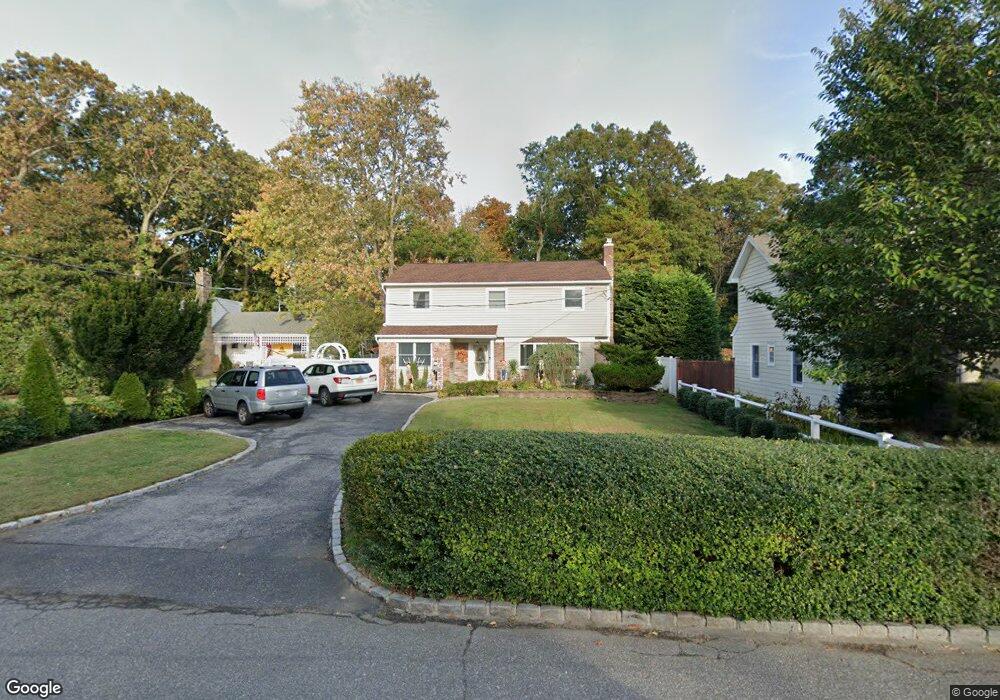
32 Thorney Ave Huntington Station, NY 11746
Estimated Value: $611,000 - $788,000
--
Bed
--
Bath
--
Sq Ft
8,276
Sq Ft Lot
About This Home
This home is located at 32 Thorney Ave, Huntington Station, NY 11746 and is currently estimated at $698,367. 32 Thorney Ave is a home located in Suffolk County with nearby schools including Silas Wood Sixth Grade Center, Henry L Stimson Middle School, and Walt Whitman High School.
Ownership History
Date
Name
Owned For
Owner Type
Purchase Details
Closed on
Jul 27, 2011
Sold by
Khursand Hamed and Khursand Avesta
Bought by
Khursand David Kamran
Current Estimated Value
Home Financials for this Owner
Home Financials are based on the most recent Mortgage that was taken out on this home.
Original Mortgage
$3,940
Outstanding Balance
$2,734
Interest Rate
4.62%
Mortgage Type
Purchase Money Mortgage
Estimated Equity
$695,633
Purchase Details
Closed on
Nov 9, 2007
Sold by
Hasham Mohammad
Bought by
Khursand Hamed
Purchase Details
Closed on
Jan 3, 2003
Sold by
Bauer Ronald and Wesner Kimberly
Bought by
Hasham Mohammad
Home Financials for this Owner
Home Financials are based on the most recent Mortgage that was taken out on this home.
Original Mortgage
$292,000
Interest Rate
6.18%
Purchase Details
Closed on
Nov 16, 1995
Sold by
Np Funding Ii Lp
Bought by
Bauer Ronald and Wesner Kimberly
Create a Home Valuation Report for This Property
The Home Valuation Report is an in-depth analysis detailing your home's value as well as a comparison with similar homes in the area
Home Values in the Area
Average Home Value in this Area
Purchase History
| Date | Buyer | Sale Price | Title Company |
|---|---|---|---|
| Khursand David Kamran | -- | -- | |
| Khursand Hamed | $630,000 | Balsam Kahlan | |
| Hasham Mohammad | $390,000 | Commonwealth Land Title Ins | |
| Bauer Ronald | $128,000 | Chicago Title Insurance Co |
Source: Public Records
Mortgage History
| Date | Status | Borrower | Loan Amount |
|---|---|---|---|
| Open | Khursand David Kamran | $3,940 | |
| Previous Owner | Hasham Mohammad | $292,000 |
Source: Public Records
Tax History Compared to Growth
Tax History
| Year | Tax Paid | Tax Assessment Tax Assessment Total Assessment is a certain percentage of the fair market value that is determined by local assessors to be the total taxable value of land and additions on the property. | Land | Improvement |
|---|---|---|---|---|
| 2024 | $11,773 | $2,800 | $75 | $2,725 |
| 2023 | $5,886 | $2,800 | $75 | $2,725 |
| 2022 | $10,545 | $2,800 | $75 | $2,725 |
| 2021 | $10,358 | $2,800 | $75 | $2,725 |
| 2020 | $10,185 | $2,800 | $75 | $2,725 |
| 2019 | $20,370 | $0 | $0 | $0 |
| 2018 | $9,524 | $2,800 | $75 | $2,725 |
| 2017 | $9,524 | $2,800 | $75 | $2,725 |
| 2016 | $9,355 | $2,800 | $75 | $2,725 |
| 2015 | -- | $2,800 | $75 | $2,725 |
| 2014 | -- | $2,800 | $75 | $2,725 |
Source: Public Records
Map
Nearby Homes
- 30 Thorney Ave
- 34 Thorney Ave
- 28 Thorney Ave
- 31 Thorney Ave
- 17 Richwood Place
- 38 Thorney Ave
- 29 Thorney Ave
- 26 Thorney Ave
- 27 Thorney Ave
- 15 Richwood Place
- 10 Richwood Place
- 24 Thorney Ave
- 8 Bernice Ct
- 8 Richwood Place
- 7 Bernice Ct
- 40 Thorney Ave
- 35 Thorney Ave
- 25 Thorney Ave
- 6 Bernice Ct
- 159 E 23rd St