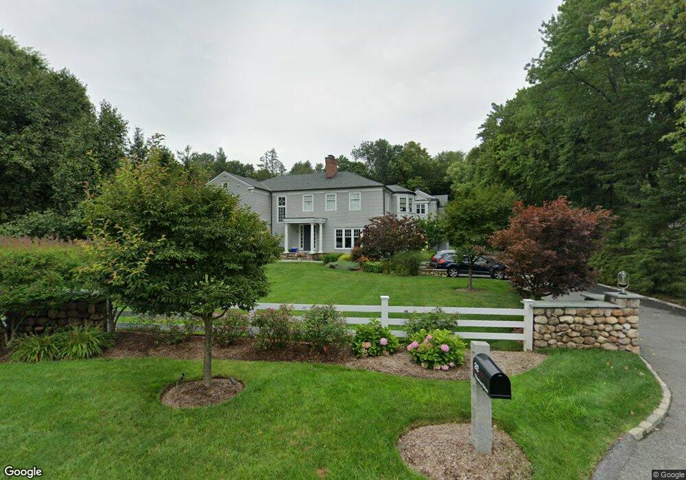
32 Thurton Dr New Canaan, CT 06840
Estimated Value: $3,546,664 - $4,151,000
5
Beds
5
Baths
5,514
Sq Ft
$704/Sq Ft
Est. Value
About This Home
This home is located at 32 Thurton Dr, New Canaan, CT 06840 and is currently estimated at $3,883,666, approximately $704 per square foot. 32 Thurton Dr is a home located in Fairfield County with nearby schools including West Elementary School, Saxe Middle School, and New Canaan High School.
Ownership History
Date
Name
Owned For
Owner Type
Purchase Details
Closed on
Oct 27, 2014
Sold by
Hijkoop Franciscus and Hijkoop Eulink-Hijkoop C
Bought by
Freeman Tr Roger C and Cho-Freeman Mi-Sun
Current Estimated Value
Home Financials for this Owner
Home Financials are based on the most recent Mortgage that was taken out on this home.
Original Mortgage
$1,595,750
Outstanding Balance
$1,157,183
Interest Rate
2.62%
Mortgage Type
Adjustable Rate Mortgage/ARM
Estimated Equity
$2,726,483
Purchase Details
Closed on
Jul 26, 2007
Sold by
Arnold Robert and Blum Suzanne
Bought by
Hijkoop Franciscus
Purchase Details
Closed on
Sep 27, 2002
Sold by
Palmer Design Llc
Bought by
Blum Suzanne
Purchase Details
Closed on
Sep 28, 2001
Sold by
Mahon Mary
Bought by
Palmer Design
Purchase Details
Closed on
Dec 1, 1989
Sold by
Curry Muriel
Bought by
Mahon Mary
Create a Home Valuation Report for This Property
The Home Valuation Report is an in-depth analysis detailing your home's value as well as a comparison with similar homes in the area
Home Values in the Area
Average Home Value in this Area
Purchase History
| Date | Buyer | Sale Price | Title Company |
|---|---|---|---|
| Freeman Tr Roger C | $2,455,000 | -- | |
| Hijkoop Franciscus | $2,815,000 | -- | |
| Blum Suzanne | $2,250,000 | -- | |
| Palmer Design | $792,500 | -- | |
| Mahon Mary | $353,000 | -- |
Source: Public Records
Mortgage History
| Date | Status | Borrower | Loan Amount |
|---|---|---|---|
| Open | Mahon Mary | $1,595,750 | |
| Previous Owner | Mahon Mary | $985,000 |
Source: Public Records
Tax History Compared to Growth
Tax History
| Year | Tax Paid | Tax Assessment Tax Assessment Total Assessment is a certain percentage of the fair market value that is determined by local assessors to be the total taxable value of land and additions on the property. | Land | Improvement |
|---|---|---|---|---|
| 2025 | $32,120 | $1,924,510 | $560,000 | $1,364,510 |
| 2024 | $31,062 | $1,924,510 | $560,000 | $1,364,510 |
| 2023 | $28,611 | $1,510,600 | $605,570 | $905,030 |
| 2022 | $27,750 | $1,510,600 | $605,570 | $905,030 |
| 2021 | $27,432 | $1,510,600 | $605,570 | $905,030 |
| 2020 | $27,432 | $1,510,600 | $605,570 | $905,030 |
| 2019 | $27,553 | $1,510,600 | $605,570 | $905,030 |
| 2018 | $31,756 | $1,872,430 | $560,700 | $1,311,730 |
| 2017 | $31,213 | $1,872,430 | $560,700 | $1,311,730 |
| 2016 | $30,539 | $1,872,430 | $560,700 | $1,311,730 |
| 2015 | $28,901 | $1,807,470 | $560,700 | $1,246,770 |
| 2014 | $28,088 | $1,807,470 | $560,700 | $1,246,770 |
Source: Public Records
Map
Nearby Homes
- 474 Ponus Ridge
- 470 Frogtown Rd Unit Lot 1
- 113 Skyview Ln
- 357 Jelliff Mill Rd
- 39 Running Brook Ln
- 100 Spring Water Ln
- 202 Weed St
- 139 Jelliff Mill Rd
- 185 Interlaken Rd
- 119 Wedgemere Rd
- 1552 Hope St
- 105 N Stamford Rd
- 317 Park St
- 77 Putter Dr
- 25 Gower Rd
- 197 Park St Unit 13
- 865 Hollow Tree Ridge Rd
- 354 South Ave
- 60 Redmont Rd
- 19 Skymeadow Dr
- 50 Thurton Dr
- 413 Ponus Ridge
- 31 Thurton Dr
- 433 Ponus Ridge
- 47 Thurton Dr
- 7 Thurton Dr
- 62 Thurton Dr
- 429 Ponus Ridge Rd
- 61 Thurton Dr
- 584 Frogtown Rd
- 424 Ponus Ridge Rd
- 375 Ponus Ridge
- 394 Ponus Ridge
- 78 Thurton Dr
- 568 Frogtown Rd
- 361 Ponus Ridge
- 626 Frogtown Rd
- 85 Thurton Dr
- 377 Ponus Ridge
- 379 Ponus Ridge