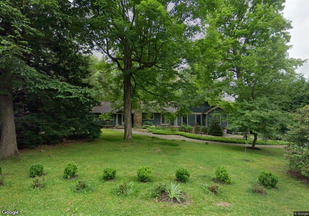
32 Tibbs Rd Morgantown, WV 26508
Estimated Value: $446,600 - $505,000
5
Beds
4
Baths
3,034
Sq Ft
$158/Sq Ft
Est. Value
About This Home
This home is located at 32 Tibbs Rd, Morgantown, WV 26508 and is currently estimated at $479,150, approximately $157 per square foot. 32 Tibbs Rd is a home located in Monongalia County with nearby schools including Cheat Lake Elementary School, Mountaineer Middle School, and University High School.
Ownership History
Date
Name
Owned For
Owner Type
Purchase Details
Closed on
Aug 5, 2022
Sold by
Sarah Harrell
Bought by
Anderson Joanne G
Current Estimated Value
Purchase Details
Closed on
Jan 21, 2022
Sold by
Wise Deborah A
Bought by
Wise Deborah A and Redd Candice
Purchase Details
Closed on
Dec 14, 2007
Sold by
Anderson Thomas M and Anderson Gwenda L
Bought by
Robinson Robert L and Wise Deborah A
Create a Home Valuation Report for This Property
The Home Valuation Report is an in-depth analysis detailing your home's value as well as a comparison with similar homes in the area
Home Values in the Area
Average Home Value in this Area
Purchase History
| Date | Buyer | Sale Price | Title Company |
|---|---|---|---|
| Anderson Joanne G | $430,000 | None Listed On Document | |
| Wise Deborah A | -- | None Listed On Document | |
| Robinson Robert L | -- | None Available |
Source: Public Records
Tax History Compared to Growth
Tax History
| Year | Tax Paid | Tax Assessment Tax Assessment Total Assessment is a certain percentage of the fair market value that is determined by local assessors to be the total taxable value of land and additions on the property. | Land | Improvement |
|---|---|---|---|---|
| 2025 | $1,333 | $144,720 | $25,980 | $118,740 |
| 2024 | $1,333 | $144,840 | $25,980 | $118,860 |
| 2023 | $3,083 | $144,120 | $25,980 | $118,140 |
| 2022 | $1,455 | $142,020 | $25,980 | $116,040 |
| 2021 | $1,463 | $142,020 | $25,980 | $116,040 |
| 2020 | $1,294 | $125,100 | $18,180 | $106,920 |
| 2019 | $1,305 | $125,220 | $18,180 | $107,040 |
| 2018 | $1,309 | $125,220 | $18,180 | $107,040 |
| 2017 | $1,299 | $123,600 | $24,540 | $99,060 |
| 2016 | $1,290 | $122,040 | $22,980 | $99,060 |
| 2015 | $1,215 | $120,180 | $21,120 | $99,060 |
| 2014 | $1,100 | $114,120 | $16,440 | $97,680 |
Source: Public Records
Map
Nearby Homes
- 21 Brandywine Estates Dr
- 211 Summerfield Dr
- 79 Tibbs Rd
- 529 Turquoise Ln
- 3 Banner Place
- 41 Chardonnay Dr
- TBD Rockley Rd
- 20 Meadow Brooke Dr
- 213 Greenview Dr
- 104 Granite Dr
- Oak Park Plan at Whispering Oaks
- Lehigh Plan at Whispering Oaks
- Esquire Place Plan at Whispering Oaks
- Seneca Plan at Whispering Oaks
- Greenwood Plan at Whispering Oaks
- Normandy Plan at Whispering Oaks
- 171 Stockett Rd
- 0 Oak Hill Ln Unit 2
- 00 Oak Hill Ln Unit 3 & 4
- 000 Oak Hill Ln Unit 6
- 103 Bur Oak Ln
- 101 Bur Oak Ln
- 4 Candlelight Dr
- 105 Bur Oak Ln
- 107 Bur Oak Ln
- 102 Bur Oak Ln
- 28 Candlelight Dr
- 37 Tibbs Rd
- 50 Tibbs Rd
- 106 Bur Oak Ln
- 201 Black Oak Ln
- 186 Tyrone Rd
- 23 Candlelight Dr
- 208 Black Oak Rd
- 205 Black Oak Ln
- 210 Black Oak Rd
- 207 Black Oak Ln
- 60 Tibbs Rd
- 15 Tibbs Rd
- 209 Black Oak Rd