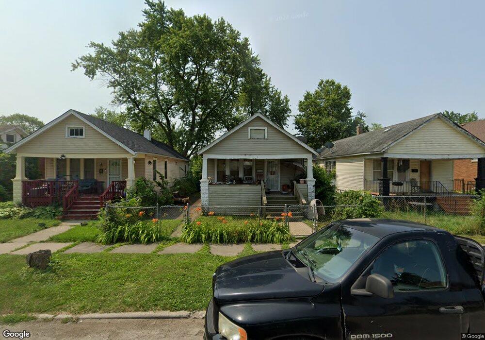
32 W 151st St Harvey, IL 60426
Estimated Value: $89,000 - $160,000
3
Beds
1
Bath
900
Sq Ft
$130/Sq Ft
Est. Value
About This Home
This home is located at 32 W 151st St, Harvey, IL 60426 and is currently estimated at $117,057, approximately $130 per square foot. 32 W 151st St is a home located in Cook County with nearby schools including Thornton Township High School.
Ownership History
Date
Name
Owned For
Owner Type
Purchase Details
Closed on
Feb 20, 2009
Sold by
Us Bank National Association
Bought by
Walker Dorlisa
Current Estimated Value
Purchase Details
Closed on
Aug 19, 2008
Sold by
Nesbitt Rickey and Nesbitt Rickey R
Bought by
Us Bank Na and Citigroup Mortgage Loan Trust Inc Asset
Purchase Details
Closed on
Sep 1, 2005
Sold by
Nesbitt Rickey and Nesbitt Carin
Bought by
Chicago Title Land Trust Co and Trust #1114743
Purchase Details
Closed on
Jul 17, 2003
Sold by
State Street Bank & Trust Co
Bought by
Nesbitt Rickey and Nesbitt Carin
Home Financials for this Owner
Home Financials are based on the most recent Mortgage that was taken out on this home.
Original Mortgage
$55,350
Interest Rate
6.33%
Mortgage Type
Unknown
Purchase Details
Closed on
Aug 21, 2002
Sold by
Johnson
Bought by
State Street Bank & Trust Company and Soverign Bank Home Equity Loan Trust
Purchase Details
Closed on
Dec 28, 1999
Sold by
Jones Dwight
Bought by
Johnson Danielle
Home Financials for this Owner
Home Financials are based on the most recent Mortgage that was taken out on this home.
Original Mortgage
$57,600
Interest Rate
7.98%
Create a Home Valuation Report for This Property
The Home Valuation Report is an in-depth analysis detailing your home's value as well as a comparison with similar homes in the area
Home Values in the Area
Average Home Value in this Area
Purchase History
| Date | Buyer | Sale Price | Title Company |
|---|---|---|---|
| Walker Dorlisa | $8,000 | None Available | |
| Us Bank Na | -- | None Available | |
| Chicago Title Land Trust Co | -- | Chicago Title Insurance Comp | |
| Nesbitt Rickey | $29,000 | First American | |
| State Street Bank & Trust Company | -- | -- | |
| Johnson Danielle | $74,000 | -- |
Source: Public Records
Mortgage History
| Date | Status | Borrower | Loan Amount |
|---|---|---|---|
| Previous Owner | Nesbitt Rickey | $55,350 | |
| Previous Owner | Johnson Danielle | $57,600 | |
| Closed | Johnson Danielle | $14,400 |
Source: Public Records
Tax History Compared to Growth
Tax History
| Year | Tax Paid | Tax Assessment Tax Assessment Total Assessment is a certain percentage of the fair market value that is determined by local assessors to be the total taxable value of land and additions on the property. | Land | Improvement |
|---|---|---|---|---|
| 2024 | $1,292 | $5,800 | $1,171 | $4,629 |
| 2023 | $14 | $5,800 | $1,171 | $4,629 |
| 2022 | $14 | $4,121 | $1,171 | $2,950 |
| 2021 | $105 | $4,120 | $1,170 | $2,950 |
| 2020 | $326 | $4,120 | $1,170 | $2,950 |
| 2019 | $3,172 | $3,912 | $1,064 | $2,848 |
| 2018 | $3,071 | $3,912 | $1,064 | $2,848 |
| 2017 | $3,021 | $3,912 | $1,064 | $2,848 |
| 2016 | $3,175 | $4,394 | $957 | $3,437 |
| 2015 | $3,054 | $4,394 | $957 | $3,437 |
| 2014 | $3,038 | $4,394 | $957 | $3,437 |
| 2013 | $2,892 | $4,538 | $957 | $3,581 |
Source: Public Records
Map
Nearby Homes
- 15033 Paulina St
- 15032 Marshfield Ave
- 36 E 151st St
- 15231 Ashland Ave
- 15240 Ashland Ave
- 14911 Page Ave
- 15018 Myrtle Ave
- 110 W 150th St
- 14910 S Wood St
- 14900 Vine Ave
- 15131 Winchester Ave
- 14921 Lincoln Ave
- 15032 Winchester Ave
- 14807 Paulina St
- 15025 Loomis Ave
- 147 W 150th St
- 15311 Winchester Ave
- 98 W 154th St
- 15321 Winchester Ave
- 48 E 154th St
- 36 W 151st St
- 30 W 151st St
- 40 W 151st St
- 26 W 151st St
- 15113 Paulina St
- 15112 Marshfield Ave
- 15115 Paulina St
- 15116 Marshfield Ave
- 15119 Paulina St
- 15108 Paulina St
- 15108 Paulina St
- 33 W 151st St
- 15118 Marshfield Ave
- 29 W 151st St
- 35 W 151st St
- 25 W 151st St
- 25 W 151st St
- 37 W 151st St
- 15123 Paulina St
- 21 W 151st St