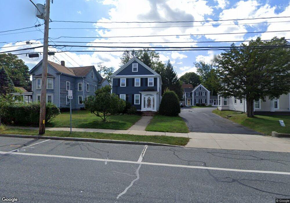
32 W Central St Natick, MA 01760
Estimated Value: $831,000 - $909,529
4
Beds
2
Baths
2,135
Sq Ft
$403/Sq Ft
Est. Value
About This Home
This home is located at 32 W Central St, Natick, MA 01760 and is currently estimated at $860,882, approximately $403 per square foot. 32 W Central St is a home located in Middlesex County with nearby schools including Natick High School, Wilson Middle School, and Bennett-Hemenway (Ben-Hem) Elementary School.
Ownership History
Date
Name
Owned For
Owner Type
Purchase Details
Closed on
Sep 24, 2007
Sold by
Cox Colleen M and Cox Pamela Condlin
Bought by
32 West Central T and King
Current Estimated Value
Purchase Details
Closed on
Aug 28, 1998
Sold by
Adams R Mark R and Adams Pamela K
Bought by
Cox Marcia A and Cox Colleen M
Home Financials for this Owner
Home Financials are based on the most recent Mortgage that was taken out on this home.
Original Mortgage
$220,000
Interest Rate
6.9%
Mortgage Type
Purchase Money Mortgage
Purchase Details
Closed on
Aug 25, 1994
Sold by
Sherman Robert T
Bought by
Adams R Mark R and Adams Pamela K
Purchase Details
Closed on
Jan 19, 1988
Sold by
Beckett Edward W
Bought by
Sherman Robert T
Create a Home Valuation Report for This Property
The Home Valuation Report is an in-depth analysis detailing your home's value as well as a comparison with similar homes in the area
Home Values in the Area
Average Home Value in this Area
Purchase History
| Date | Buyer | Sale Price | Title Company |
|---|---|---|---|
| 32 West Central T | $380,000 | -- | |
| 32 West Central T | $380,000 | -- | |
| Cox Marcia A | $275,000 | -- | |
| Adams R Mark R | $216,300 | -- | |
| Sherman Robert T | $235,500 | -- |
Source: Public Records
Mortgage History
| Date | Status | Borrower | Loan Amount |
|---|---|---|---|
| Previous Owner | Sherman Robert T | $214,100 | |
| Previous Owner | Sherman Robert T | $220,000 | |
| Previous Owner | Sherman Robert T | $190,000 |
Source: Public Records
Tax History Compared to Growth
Tax History
| Year | Tax Paid | Tax Assessment Tax Assessment Total Assessment is a certain percentage of the fair market value that is determined by local assessors to be the total taxable value of land and additions on the property. | Land | Improvement |
|---|---|---|---|---|
| 2025 | $9,246 | $773,100 | $368,800 | $404,300 |
| 2024 | $8,881 | $724,400 | $348,300 | $376,100 |
| 2023 | $8,504 | $672,800 | $327,900 | $344,900 |
| 2022 | $8,197 | $614,500 | $299,200 | $315,300 |
| 2021 | $7,849 | $576,700 | $282,800 | $293,900 |
| 2020 | $7,324 | $538,100 | $258,200 | $279,900 |
| 2019 | $6,839 | $538,100 | $258,200 | $279,900 |
| 2018 | $6,706 | $513,900 | $245,900 | $268,000 |
| 2017 | $6,301 | $467,100 | $217,200 | $249,900 |
| 2016 | $5,955 | $438,800 | $204,100 | $234,700 |
| 2015 | $6,132 | $443,700 | $204,100 | $239,600 |
Source: Public Records
Map
Nearby Homes
- 49 Summer St
- 58 W Central St
- 48 S Main St Unit 7
- 8 Floral Avenue Extension
- 8 Floral Ave Unit 8
- 15 Church St Unit 3
- 34 N Main St Unit 2
- 2 Yuba Place
- 26 Walnut St
- 4 Willow St
- 47 High St
- 6B Lincoln St Unit 6B
- 4B Lincoln St Unit 4B
- 25 Forest Ave
- 58 N Main St Unit 304
- 5 Wilson St Unit 5A
- 3 Wilson St Unit 3B
- 16 Harvard St
- 11 Avon St
- 20 Florence St Unit B
- 30 W Central St
- 34 W Central St
- 34 W Central St Unit A
- 34 W Cenral St Unit 1
- 1 Palmer Ave
- 36 W Central St Unit 1
- 36 W Central St Unit 2
- 36 W Central St
- 36 W Central St Unit B
- 41 Pond St
- 28 W Central St
- 28 W Central St Unit 1
- 28 W Central St Unit 2
- 37 W Central St
- 6 Palmer Ave Unit 6
- 6 Palmer Ave
- 6 Palmer Ave
- 39 W Central St
- 35 W Central St
- 37 Pond St