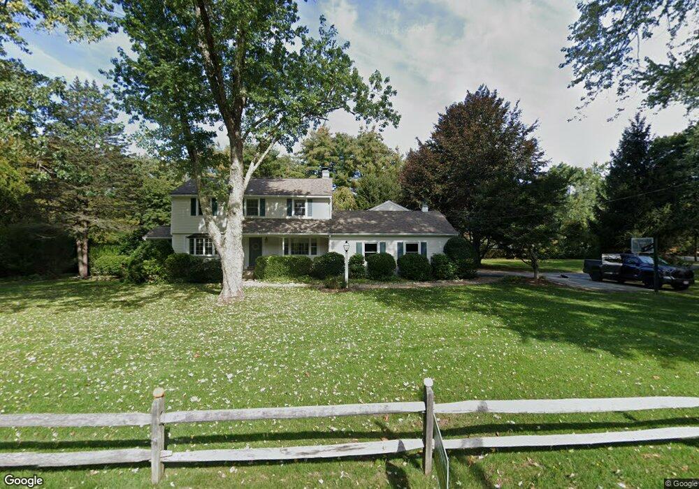
32 Waltham Rd Wayland, MA 01778
Estimated Value: $1,273,968 - $1,425,000
4
Beds
3
Baths
2,689
Sq Ft
$495/Sq Ft
Est. Value
About This Home
This home is located at 32 Waltham Rd, Wayland, MA 01778 and is currently estimated at $1,330,492, approximately $494 per square foot. 32 Waltham Rd is a home located in Middlesex County with nearby schools including Lincoln-Sudbury Regional High School, Corwin-Russell School at Broccoli Hall, and The Cambridge School Of Weston.
Ownership History
Date
Name
Owned For
Owner Type
Purchase Details
Closed on
Apr 28, 2017
Sold by
Mellen M Scott and Mellen Jennifer R
Bought by
Mellen Peter
Current Estimated Value
Home Financials for this Owner
Home Financials are based on the most recent Mortgage that was taken out on this home.
Original Mortgage
$640,000
Outstanding Balance
$535,132
Interest Rate
4.3%
Mortgage Type
Purchase Money Mortgage
Estimated Equity
$795,360
Purchase Details
Closed on
Nov 6, 1995
Sold by
Macmahon Darcy G and Macmahon Kathryn Ms
Bought by
Mellen M Scott M and Mellen Jennifer R
Home Financials for this Owner
Home Financials are based on the most recent Mortgage that was taken out on this home.
Original Mortgage
$288,000
Interest Rate
7.58%
Mortgage Type
Purchase Money Mortgage
Create a Home Valuation Report for This Property
The Home Valuation Report is an in-depth analysis detailing your home's value as well as a comparison with similar homes in the area
Home Values in the Area
Average Home Value in this Area
Purchase History
| Date | Buyer | Sale Price | Title Company |
|---|---|---|---|
| Mellen Peter | $800,000 | -- | |
| Mellen Peter | $800,000 | -- | |
| Mellen M Scott M | $360,000 | -- |
Source: Public Records
Mortgage History
| Date | Status | Borrower | Loan Amount |
|---|---|---|---|
| Open | Mellen Peter | $640,000 | |
| Closed | Mellen M Scott M | $640,000 | |
| Previous Owner | Mellen M Scott M | $288,000 |
Source: Public Records
Tax History Compared to Growth
Tax History
| Year | Tax Paid | Tax Assessment Tax Assessment Total Assessment is a certain percentage of the fair market value that is determined by local assessors to be the total taxable value of land and additions on the property. | Land | Improvement |
|---|---|---|---|---|
| 2025 | $16,724 | $1,070,000 | $511,800 | $558,200 |
| 2024 | $15,835 | $1,020,300 | $487,400 | $532,900 |
| 2023 | $14,847 | $891,700 | $443,200 | $448,500 |
| 2022 | $14,397 | $784,600 | $367,100 | $417,500 |
| 2021 | $13,912 | $751,200 | $333,700 | $417,500 |
| 2020 | $13,622 | $767,000 | $333,700 | $433,300 |
| 2019 | $13,014 | $711,900 | $317,900 | $394,000 |
| 2018 | $12,161 | $674,500 | $317,900 | $356,600 |
| 2017 | $11,829 | $652,100 | $302,700 | $349,400 |
| 2016 | $10,957 | $631,900 | $296,800 | $335,100 |
Source: Public Records
Map
Nearby Homes
- 93 Old Sudbury Rd
- 236 Lincoln Rd
- 244 Lincoln Rd
- 12 Pine Ridge Rd
- 224 Aspen Cir
- 134 Chestnut Cir
- 448 & 454 Concord Rd
- 15 Lewis Path
- 11 Grove St
- 25 Birchwood Ln
- 49 Birchwood Ln Unit 49
- 130 Tower Rd
- 3 Clifford Ln
- 156 Cherry Brook Rd
- 99 Tower Rd
- 6 Clifford Ln
- 33 Old Concord Rd
- 44 Baker Bridge Rd
- 75 Westland Rd
- 50 3 Ponds Rd