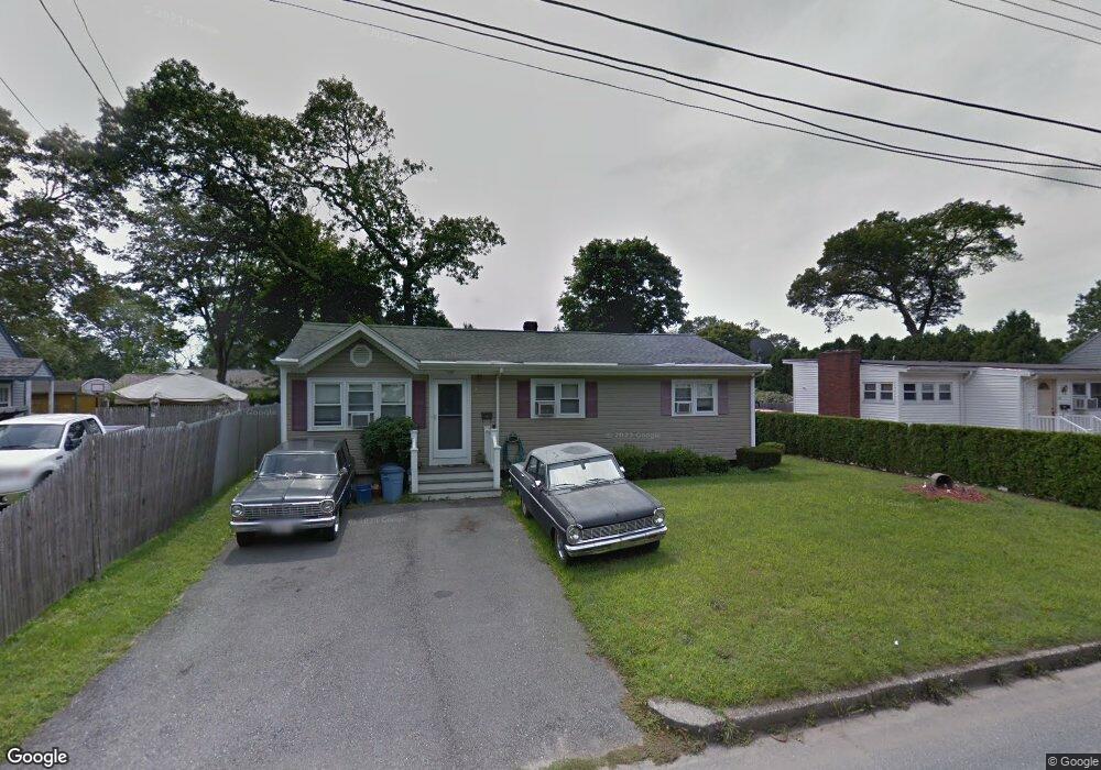
32 Wamsutta Ave Acushnet, MA 02743
Upper Acushnet NeighborhoodEstimated Value: $376,000 - $405,000
--
Bed
1
Bath
1,093
Sq Ft
$355/Sq Ft
Est. Value
About This Home
This home is located at 32 Wamsutta Ave, Acushnet, MA 02743 and is currently estimated at $388,442, approximately $355 per square foot. 32 Wamsutta Ave is a home located in Bristol County with nearby schools including Acushnet Elementary School, Albert F Ford Middle School, and Alma Del Mar Charter School.
Ownership History
Date
Name
Owned For
Owner Type
Purchase Details
Closed on
Dec 1, 1992
Sold by
Albanese Lawrence L and Albanese Gertrude
Bought by
Moniz Michael A and Moniz Theresa M
Current Estimated Value
Purchase Details
Closed on
Sep 20, 1991
Sold by
Tremblay Pierre L and Tremblay Cynthia A
Bought by
Albanese Lawrence L and Albanese Gertrud
Create a Home Valuation Report for This Property
The Home Valuation Report is an in-depth analysis detailing your home's value as well as a comparison with similar homes in the area
Home Values in the Area
Average Home Value in this Area
Purchase History
| Date | Buyer | Sale Price | Title Company |
|---|---|---|---|
| Moniz Michael A | $90,000 | -- | |
| Albanese Lawrence L | $90,000 | -- |
Source: Public Records
Mortgage History
| Date | Status | Borrower | Loan Amount |
|---|---|---|---|
| Open | Albanese Lawrence L | $135,000 | |
| Closed | Albanese Lawrence L | $129,500 | |
| Closed | Albanese Lawrence L | $82,750 |
Source: Public Records
Tax History Compared to Growth
Tax History
| Year | Tax Paid | Tax Assessment Tax Assessment Total Assessment is a certain percentage of the fair market value that is determined by local assessors to be the total taxable value of land and additions on the property. | Land | Improvement |
|---|---|---|---|---|
| 2025 | $36 | $334,600 | $118,900 | $215,700 |
| 2024 | $3,429 | $300,500 | $112,700 | $187,800 |
| 2023 | $3,305 | $275,400 | $102,200 | $173,200 |
| 2022 | $3,291 | $248,000 | $96,000 | $152,000 |
| 2021 | $3,168 | $229,100 | $96,000 | $133,100 |
| 2020 | $3,056 | $219,200 | $89,700 | $129,500 |
| 2019 | $2,924 | $206,200 | $85,500 | $120,700 |
| 2018 | $2,829 | $196,200 | $85,500 | $110,700 |
| 2017 | $2,728 | $188,900 | $85,500 | $103,400 |
| 2016 | $2,655 | $182,700 | $85,500 | $97,200 |
| 2015 | $2,519 | $176,400 | $85,500 | $90,900 |
Source: Public Records
Map
Nearby Homes
- 30 Wamsutta Ave
- 37 Harbeck St
- 39 Harbeck St
- 28 Wamsutta Ave
- 38 Wamsutta Ave
- 35 Harbeck St
- 33 Wamsutta Ave
- 41 Harbeck St
- 35 Wamsutta Ave
- 29 Wamsutta Ave
- 26 Wamsutta Ave
- 25 Wamsutta Ave
- 45 Harbeck St
- 40 Wamsutta Ave
- 40 Wamsutta Ave Unit 40
- 24 Wamsutta Ave
- 34 Harbeck St
- 39 Wamsutta Ave
- 37 Wamsutta Ave
- 23 Wamsutta Ave