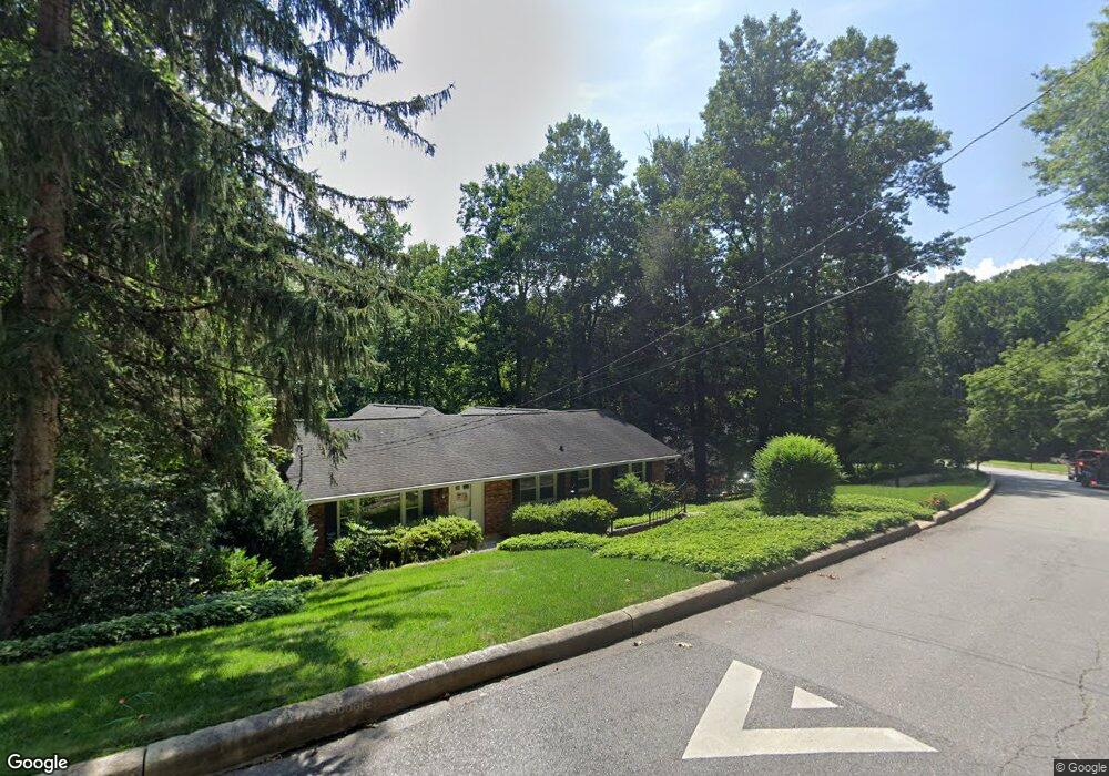
32 Westridge Dr Asheville, NC 28803
Biltmore Park NeighborhoodEstimated Value: $745,906 - $870,000
3
Beds
4
Baths
1,927
Sq Ft
$419/Sq Ft
Est. Value
About This Home
This home is located at 32 Westridge Dr, Asheville, NC 28803 and is currently estimated at $807,977, approximately $419 per square foot. 32 Westridge Dr is a home located in Buncombe County with nearby schools including William W. Estes Elementary School, T.C. Roberson High School, and Koontz Intermediate School.
Ownership History
Date
Name
Owned For
Owner Type
Purchase Details
Closed on
Mar 10, 2004
Sold by
Clark Christopher H and Clark Kristen H
Bought by
Latham John A and Latham Joyce H
Current Estimated Value
Purchase Details
Closed on
Oct 26, 1999
Sold by
Coppedge William W and Coppedge Lynn F
Bought by
Clark Christopher H and Clark Kristen H
Home Financials for this Owner
Home Financials are based on the most recent Mortgage that was taken out on this home.
Original Mortgage
$163,400
Interest Rate
6.75%
Mortgage Type
Unknown
Create a Home Valuation Report for This Property
The Home Valuation Report is an in-depth analysis detailing your home's value as well as a comparison with similar homes in the area
Home Values in the Area
Average Home Value in this Area
Purchase History
| Date | Buyer | Sale Price | Title Company |
|---|---|---|---|
| Latham John A | $301,000 | -- | |
| Clark Christopher H | $172,000 | -- |
Source: Public Records
Mortgage History
| Date | Status | Borrower | Loan Amount |
|---|---|---|---|
| Previous Owner | Clark Christopher H | $163,400 |
Source: Public Records
Tax History Compared to Growth
Tax History
| Year | Tax Paid | Tax Assessment Tax Assessment Total Assessment is a certain percentage of the fair market value that is determined by local assessors to be the total taxable value of land and additions on the property. | Land | Improvement |
|---|---|---|---|---|
| 2025 | $4,232 | $456,600 | $68,300 | $388,300 |
| 2024 | $4,232 | $456,600 | $68,300 | $388,300 |
| 2023 | $4,232 | $456,600 | $68,300 | $388,300 |
| 2022 | $4,068 | $456,600 | $0 | $0 |
| 2021 | $4,068 | $456,600 | $0 | $0 |
| 2020 | $3,345 | $349,200 | $0 | $0 |
| 2019 | $3,345 | $349,200 | $0 | $0 |
| 2018 | $3,345 | $349,200 | $0 | $0 |
| 2017 | $3,380 | $336,700 | $0 | $0 |
| 2016 | $3,633 | $336,700 | $0 | $0 |
| 2015 | $3,633 | $336,700 | $0 | $0 |
| 2014 | $3,582 | $336,700 | $0 | $0 |
Source: Public Records
Map
Nearby Homes
- 108 Galloway Dr
- 26 Bevlyn Dr
- 316 S Braeside Ct
- 109 Round Table Trail Unit 7
- 105 Round Table Trail Unit 6
- 4 Overlook Place Unit 5
- 8 Bevlyn Dr
- 303 S Braeside Ct
- 30 S Oak Forest Dr
- 1945 Hendersonville Rd
- 12 Pebble Creek Dr Unit A2
- 93 & 95 Springside Rd
- 40 Overlook Rd
- 530 Crowfields Ln
- 124 Cedar Forest Trail Unit 124
- 33 Deerhaven Ln
- 107 Cedar Forest Trail
- 514 Crowfields Ln Unit 2
- 102 Cedar Forest Trail Unit 102
- 609 Crowfields Ln
- 34 Westridge Dr
- 30 Westridge Dr
- 36 Westridge Dr
- 33 Pheasant Dr
- 28 Westridge Dr
- 34 Pheasant Dr
- 31 Westridge Dr
- 101 Galloway Dr
- 35 Westridge Dr
- 35 Westridge Dr Unit 7
- 26 Westridge Dr
- 38 Westridge Dr
- 29 Westridge Dr
- 24 Westridge Dr
- 120 Overlook Rd
- 32 Pheasant Dr
- 102 Galloway Dr
- 102 Galloway Dr Unit 1
- 27 Westridge Dr
- 105 Galloway Dr