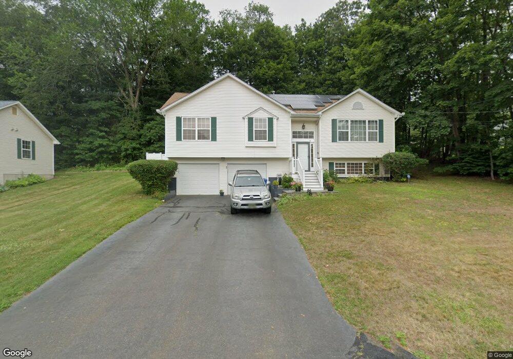
32 Wiscassett Ave Hamden, CT 06518
Estimated Value: $435,087 - $466,000
3
Beds
2
Baths
1,702
Sq Ft
$266/Sq Ft
Est. Value
About This Home
This home is located at 32 Wiscassett Ave, Hamden, CT 06518 and is currently estimated at $453,022, approximately $266 per square foot. 32 Wiscassett Ave is a home located in New Haven County with nearby schools including Hamden Middle School, Hamden High School, and Alphabet Academy - Hamden North Campus.
Ownership History
Date
Name
Owned For
Owner Type
Purchase Details
Closed on
Jul 1, 2004
Sold by
Malkin Ira R and Malkin Jessica L
Bought by
Simmons Evans K and Simmons Sophia A
Current Estimated Value
Home Financials for this Owner
Home Financials are based on the most recent Mortgage that was taken out on this home.
Original Mortgage
$291,000
Interest Rate
6.3%
Purchase Details
Closed on
Jun 1, 1995
Sold by
Rm Skinner Ent
Bought by
Malkin Ira R and Malkin Jessica L
Create a Home Valuation Report for This Property
The Home Valuation Report is an in-depth analysis detailing your home's value as well as a comparison with similar homes in the area
Home Values in the Area
Average Home Value in this Area
Purchase History
| Date | Buyer | Sale Price | Title Company |
|---|---|---|---|
| Simmons Evans K | $300,000 | -- | |
| Malkin Ira R | $156,500 | -- |
Source: Public Records
Mortgage History
| Date | Status | Borrower | Loan Amount |
|---|---|---|---|
| Open | Malkin Ira R | $273,250 | |
| Closed | Malkin Ira R | $278,625 | |
| Closed | Malkin Ira R | $281,250 | |
| Closed | Malkin Ira R | $291,000 |
Source: Public Records
Tax History Compared to Growth
Tax History
| Year | Tax Paid | Tax Assessment Tax Assessment Total Assessment is a certain percentage of the fair market value that is determined by local assessors to be the total taxable value of land and additions on the property. | Land | Improvement |
|---|---|---|---|---|
| 2024 | $9,214 | $165,690 | $45,850 | $119,840 |
| 2023 | $9,582 | $169,960 | $45,850 | $124,110 |
| 2022 | $9,429 | $169,960 | $45,850 | $124,110 |
| 2021 | $8,913 | $169,960 | $45,850 | $124,110 |
| 2020 | $8,463 | $162,820 | $70,490 | $92,330 |
| 2019 | $7,955 | $162,820 | $70,490 | $92,330 |
| 2018 | $7,809 | $162,820 | $70,490 | $92,330 |
| 2017 | $7,369 | $162,820 | $70,490 | $92,330 |
| 2016 | $7,386 | $162,820 | $70,490 | $92,330 |
| 2015 | $7,086 | $173,390 | $71,820 | $101,570 |
| 2014 | $6,923 | $173,390 | $71,820 | $101,570 |
Source: Public Records
Map
Nearby Homes
- 2 Heather Rd
- 133 Pelham Ave
- 162 Forest St
- 100 Anns Farm Rd
- 2764 Whitney Ave
- 2756 Whitney Ave
- 306 Forest Street Extension
- 254 Riverside Dr
- 655 Evergreen Ave
- 63 Bolton St
- 110 Dickerman St
- 17 Valley View Ct Unit 17
- 2974 Whitney Ave
- 3 Valley View Dr Unit 3
- 70 Murlyn Rd
- 6 Ferguson Rd
- 130 Murlyn Rd
- 155 Colony St
- 175 Colony St
- 33 Evergreen Ave
- 173 Briarcliff Rd
- 156 Briarcliff Rd
- 461 Evergreen Ave
- 16 Wiscassett Ave
- 185 Briarcliff Rd
- 159 Briarcliff Rd
- 21 Wiscassett Ave
- 449 Evergreen Ave
- 0000 Evergreen Ave
- 491 Evergreen Ave
- 153 Briarcliff Rd
- 6 Wiscassett Ave
- 140 Briarcliff Rd
- 156 Cannon St
- 168 Cannon St
- 141 Briarcliff Rd
- 439 Evergreen Ave
- 3 Wiscassett Ave
- 6 Flower Dr