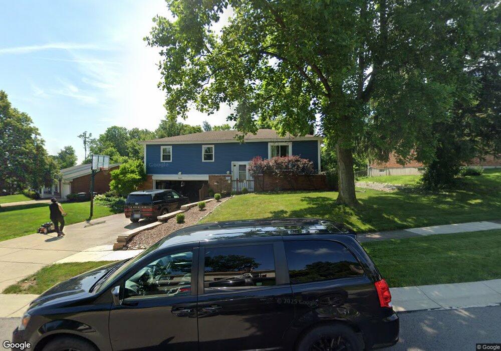
320 Allanhurst Ave Vandalia, OH 45377
Estimated Value: $271,788 - $307,000
4
Beds
3
Baths
2,320
Sq Ft
$125/Sq Ft
Est. Value
About This Home
This home is located at 320 Allanhurst Ave, Vandalia, OH 45377 and is currently estimated at $289,447, approximately $124 per square foot. 320 Allanhurst Ave is a home located in Montgomery County with nearby schools including Helke Elementary School, Morton Middle School, and Butler High School.
Ownership History
Date
Name
Owned For
Owner Type
Purchase Details
Closed on
Mar 30, 2015
Sold by
Zechar Karen S
Bought by
Formsma Blake and Formsma Melissa
Current Estimated Value
Home Financials for this Owner
Home Financials are based on the most recent Mortgage that was taken out on this home.
Original Mortgage
$117,900
Interest Rate
3.73%
Mortgage Type
New Conventional
Purchase Details
Closed on
Jun 3, 2009
Sold by
Zechar Kenny D and Zechar Karen S
Bought by
Zechar Karen S
Home Financials for this Owner
Home Financials are based on the most recent Mortgage that was taken out on this home.
Original Mortgage
$105,000
Interest Rate
4.83%
Mortgage Type
New Conventional
Purchase Details
Closed on
Jul 15, 1996
Sold by
Wadhams Richard A and Wadhams Elizabeth A
Bought by
Zechar Kenny D and Zechar Karen S
Create a Home Valuation Report for This Property
The Home Valuation Report is an in-depth analysis detailing your home's value as well as a comparison with similar homes in the area
Home Values in the Area
Average Home Value in this Area
Purchase History
| Date | Buyer | Sale Price | Title Company |
|---|---|---|---|
| Formsma Blake | $131,100 | Chicago Title Company Llc | |
| Zechar Karen S | -- | Attorney | |
| Zechar Kenny D | $112,900 | Landmark Title |
Source: Public Records
Mortgage History
| Date | Status | Borrower | Loan Amount |
|---|---|---|---|
| Previous Owner | Formsma Blake | $117,900 | |
| Previous Owner | Zechar Karen S | $105,000 |
Source: Public Records
Tax History Compared to Growth
Tax History
| Year | Tax Paid | Tax Assessment Tax Assessment Total Assessment is a certain percentage of the fair market value that is determined by local assessors to be the total taxable value of land and additions on the property. | Land | Improvement |
|---|---|---|---|---|
| 2024 | $3,682 | $70,560 | $11,280 | $59,280 |
| 2023 | $3,682 | $70,560 | $11,280 | $59,280 |
| 2022 | $3,612 | $55,990 | $8,950 | $47,040 |
| 2021 | $3,615 | $55,990 | $8,950 | $47,040 |
| 2020 | $3,604 | $55,990 | $8,950 | $47,040 |
| 2019 | $3,174 | $45,160 | $8,950 | $36,210 |
| 2018 | $3,180 | $45,160 | $8,950 | $36,210 |
| 2017 | $3,156 | $45,160 | $8,950 | $36,210 |
| 2016 | $3,193 | $44,900 | $8,950 | $35,950 |
| 2015 | $3,153 | $44,900 | $8,950 | $35,950 |
| 2014 | $3,153 | $44,900 | $8,950 | $35,950 |
| 2012 | -- | $48,110 | $9,990 | $38,120 |
Source: Public Records
Map
Nearby Homes
- 246 Crest Hill Ave
- 1052 Forest Crest Place
- 1441 S Dixie Dr
- 1054 Wilhelmina Dr
- 696 W Alkaline Springs Rd
- 1515 Ash Ridge Ct
- 416 Attica St
- 485 Pilot Point Unit 1-301
- 416 Bent Twig Dr
- 461 Poplar Grove Dr
- 469 Farrell Rd
- 612 Bennert Dr
- 545 Koch Ave
- 32 Gabriel St
- 465 Pilot Point Unit 1-302
- 475 Pilot Point Unit 1-300
- 626 W National Rd
- 1018 Marcellus Dr
- 108 Tionda Dr S
- 521 Rader Dr
- 310 Allanhurst Ave
- 340 Allanhurst Ave
- 289 Topton Dr
- 288 Allanhurst Ave
- 321 Allanhurst Ave
- 335 Allanhurst Ave
- 356 Allanhurst Ave
- 277 Topton Dr
- 313 Allanhurst Ave
- 309 Allanhurst Ave
- 349 Allanhurst Ave
- 301 Topton Dr
- 287 Allanhurst Ave
- 268 Allanhurst Ave
- 265 Topton Dr
- 366 Allanhurst Ave
- 363 Allanhurst Ave
- 317 Topton Dr
- 300 Crest Hill Ave
- 344 Crest Hill Ave