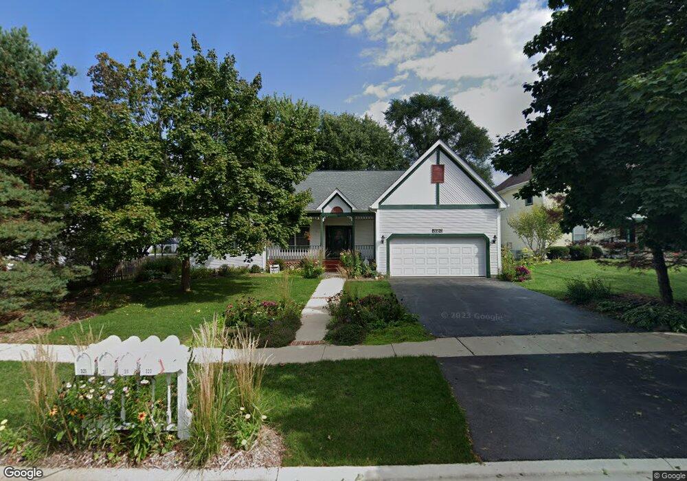
320 Barn Swallow Dr Woodstock, IL 60098
Estimated Value: $285,550 - $338,000
2
Beds
--
Bath
1,316
Sq Ft
$235/Sq Ft
Est. Value
About This Home
This home is located at 320 Barn Swallow Dr, Woodstock, IL 60098 and is currently estimated at $309,638, approximately $235 per square foot. 320 Barn Swallow Dr is a home located in McHenry County with nearby schools including Olson Elementary School, Northwood Middle School, and Woodstock North High School.
Ownership History
Date
Name
Owned For
Owner Type
Purchase Details
Closed on
Nov 1, 2014
Sold by
Fejdasz Marie T and Fejdasz Florian
Bought by
Marie T Fedasz Living Trust and Ffsdasz Steven F
Current Estimated Value
Purchase Details
Closed on
May 4, 1998
Sold by
Harris Bank Woodstock
Bought by
Harris Bank Woodstock
Home Financials for this Owner
Home Financials are based on the most recent Mortgage that was taken out on this home.
Original Mortgage
$167,000
Outstanding Balance
$32,915
Interest Rate
7.2%
Estimated Equity
$276,723
Create a Home Valuation Report for This Property
The Home Valuation Report is an in-depth analysis detailing your home's value as well as a comparison with similar homes in the area
Home Values in the Area
Average Home Value in this Area
Purchase History
| Date | Buyer | Sale Price | Title Company |
|---|---|---|---|
| Marie T Fedasz Living Trust | -- | None Available | |
| Harris Bank Woodstock | -- | Chicago Title |
Source: Public Records
Mortgage History
| Date | Status | Borrower | Loan Amount |
|---|---|---|---|
| Open | Harris Bank Woodstock | $167,000 |
Source: Public Records
Tax History Compared to Growth
Tax History
| Year | Tax Paid | Tax Assessment Tax Assessment Total Assessment is a certain percentage of the fair market value that is determined by local assessors to be the total taxable value of land and additions on the property. | Land | Improvement |
|---|---|---|---|---|
| 2024 | $2,732 | $81,647 | $25,355 | $56,292 |
| 2023 | $2,903 | $74,666 | $23,187 | $51,479 |
| 2022 | $3,586 | $70,509 | $20,835 | $49,674 |
| 2021 | $3,675 | $65,602 | $19,385 | $46,217 |
| 2020 | $3,742 | $62,200 | $18,380 | $43,820 |
| 2019 | $3,833 | $58,563 | $17,305 | $41,258 |
| 2018 | $3,898 | $54,942 | $16,235 | $38,707 |
| 2017 | $4,093 | $51,565 | $15,237 | $36,328 |
| 2016 | $4,413 | $48,408 | $14,304 | $34,104 |
| 2013 | -- | $47,959 | $14,171 | $33,788 |
Source: Public Records
Map
Nearby Homes
- 214 Raffel Rd
- 1721 Yasgur Dr
- 109 Raffel Rd
- 1832 Yasgur Dr
- 1819 Woodside Dr
- 1530 Hickory Rd Unit A
- 871 Hickman Ln
- 908 Hickory Rd
- 905 Hickory Rd
- 709 Mchenry Ave
- Roosevelt II - Ranch Plan at Fairview Estates
- Adams III - Ranch Plan at Fairview Estates
- McMahon - Ranch Plan at Fairview Estates
- Marino - Ranch Plan at Fairview Estates
- Kennedy - Ranch Plan at Fairview Estates
- Lincoln - Ranch Plan at Fairview Estates
- Newport - Two-story Plan at Fairview Estates
- Monroe II - Two-story Plan at Fairview Estates
- Elway - Ranch Plan at Fairview Estates
- Roosevelt - Ranch Plan at Fairview Estates
- 310 Barn Swallow Dr
- 361 Tanager Dr
- 321 Tanager Dr
- 311 Tanager Dr
- 300 Barn Swallow Dr
- 321 Barn Swallow Dr
- 301 Tanager Dr
- 311 Barn Swallow Dr
- 331 Barn Swallow Dr
- 301 Barn Swallow Dr
- 341 Barn Swallow Dr
- 261 Tanager Dr
- 261 Barn Swallow Dr
- 360 Tanager Dr
- 250 Barn Swallow Dr Unit 3
- 350 Tanager Dr
- 320 Redwing Dr
- 300 Redwing Dr
- 251 Tanager Dr Unit 3
- 401 Tanager Dr